There is a lot to explore in the Black Hills of South Dakota


The Black Hills region of South Dakota, known for its rich history of the gold rush and sacred Native American lands, has two National Parks, a state park, a national memorial, another memorial not yet completed, and some historical western towns all within a small vicinity of each other.
Badlands National Park and Wind Cave National Park are approximately 50 miles from each other (about an hour and 15 minutes drive) and Custer State Park is smack in the middle, about 6 miles from Wind Cave National Park. Mount Rushmore National Monument borders the northwest side of Custer State Park and Crazy Horse Memorial is about 10-15 minutes down the road from there.
We decided to stay in Custer, because it seemed very conveniently located to everything we wanted to experience.
The drive from Boulder County, Colorado was kind of typical of what a lot of our road trips in this part of the country amount to – some time on the Interstate (in this case I-25) and then move on to the state and county roads (US 85 to 16 east) which take us on long…long… stretches of road with vast amounts of land, most of it with cattle, but otherwise no structures and no signs of life.
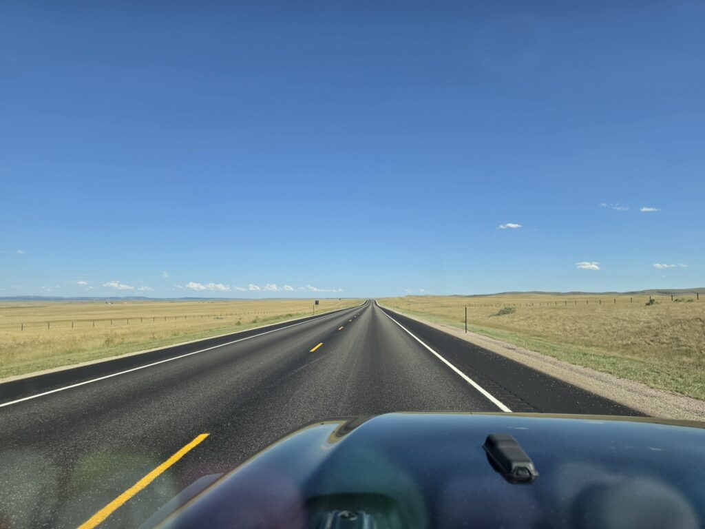
The top priority should always be to fill up with gas, top off the tank, before starting out ANYWHERE because you never know when you will finally come up to a filling station. Once you get on the roads away from the more populated areas, you are asking for trouble if you start driving around without a full tank of gas, or even some sustenance.

Torrington should be a stop along the way for any road trip in this direction.
In between some of the long stretches of nothingness, there was one stop along the way – Torrington, a town known as the Cattle Capitol of Wyoming. It is a town of just over 6,000, located near the border of Wyoming and South Dakota, where the Oregon, Mormon, and Texas Cattle Trails all intersected…as well as serving as a major stop along the famous Pony Express route.

We stopped in at the Historical Society and Visitors Center and it was a pleasant surprise. There is a museum with artifacts, a home that dates back to the 1800’s, a railroad car, a one-room schoolhouse, and a small collection of extremely old vehicles.
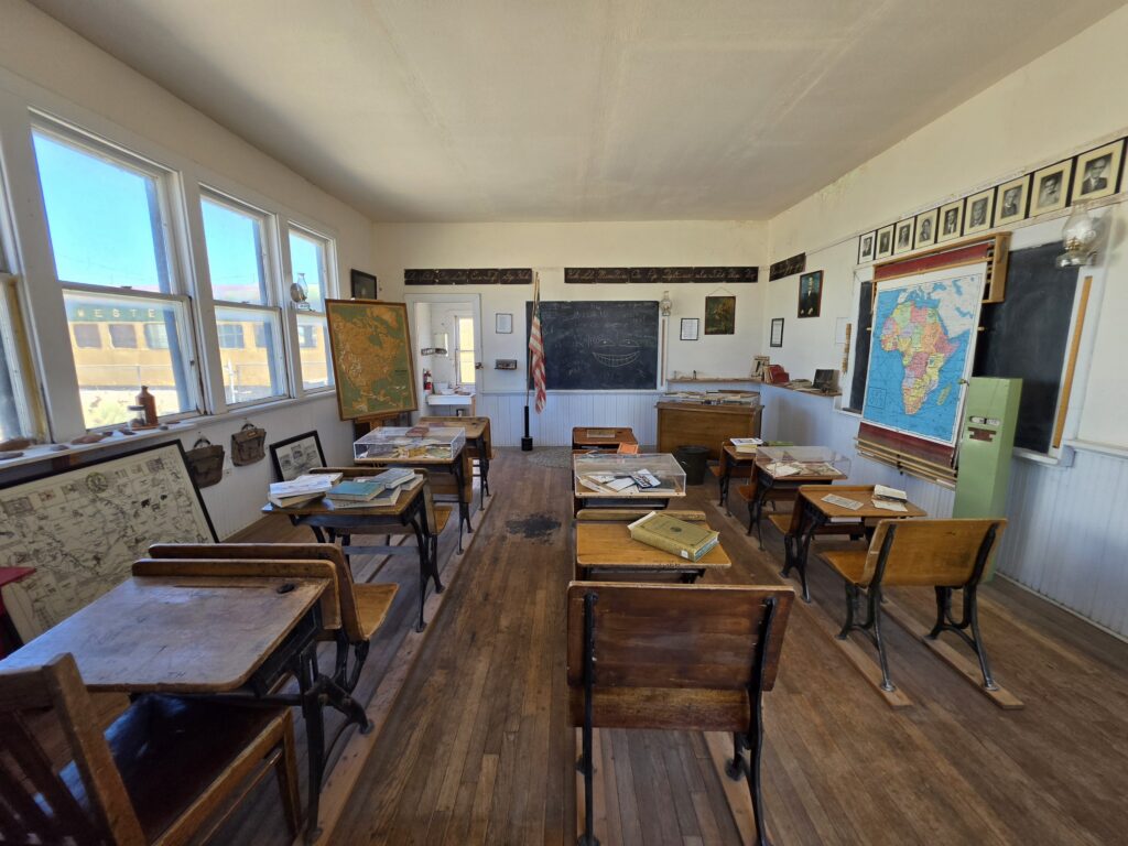
The Historical Society has done a magnificent job with creating the collections and setting up the displays. And they have done it all with private donations…an amazing feat considering that way too many nonprofits wrongfully rely on government funding. But that’s an issue for another story.
Custer is the oldest town established in the Black Hills when gold was discovered nearby.
We decided to stay in the town of Custer, currently with a posted population of 1,919 residents. It has a quaint main street that is named Mount Rushmore Road with a stretch of older buildings housing shops and restaurants that attract a lot of tourists.
There are three vintage motels on the main drag and we enjoyed a five-night stay at the Chalet Motel which has operated since 1937. It’s perfectly situated a few miles from the west entrance to Custer State Park, minutes away from Wind Cave National Park, Mount Rushmore National Memorial, and Crazy Horse Memorial, and a short drive from Keystone, Deadwood, and Rapid City.
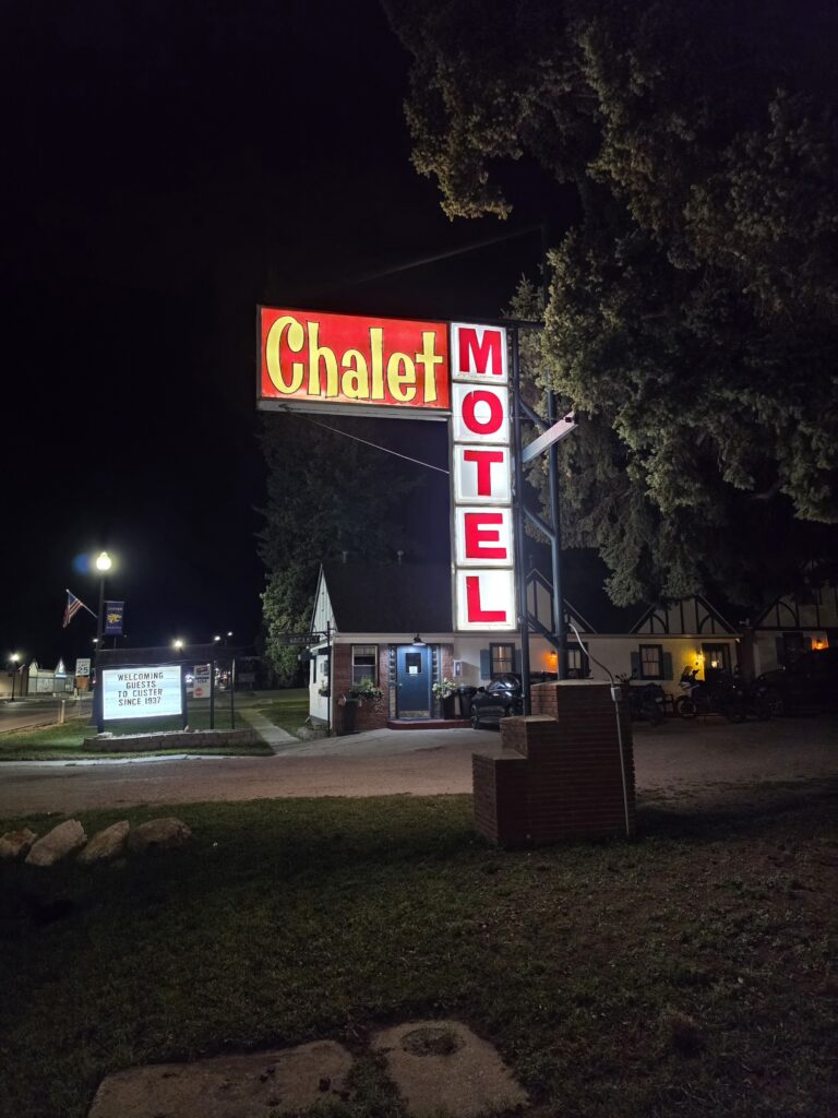
The Chalet Motel is actually a number of small individual cottages that are clean and have everything you need for a comfortable stay. The owners have done an exceptional job modernizing the place while keeping with its original nostalgic appearance.
The two National Parks are the obvious draw, and of course, Mount Rushmore, but the real jewel here in the Black Hills is nearby Custer State Park. But I’ll get to that.
Badlands National Park has a geography that makes you feel like you can be on another planet.
There are a few ways to get to Badlands National Park from Custer, one of which is to get to the Interstate and take I-90 for a portion of the way. We decided to take the “back roads” and go through Custer State Park to Hermosa, before taking SD 40.
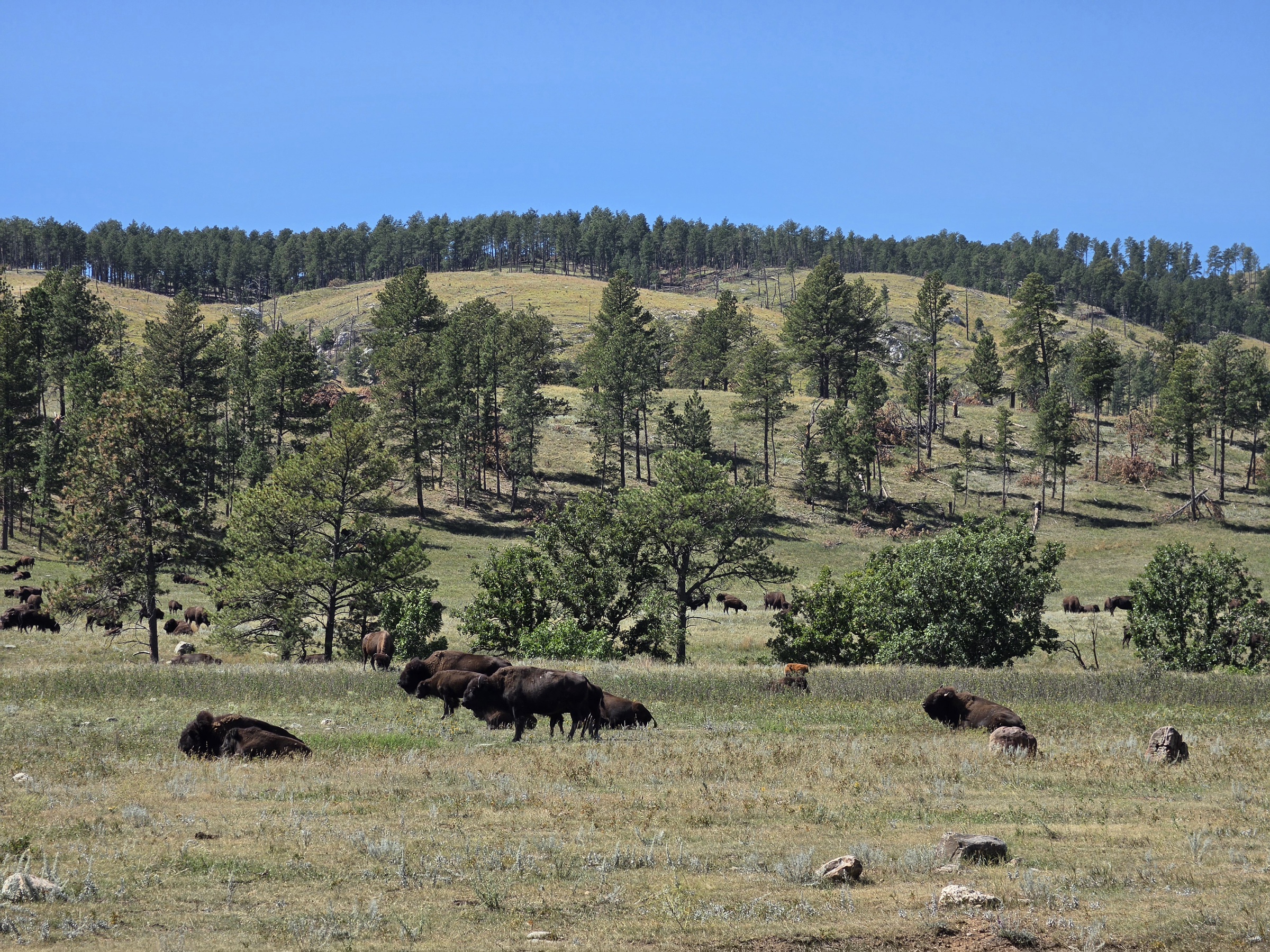
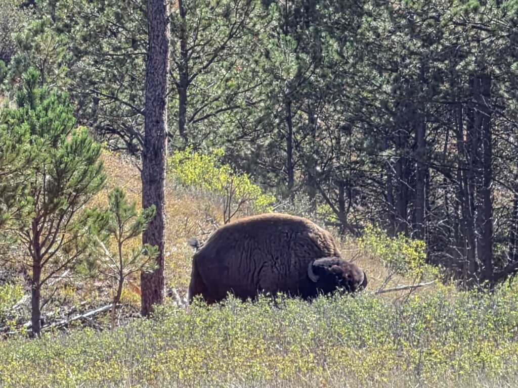
Melissa kept saying “I better see buffaloes…” for days before we left and all the way to Custer. And thankfully because we chose the path we did that day…we immediately came upon a male bison standing on the side of the road all by its lonesome. And then after we carefully got our pictures, a mile up the road we were treated to literally hundreds of bison moving about, with the adult females guiding their calves.
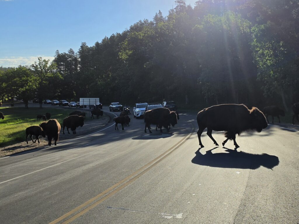
So here are a couple of questions: 1) What’s the difference between a bison and a buffalo? And 2) Why would a male bison be off by themselves while the females and young calves are all clustered in large groups?
I will answer the second question first. In the bison community, once the procreation is completed, the male serves no use to the “family.” It is the female that does everything and protects the young. In essence, the male is ostracized from the community and tends to roam free in solitude. We came upon several males that were lingering by themselves quite a distance from any herd.
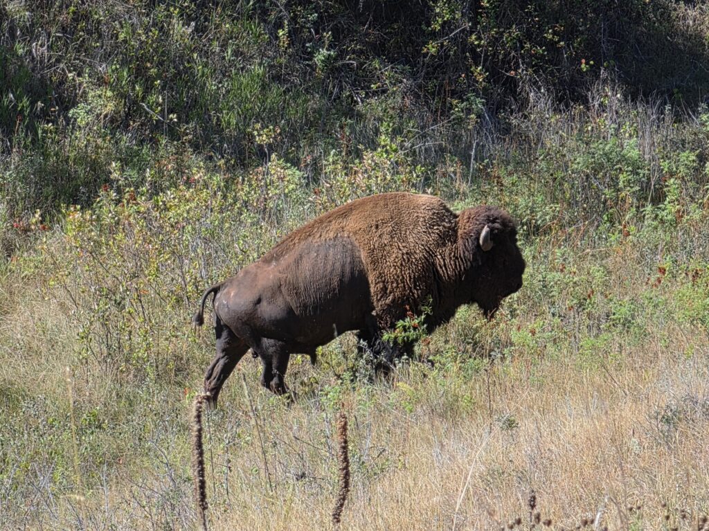
The answer to the first question is a little more delicate. The actual term for what we all grew up to know as “buffalo” is “bison.” Bison is the scientific term for the animal that is native to North America and parts of Europe. Buffalo, also known as water buffalo (not the lodge members from the Flintstones) or Cape buffalo are native to Africa and Asia. Bison have a large hump and shoulders, a beard, and short horns, thrive in harsh winters and can plow snow with those huge shoulders. Buffalo have NO hump and have much longer and sharper horns, no beards, and are more adapted to warm tropical climates.
But then why the confusion with the name? Early European explorers mistakenly called the bison they came upon buffalo because it did resemble the animal they had known previously. Native American cultures have many different names for the animal, including “tatanka” in Latonka and “iinniiwa” in Blackfoot. But many tribal people still refer to the animal as buffalo out of respect for the ancestral culture.
So while bison is the scientific name for the species, buffalo is more closely tied to honoring the importance of the animal to the Native Americans.
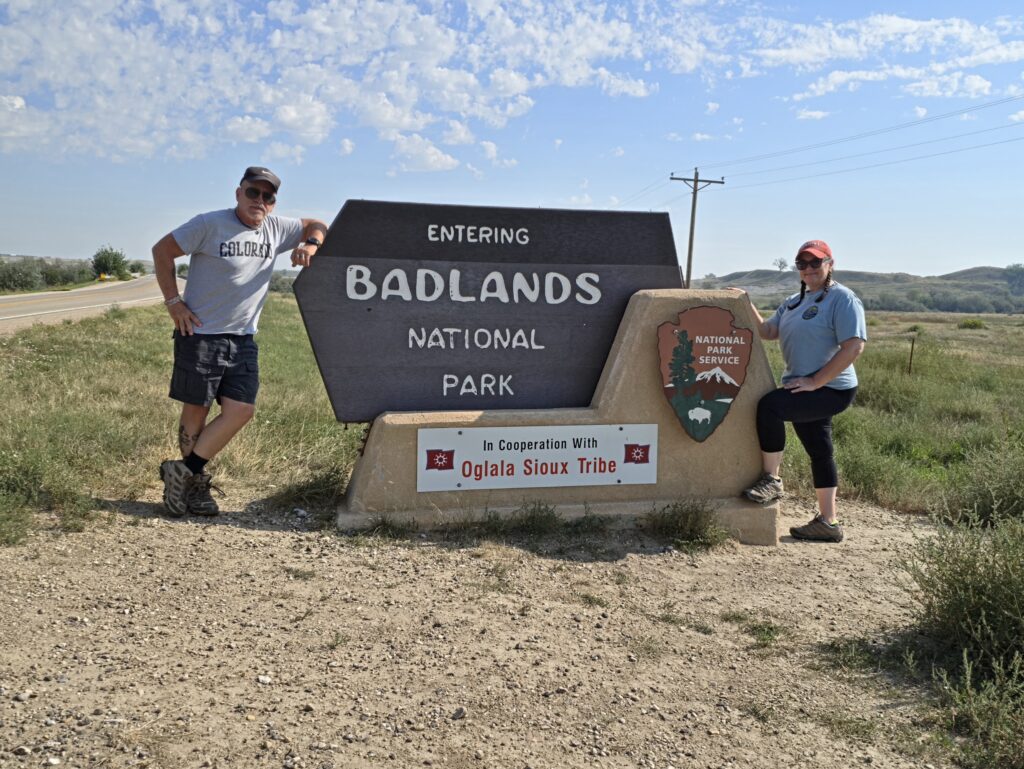
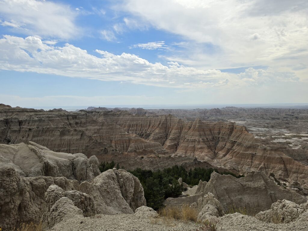
Taking SD 40 led us into the southwest corner of Badlands National Park. By taking the route, we were able to see what the Park Rangers would tell us was the best panoramic view of the Park from the Red Shirt Table Overlook in the Pine Ridge Indian Reservation. If you enter the Park from any other direction, and take the scenic drives, you will miss this overlook.
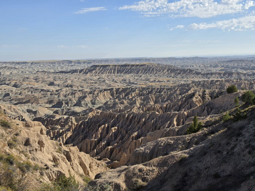
Eventually SD 40 will put you on BIA (Bureau of Indian Affairs) 2 and bring you to the White Rivers Visitors Center.
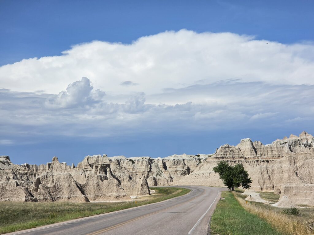
The Rangers there gave us some great input (that’s how we knew we got to see the overlook that most people miss by going through the main entrances to the Park). It was a hot day and while there are, in fact, some hiking trails, you can experience the Park best by driving the scenic Badlands Loop Road and get out at the many turnouts and get some great pictures.
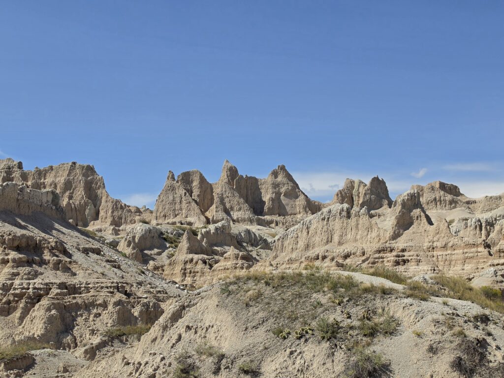
We did get a quick hike…really a quick walk…on the Door Trail which takes you out to a vantage point which looks like you could actually be on another planet.
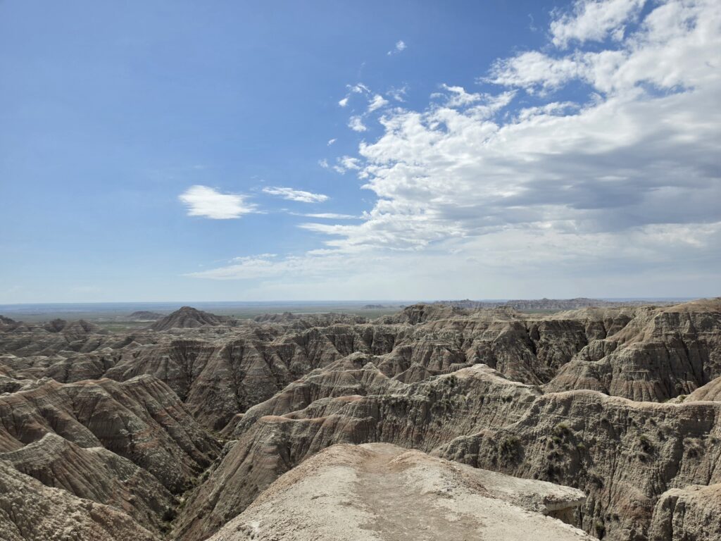
There were many amazing views along Badlands Loop Road, especially at Panorama Point and Pinnacles Outlooks.
Melissa had always wanted to visit Wall Drugs and I had also heard a lot about the place. It’s a very well-known place and, much like South of the Border, has signs for MILES all along the road there.
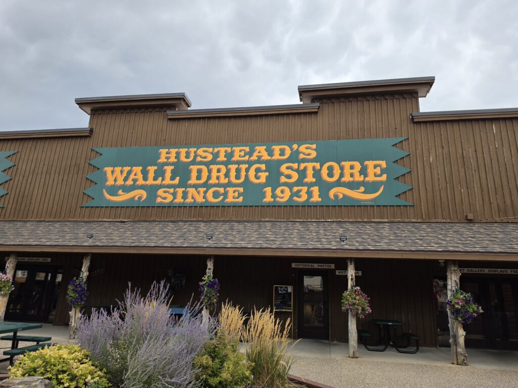
And after all of the billboards for hundreds of miles, it turned out to be just another tourist trap. Busloads of people being brought in to buy crap that will no doubt soon end up at a yard sale and food that was not very appetizing. They have an old soda fountain and ice cream counter and did not have much to offer even in that department. We were all built up for a huge let down.
Custer State Park is the real gem.
We got a really early start because we wanted to get in a hike and we were told by the Park Rangers that parking at the trailheads could pose a problem. And the hike that we were advised to do – Cathedral Spires – was along the famous Needles Highway, something else that was on our list, so we figured we would just stop along the way for the hike.
How was Needles Highway conceived?
A lot of roads, highways, scenic byways in mountainous areas are often twisty turny. But what is it that makes Needles Highway so unique and special? The 14 miles of twists and turns are great, but it is the three narrow granite tunnels – including the 8-feet wide Needles Eye Tunnel – and pigtail timber bridges that make it an engineering marvel.
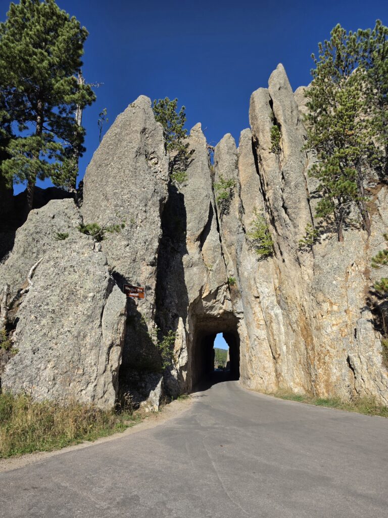
We managed to get a parking space just after a hairpin turn and near the trailhead for the Cathedral Spires Trail. We came to realize long ago that descriptions of trails are not always accurate and are highly subjective depending on who you interrogate. And, of course, this time was no different.
We always look to include at least one hike that is at least three miles, no more than five, round trip, and is anything but difficult or what is often called strenuous. The Rangers had told us that Cathedral Spires Trail was easy to moderate and was 3.8 miles round trip. The Park guide stated it was 1.5 miles one way (making it 3.0 round trip) and it was moderate to strenuous. The sign at the trailhead indicated 2.3 miles round trip and strenuous. Now what?
We WERE told by the Rangers there was shade, and a teeny tiny rock scramble. They lied.
The trail was absolutely gorgeous and breathtaking. There were many aspects to it. But those aspects included sections that were obviously NOT in the shade but two sections of trail that were not rock scrambles but actually like rock climbing because you had to literally climb over jagged rocks that were fairly large. And while that would be a rock scramble on more level ground, this was a pretty steep elevation. Twice.
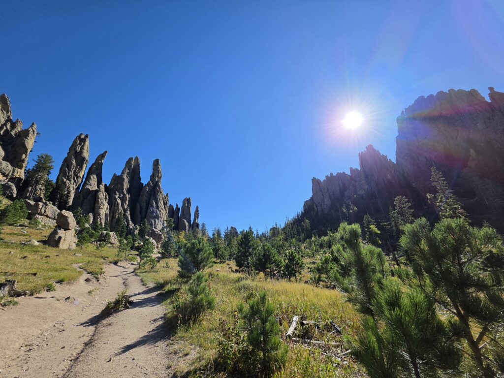
But once we cleared the rocky elevations, the reward was great. The valley of spires was beautiful and serene. It was extremely well worth the “strenuous” effort.
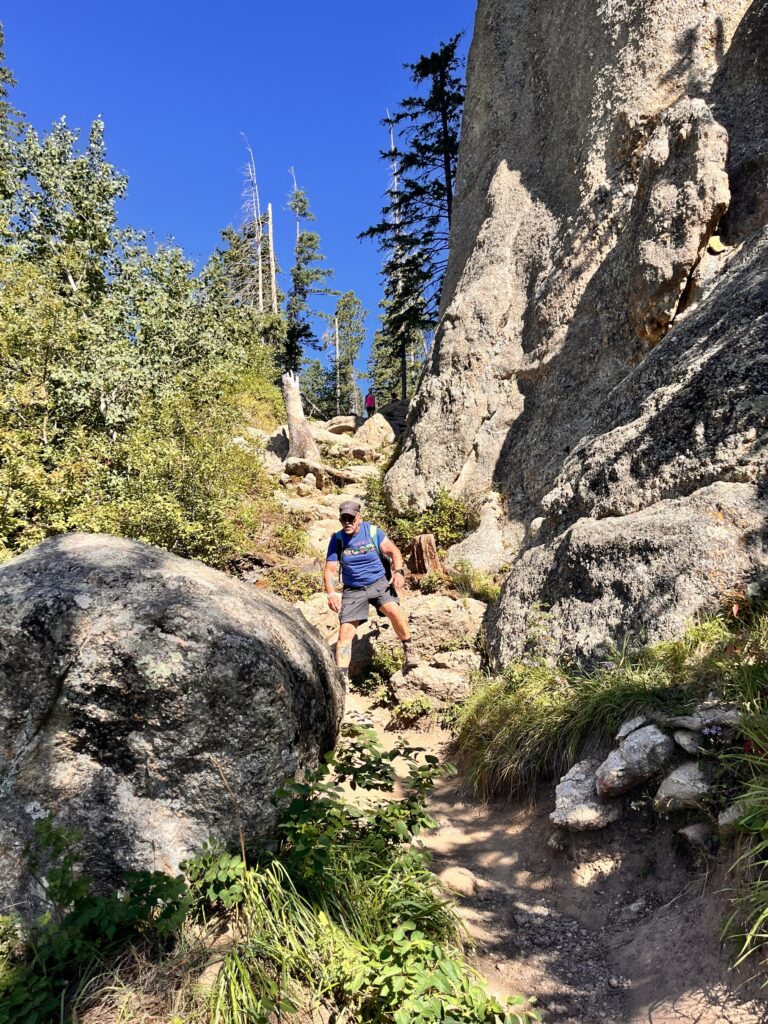
And getting down was no easy task either. Honestly, there was a family, a young couple with an infant in a pouch on the dad’s back, also carrying a toddler in his arms, and the mom was at least 6 months pregnant, and they went up and down like it was nothing. Melissa and I just look at each other because it’s so obvious who the people are who grew up in these parts doing this all the time. Nothing phases them.
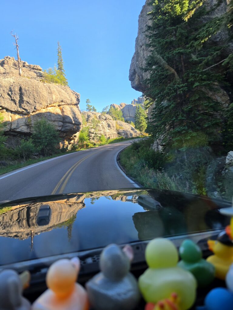
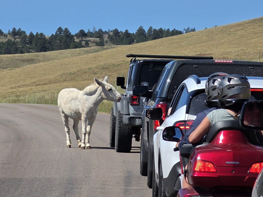
We continued on Needles Highway for the rest of the way and saw a lot more bison, as well as wild burros that people stopped to feed.
Mount Rushmore National Monument draws millions of visitors each year.
We got to Mount Rushmore later in the day for a quick photo. I mean once you see it, what else is there to do? There was no entry fee but it did cost $10 to park.
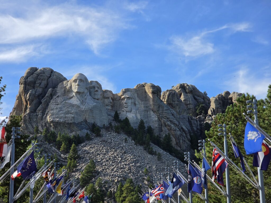
The sculpture was the idea of Doane Robinson who was the South Dakota State Historian. Robinson originally wanted people honored from the region, including pioneers Lewis and Clark and Lakota Chief Crazy Horse. But sculptor Gutzon Borglum insisted it be more national in scope and chose the four Presidents – George Washington, Thomas Jefferson, Abraham Lincoln, and Teddy Roosevelt.
Gutzon oversaw the project beginning in 1927 and then it was completed by his son Lincoln Borglum in 1941 after Gutzon’s passing in March of that year.
Just down the road is the Crazy Horse Memorial…which can easily been seen from the road. It’s a charge of $15 per person, maximum of $30 per carload, to enter the parking lot. Initially it was a bit surprising to realize the expense to enter the grounds for the Memorial. But then once you know the background…you understand.
Mount Rushmore National Monument was built on land stolen from the Sioux Nation in the 1870’s. It’s on sacred tribal land. After 100 years, the United States Supreme Court ruled that the taking of the Black Hills required just compensation and awarded the Sioux Nation $102 million ($413.34 million today). The Sioux have refused the money and have continued to demand the return of the land.
When the decision was made to create a memorial to Crazy Horse as well, efforts were made to contact Gutzon Borglum to do that project as well. Gutzon Borglum refused to even respond to the communications from Henry Standing Bear, a Lakota elder.
Crazy Horse Memorial doesn’t get the recognition it deserves.
The Crazy Horse Memorial was begun in 1948 and has been a work in progress ever since. You can clearly see the profile and the extended hand of Crazy Horse.
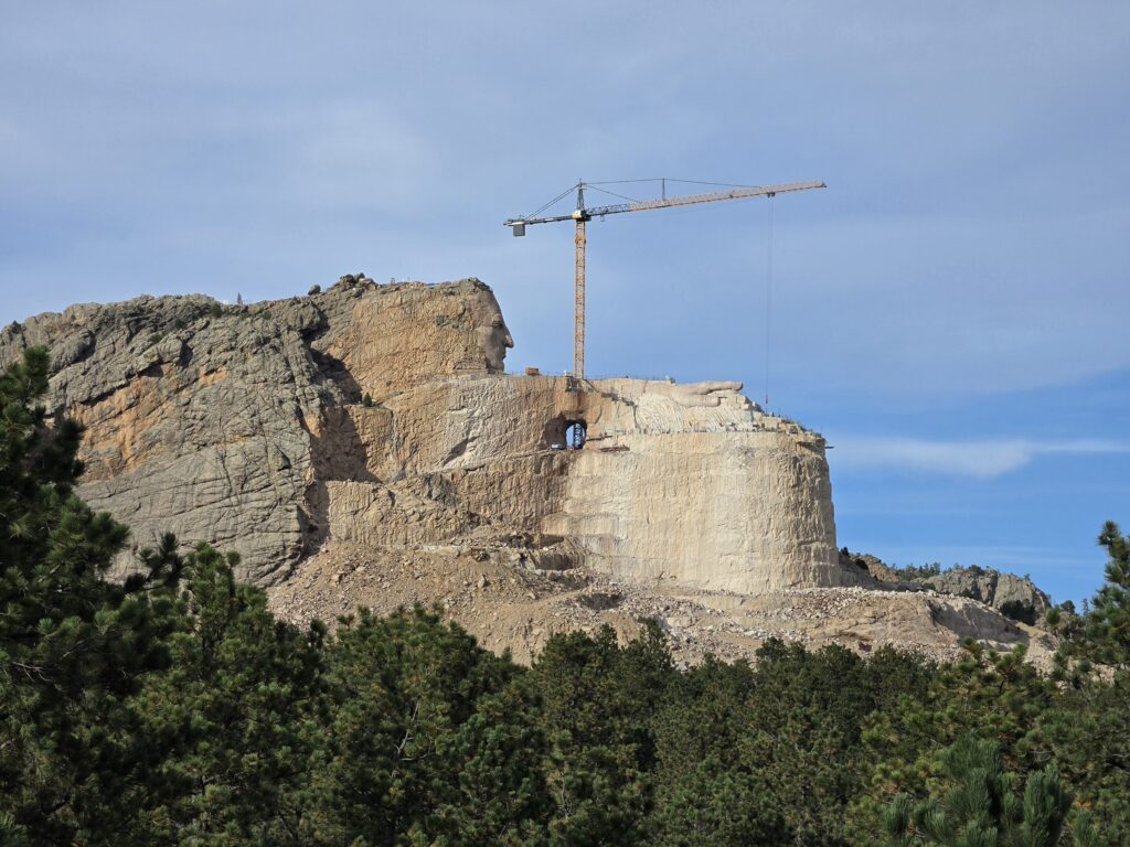
Recent work has been achieved thanks to private donations and entry fees taken to view the Memorial and the museum. The Memorial is administrated by a 501(c)3 non-profit that amazingly takes no monies from the government…ZERO government funding…they refuse to accept it. Everything they get is through private philanthropy.
So that is why the shock of higher entrance fees in comparison to Mount Rushmore became more of a sense of respect for, and appreciation of, the efforts of the Crazy Horse Memorial Foundation.
Deadwood is a rootin’ tootin’ tourist trap.
As a history buff and someone who romanticized about the “Old West” I was so looking forward to exploring some of the old towns. But it wasn’t exactly what we expected…although it was actually what we have come to expect at each of these little towns across America.
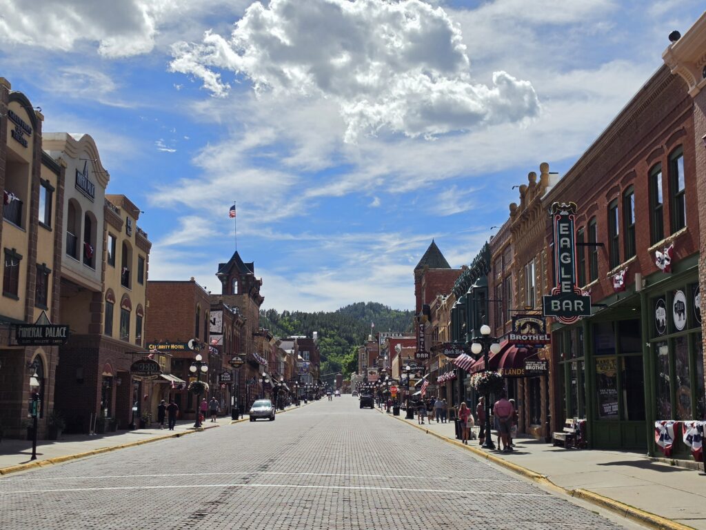
It’s got shops with expensive chotchka that you really have no need for…and casinos (if you can actually call them casinos) galore.
Deadwood’s hey day was from about 1876 to 1879 when they found “gold in them thar hills” and was home to the likes of Wyatt Earp, Calamity Jane, and Wild Bill Hickock, who was shot and killed in Saloon No. 10 on what is today Historic Main Street.
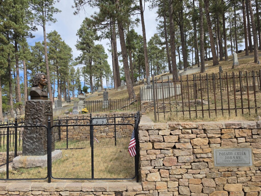
There is a shootout on the streets for the tourists but we didn’t get to see it. What we did get to see was the Mount Moriah Cemetery which is home to the burial site of Wild Bill Hickock as well as Calamity Jane. The cemetery is up a very steep hill, reminiscent of the steep hills in San Francisco. And it’s an uphill walk to visit the plots where Wild Bill Hickock and Calamity Jane are buried next to each other.
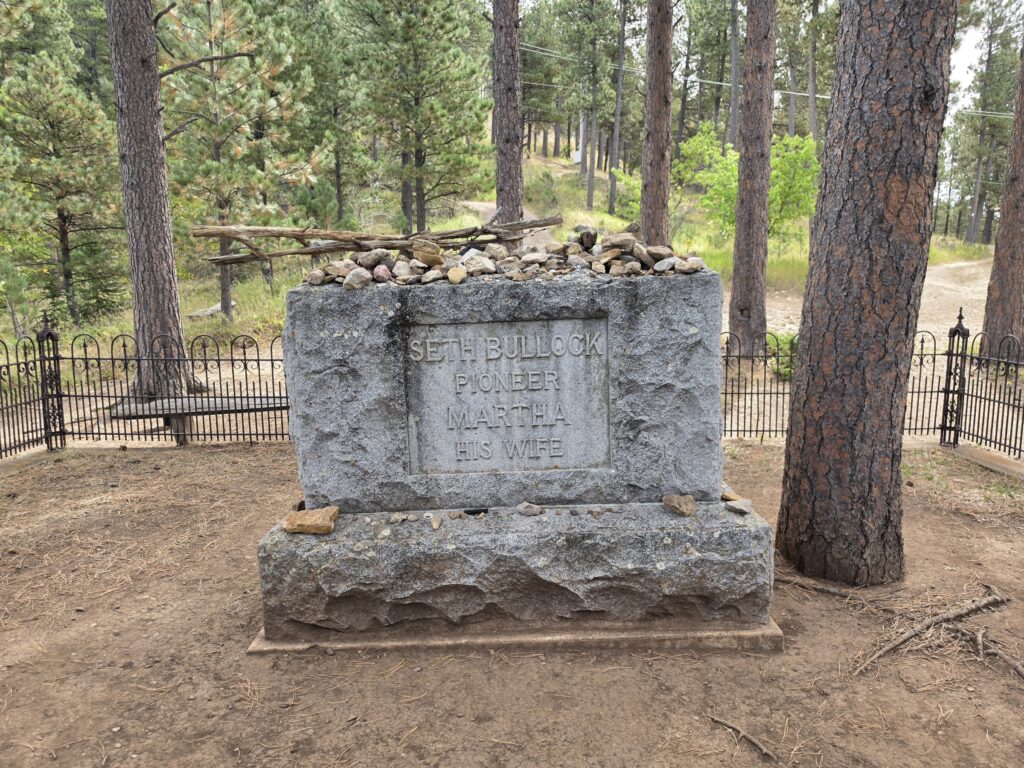
Up another VERY steep incline to a site that looks out over the entire city is the resting place of pioneer Seth Bullock. Who is Seth Bullock?
We got the details about how Calamity Jane ended up next to Wild Bill…as well as the story behind Seth Bullock and Teddy Roosevelt from the gentleman at the ticket booth. In a case of “you just never know who you will run into” that man at the ticket booth was Tom Griffith…professionally known as T.D. Griffith, author/co-author of more than 80 books, most of which deal with the history of the old west and the Black Hills Region, and is considered a well-known authority of most historical aspects of Teddy Roosevelt and his relationship with Seth Bullock.
Griffith and his wife Nyla, a successful novelist in her own right, have made Deadwood their home and have been activists for many local and national causes. Griffith’s work includes “Black Hills Myths and Legends: The True Stories Behind History’s Mysteries” and “Outlaw Tales of South Dakota: True Stories.”
Meanwhile…Seth Bullock arrived in Deadwood in 1876 and was the town’s first Sheriff. He opened a hardware store and was the proprietor of the Bullock Hotel. But while his local exploits would be enough to warrant a top billing, it was his close friendship with Teddy Roosevelt that was most noticeable.
Roosevelt had such an admiration for Bullock that he sent his sons off to spend long periods of time with Bullock so that the young Roosevelts would learn the ways of the West and gain survival instincts. He entrusted Bullock with the lives of his children.
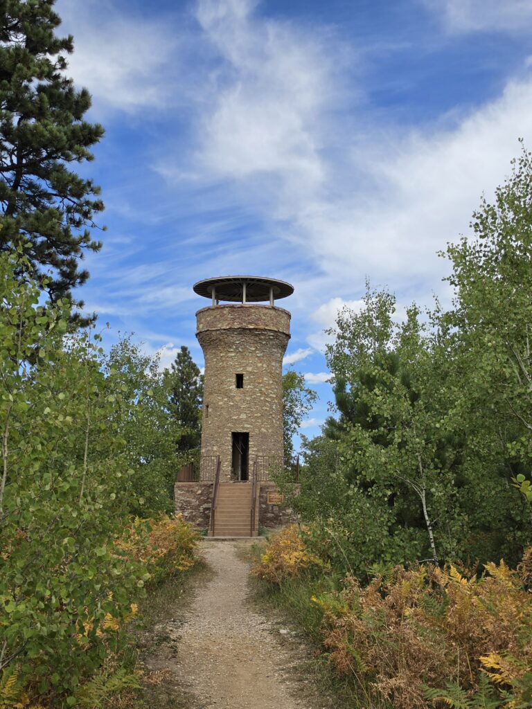
Bullock so admired Roosevelt that he had a tower erected – the Mount Roosevelt Friendship Tower – to honor their friendship. And from Bullock’s gravesite you can look out and see the site of the tower. We drove to Mount Roosevelt and hiked the one-mile loop to the tower and climbed the stairs to see the view out to all four directions.
On the way back we stopped in the small town of Hill City, population 872. We walked up and down the main street and there were some, again, small shops and some food establishments. We got ourselves some ice cream sundaes and did some people watching.
Wind Cave National Park’s cave system can only be explored by reservation.
We still had a day free because our reservation for Wind Cave National Park tour wasn’t until the day after, so we decided to get some more activities in at Custer State Park and check out Rapid City.
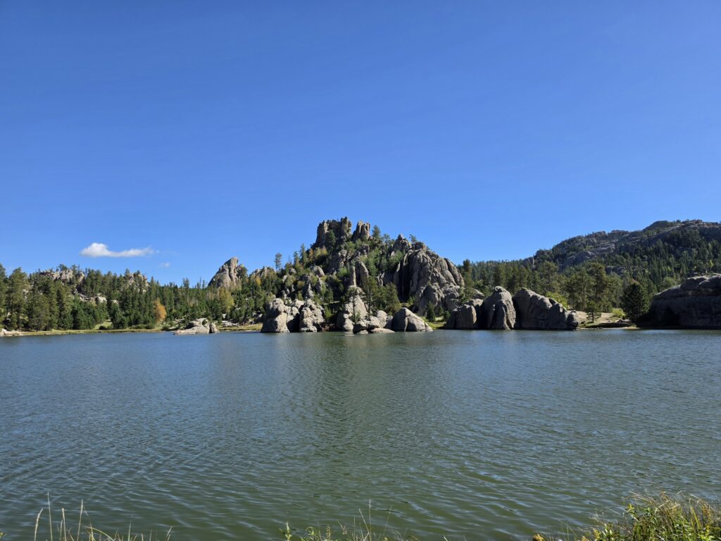
We did a hike around Sylvan Lake which, again, was supposed to be easy and family-friendly. But there were two spots, one in particular, that was in no way easy, and I would say tad beyond even moderate, because there was uneven rock scaling. Most of it WAS easy…but the difficult part was smack in the middle of the loop…so no matter which way you went – clockwise or counter-clockwise – you HAD to tackle it or turn back. I honestly don’t know how some of those people did it.
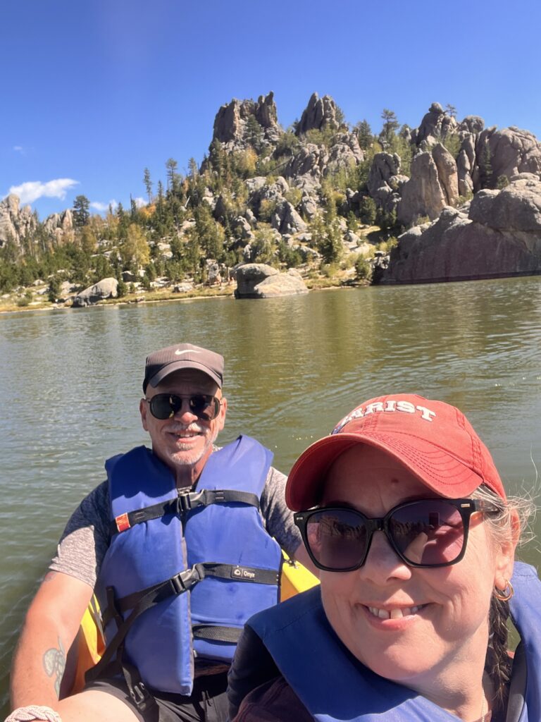
Afterwards we rented a kayak and spend 20 minutes paddling around the lake and checking out the rock formations from the other perspective…in the water.
The big venture of the day was Iron Mountain Road…another engineering marvel…that extends 17 miles with 314 curves, 14 switchbacks, 2 splits, 3 tunnels, 3 pigtail bridges, 4 US Presidents, and a Partridge in a pear tree. OK…four US Presidents? That’s because the road was specifically built for tourists and designed so that motorist could drive through the tunnels and see the faces on Mount Rushmore as you emerge from the tunnels.
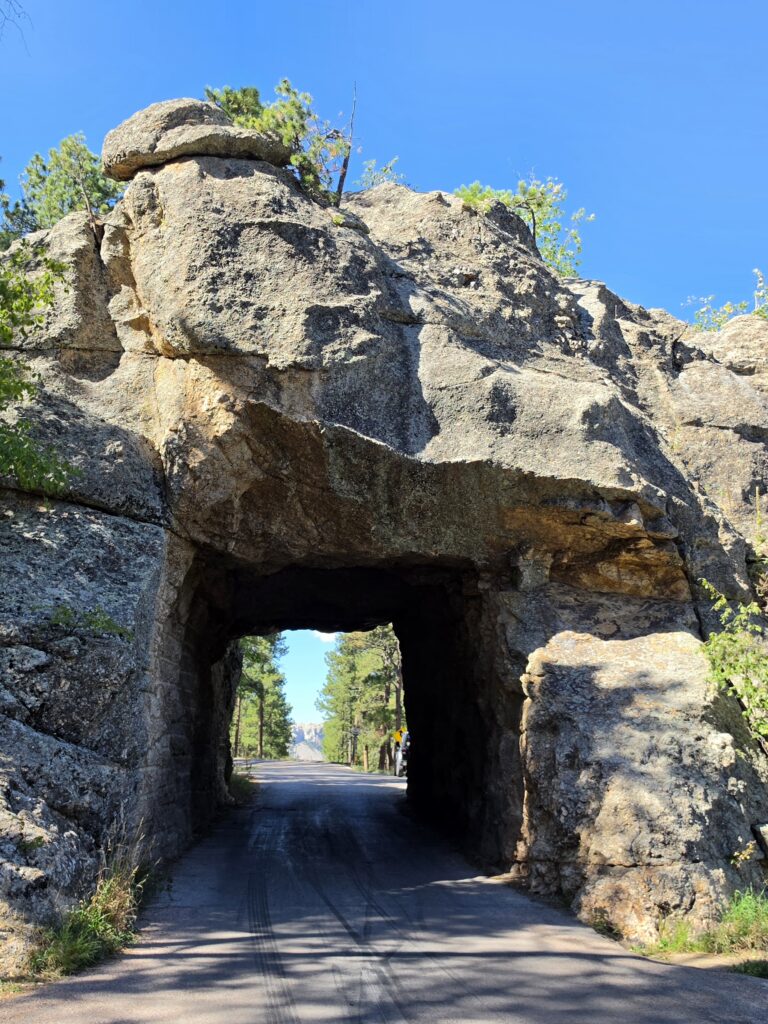
Depending on the direction you are traveling, you will either see that view twice, or once. We saw it twice.
We made a stop midway on the road at Elk Haven – a great café and general store with a campground and cabins….and a beautiful backdrop of the Black Hills.
After we completed Iron Mountain Road, we made our way to Keystone, population 240. Another nice small town with a wood-boarded walkway, but another stop with the chotchka shops and unappetizing food. (See the pattern here?)
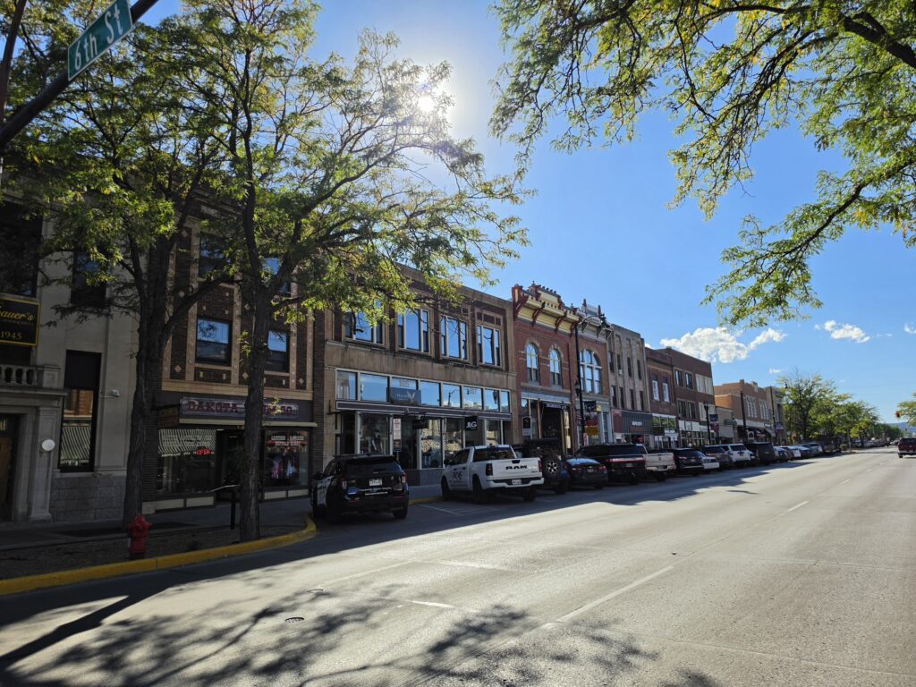
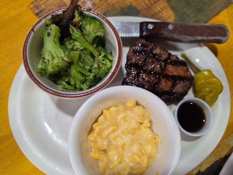
We had a tough time finding the historic area of Rapid City…it amounts to a few blocks but the buildings are really old and there are some VERY old signs from past businesses. A young couple whom we had met while hiking the Cathedral Spires Trail were locals from Custer and while we were talking (complaining) about the food, they gave us a great recommendation for dinner in Rapid City – Dakotah. Melissa had a great steak and I had the Walleye, the state fish of South Dakota. And then we shared Kuchin, the state dessert of South Dakota. When in Rome…or when in South Dakota…
Wind Cave National Park features a huge network of caves.
The cave tours are by reservation only and our reservation for the Wind Cave tour wasn’t until 2:30 p.m. But we wanted to make sure that we were able to get in everything we wanted to do before the tour and without being rushed. So we got out super early and headed to Wind Cave National Park.
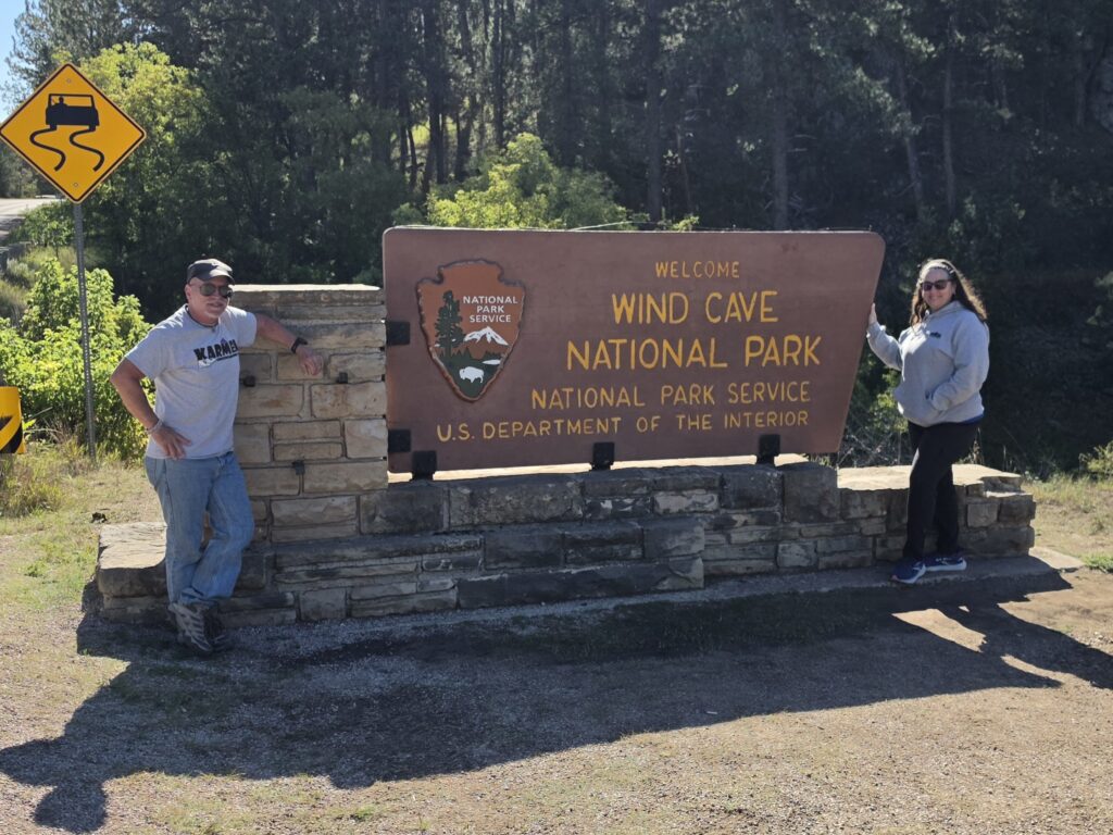
Upon recommendation from Ranger Jess, we did the Wind Cave Canyon Trail, a 3.6 miles out and back. We made it 1.45 miles on the trail until we were forced to turn back because of a huge male bison that decided to rise up from his rest off in the nearby field and locked in on us, looking in our direction. It was a Larry David “I don’t think so…” moment. We hoofed it out of there.
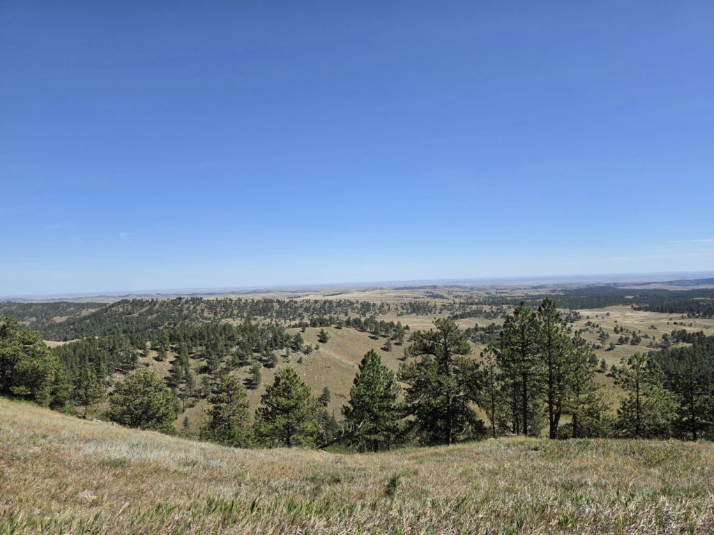
We took a ride on the scenic road, and stopped at Rankin Ridge Trail, a 1-mile loop trail to the highest point in the Park, which was, again, a bit more difficult than described but we were rewarded with a nice panoramic view.
The main event, and what we had been so looking forward to, was the tour of the cave system. Ranger Jess had that tour and gave us some great stories behind how the cave system was discovered, how it was fought over, and how Teddy Roosevelt got it to eventually become a National Park.
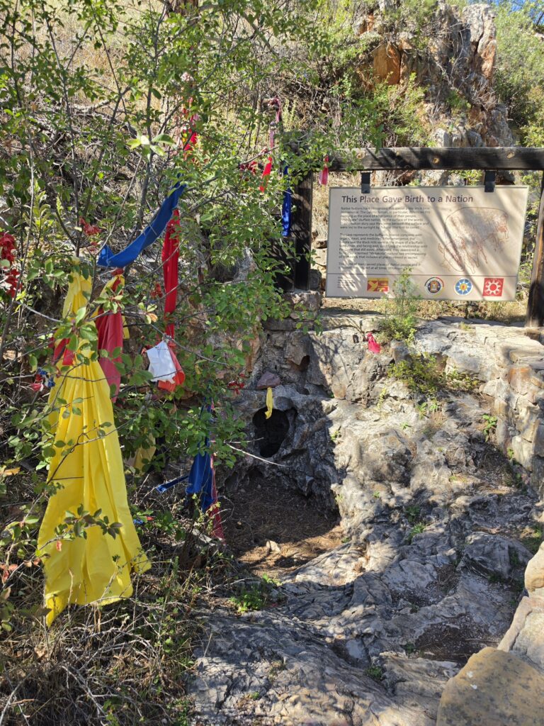
The cave tour was really nice…and it was lot more strenuous than we’ve experienced in other cave sites. This was an almost constant climbing down stairs. They tell you it’s 300 stairs but I wholeheartedly believe there are so many more.
The first stop is at the natural opening of the cave which remains a very sacred site for Native Americans and they still come to pay their respects today.
Visitors are not permitted to enter that opening, rather, they pass through a pressurized room to enter from the man-made opening.

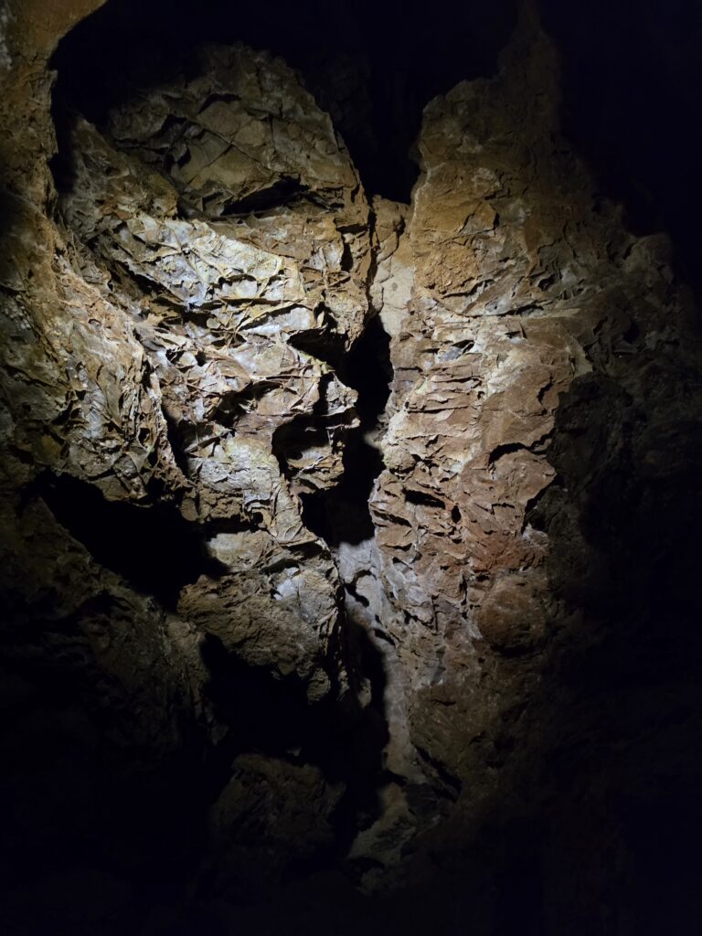
We have been to multiple other caves, including Mammoth Cave National Park in Kentucky, Luray Caverns in Virginia, and Crystal Cave in Pennsylvania. While the tour at Wind Cave was nice, and Ranger Jess did a phenomenal job with the history and stories regarding the caves, we were not as impressed as we were at Mammoth Cave, and certainly not as much as Luray Caverns. There was more of an ability to actually see what you were passing through…definitely more of an ability to capture it all in pictures. The constant stepping down stairs did not allow for much picture taking. We were told that we were not allowed to take photos while on the stairs…which was not exactly a bad rule because it was so dark that missing a step would be a problem…obviously.
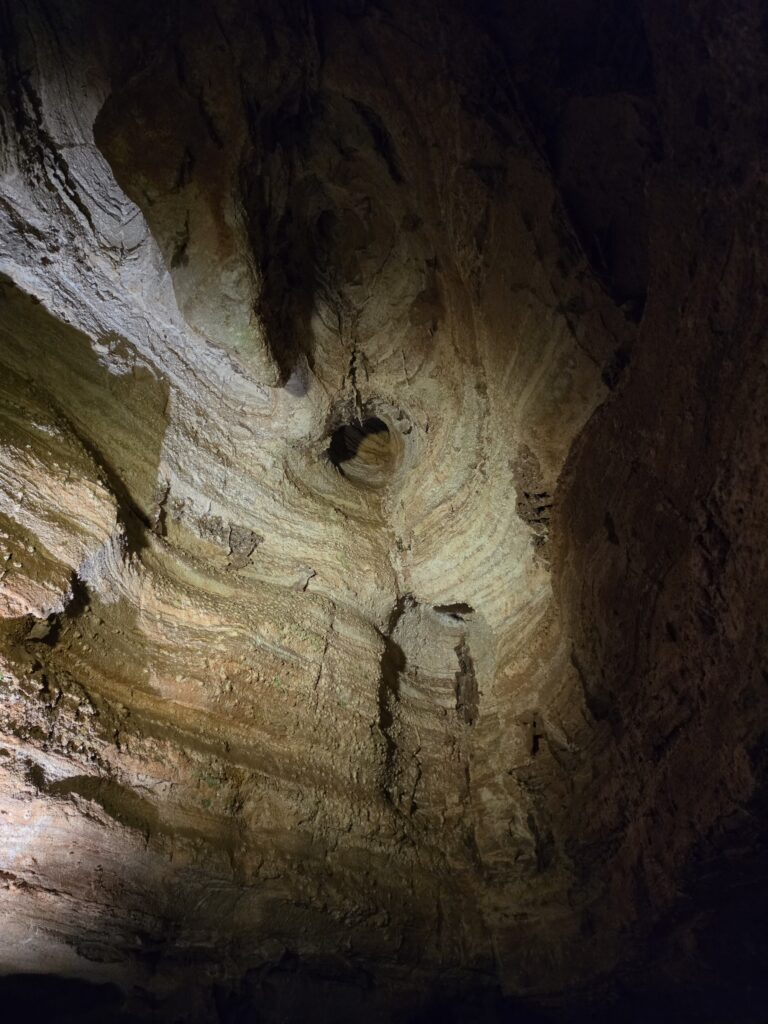
Getting back up was another issue. There are two elevators and one was not working. So Ranger Jess had to take 8 people at a time up to the surface. She had to make six trips. Do the math. The 75-minutes trek through the cave would make for the third strenuous hike of the day and it was after 4 p.m. We were now exhausted and we had 5 ½ hours to drive home. We also had to find something to eat along the way. Yeah…good luck with that!
Subscribe
We’d love to have you along for the ride! Subscribe to our newsletter to get a little piece of our latest adventures delivered straight to your inbox.