Traveling Route 66 in 10 days or less

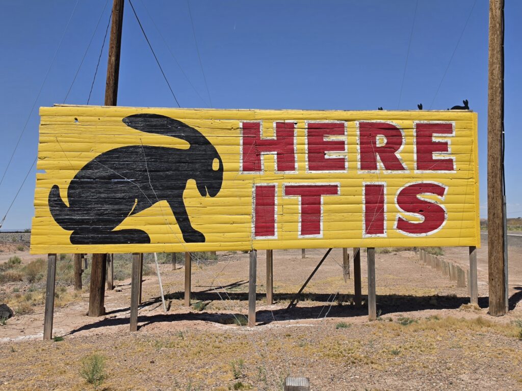
Here it is:
2,448 miles; 8 states; 3 time zones; 9 days; 2 National Parks; 18 muffler men; dozens of abandoned gas stations; dozens of abandoned roadside motels; 1,628 pictures – 63 of them abandoned gas stations, 44 of them abandoned roadside motels; 32 ducks handed out; 8 t-shirts given away; one trip to urgent care; far too many greasy meals with two times eating ice cream for lunch; one phone charger left behind; multiple times getting lost and making illegal U-turns; numerous disagreements ABOUT getting lost; countless great interactions with people along the way; endless conversations and laughter in the car; and one memorable and unforgettable honeymoon on The Mother Road.
We were supposed to honeymoon in Amsterdam. A trip along Route 66 was in the plans for the fall. However, due to the tensions overseas, we decided to tackle Route 66 first, since it was a bucket list item for us both. And what better way to celebrate the beginning of a marriage than being in a car together for 9 days and 2,448 miles.
I spent months planning and coordinating everything. Usually I hand the planning of everything over to Melissa because she is so good at it. But this trip was on me. That was made clear. And I went down every rabbit hole, got a hold of every piece of reading material, purchased a guide someone wrote, joined multiple Route 66 Facebook groups, signed up for an app, and even went to AAA.
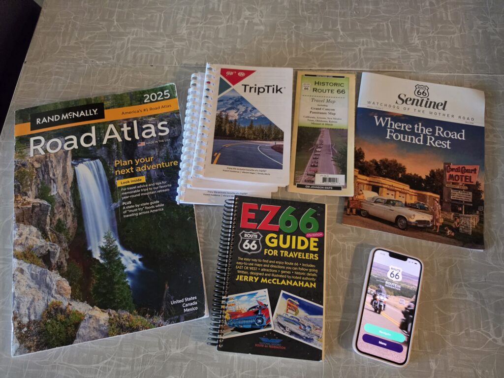
At our fingertips we had our usual United States Road Atlas that we always have handy in the car, the old-fashioned Trip Tiks put together by AAA, the EZ 66 Guide for Travelers, the Route 66 Navigation app, and good old Google Maps. FIVE different resources to get us going. And, of course, there were the signs lining the road and painted Route 66 logos on the pavements.

I do all of the driving on our trips and this trip was no different. That meant that Melissa had to do all of the navigating. That role would lead to a lot of stressful situations because…

…because Route 66 has multiple versions that can be taken at different junctures. And it is not always clear in what direction you need to head – go straight…wait…turn left…no turn right. Which is it?
With all of the resources and signs in our faces, it should be simple. Right? Wrong. It was not always simple. And sometimes it was quite confusing and difficult.
The resources did not always agree with each other and were sometimes in direct conflict with the signage on the road. Compounding the situation was that, quite often, signage would be missing. So you might be traveling straight and where you should be turning left or bearing right there is no signage to let you know and you essentially breeze past it and you are miles down the road before you realize you have been thrown off course.
We were told in Springfield, Missouri that there had been a problem with theft of signage – people grabbing souvenirs. Reportedly more than 60 signs have been removed from the roadway. However, that doesn’t explain why the Route 66 Navigation app would also be in direct conflict with Google Maps.
The most likely explanation is that Route 66 has the multiple versions due to being re-routed multiple times.
Route 66 was commissioned in 1926. Most of that 1926 version is gone. Some of it exists in its entirety for stretches in some states, some has been paved over and the path is actually used by Interstates 55 and 40, while some can be seen alongside the road with grass overgrown on the sides of it.
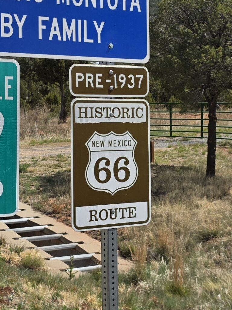
We saw signs in areas that specifically stated which version we were on – 1926-1937; 1926-1940; 1940-1977. In one spot there was a sign pointing an arrow for three different paths.
Regardless of all of the planning, research, and resources, it was all confusing…which would often lead to this encounter…
ALAN: Melissa, which way am I going?
MELISSA: I DON’T KNOW! THIS IS A LOT OF PRESSURE!
We love road trips and this one was fun. I know I pointed out how it was stressful with the navigation issues, but isn’t that PART of the fun…PART of the adventure?
We decided to conquer Route 66 from east to west, starting in Chicago, Illinois and finishing in Santa Monica, California. And we were going to complete it in nine (9) days of driving. It would be quite an ambitious task, as we discovered, and we found the other people on the Route taking a LOT more time than we were for the journey.
I had read in most accounts online that people were taking weeks, and even months, to do it. Here we were trying to make it in less than 10 days.
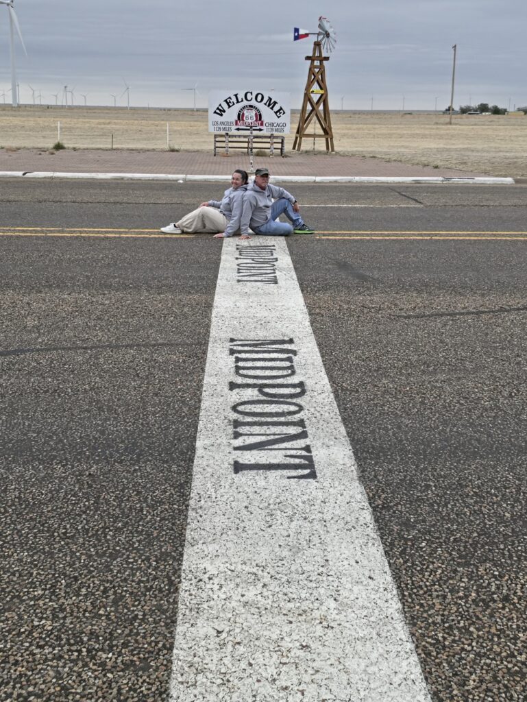
The common distance presented for the excursion is 2,448 miles from the BEGIN sign across the street from the Art Institute of Chicago on the corner of East Adams Street and East Michigan Avenue in Chicago to the END sign on the Santa Monica Pier. However, the Midpoint sign in Adrian, Texas shows a distance of 1,139 miles east to Chicago and 1,139 miles west to Los Angeles – a total of 2,278 miles. So another source of confusion. Which IS it?
Apparently, the difference exists because the 2,448 miles includes all of the various looping around of the different alignments along the way. So, for instance, we were on a segment that was the original Route and the app had us turn left and we drove about five miles and we ended up making another left onto the very same roadway we had been on when we made the first left turn. We simply did a horseshoe or U-shaped move that added a few miles…for no reason…we saw nothing. Well, most of the time we saw nothing. Every so often there would be a landmark that we would not have seen if we didn’t make that little “off the now main road” trek.
Regardless of what version of the Route we traveled, we saw a LOT. And there were a lot of thoughts and emotions. While fun to take such a journey, it was sad to see the decay caused by abandonment. The implementation of the Interstate Highway system has devastated local towns, crushing local businesses, and causing residents to move away because there was simply no way to survive.
While finding abandoned gas stations and roadside motels became like a scavenger hunt, it became depressing. Abandoned gas stations meant that once thriving communities were not only not thriving, but were in some cases long gone…virtual ghost towns.
While it’s true that Route 66 does still run through some larger and vibrant cities like Chicago, Illinois; St. Louis, Missouri; Springfield, Missouri, Tulsa, Oklahoma; Oklahoma City, Oklahoma; Albuquerque, New Mexico; Flagstaff, Arizona; and Los Angeles, California…with very few exceptions, the nostalgia of Route 66 is not exactly celebrated in those cities, it is not the focal point.
Most mom and pop businesses are long gone from those cities. And the areas that Route 66 passes through IN those cities is not exactly the most upscale areas.
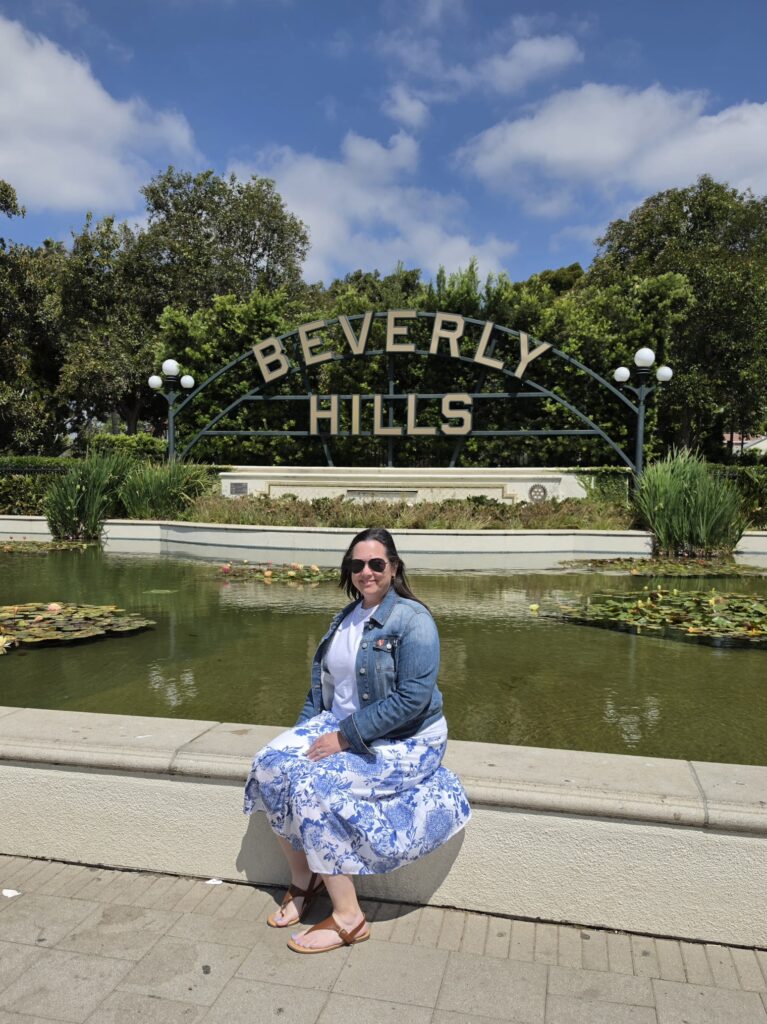
EXCEPT in a section of Los Angeles known as Beverly Hills. That’s RIGHT! Beverly Hills is located ON Route 66. Santa Monica Boulevard running through Beverly Hills IS Route 66.
But nobody ever mentions that. The famous Troubadour venue is on Route 66 right at the start of Beverly Hills. The famous Formosa Café is on Route 66.
The absolute diversity of traveling Route 66 is quite apparent from the beginning, because you are starting in Chicago, one of the largest cities in the United States, and then making your way through areas that are suburban, then rural, then abandoned, and then back the other way when you get to Los Angeles County in California.
The landscape changes and you definitely get to see so many different aspects of the country.
Because of personal time constraints, we decided to make the trip over a nine-day span. That meant that time was of the essence and we couldn’t stop at EVERY suggested landmark along the Route. It also mattered because we needed to secure reservations for our overnight stays. And while you can “wing it” on some trips, winging it wasn’t going to work on this one.
This year is the 100th Anniversary of Route 66 and there has been a renewed interest in travel along the Route. That translates into motels filling up more quickly than they usually do…especially the more popular places.
The plan, and hope, was to stay each night along the way in a typical roadside motel or motor lodge that was typical of the travel era of the 1950’s and 1960’s. This was especially important to me because I really wanted to recapture the feelings I had when I was a child traveling with my parents each summer. In those days, the biggest thrill was staying in a motel with a pool. That was Utopia when I was a seven-year-old.
While I was not able to always get a first choice, I was able to procure accommodations in very nostalgic places that were perfect for our trip.
Most of the people we met along the way spent a lot of time exploring the areas and, specifically, stopping in at the many Route 66 museums established along the way. We didn’t do that. While we did stop here and there for short walks to see the landmarks and for picture opportunities, we only made three stops of significant time – The Arch in St. Louis, Missouri; Petrified Forest National Park in Holbrook, Arizona; and the old mining town of Oatman, Arizona. We spent at least an hour at each of those destinations and were all in the itinerary. And all were well worth the stop and time spent, especially Oatman.
There were a number of things that came up as we were driving that we took notice and should be considered in the planning of a trip like this.
Food options. If you are a healthy eater, or specifically a non-meat eater, it could pose a problem. We had both said prior to the trip that we didn’t want to be relegated to junk food or “bad food choices.” And that is not to offend anyone or their respective eating habits or food choices, but the fact is that there are VERY few places along the Route that have anything on the healthy or clean eating side. Combine that with the fact that places open late and close early, if they are open at all on any particular day, and you are on a scavenger hunt for food as much as you are for abandoned gas stations. What diner doesn’t open until 11 a.m.? How are you serving travelers if you are not open?
Things we really needed. I had looked at a number of posts on social media made by others and had made a list of what they had said. And I should have taken those lists more seriously. Two things I wished I had available to us are 1) a 12-volt cooler for food and 2) a power strip with a long extension cord for charging devices. Both would have come in very handy. One other thing that would have been nice to have is a dash cam. However, the car, and windshield specifically, got so dirty that a dash cam would have been neutralized and ineffective. Even a drone would have been nice, but that is something to explore for the future.
The resources were not accurate. Each of the resources had “landmarks” that were listed. There were places and landmarks not on any list. Yet there were places listed that simply weren’t there. And the app had places come up that weren’t landmarks, rather, they were simply restaurants or shops on the side of the road. So we would get all excited…just to realize it was Bob’s Garage. And unless I am in Schitt’s Creek, I don’t care about Bob’s Garage.
The neon. That was the big thing…“the neon.” Well a lot of the neon was not working and some, while working, were not on because it was not during business hours. So what is the point of the neon if it is not on during the night?
The sources. We have come to realize, as I am sure so many others have, that when you see a post, or a reel, or a story, you only see the “good” stuff, not the “bad” stuff. As a photographer, I can tell you, it’s all about the “framing.” And seeing what is online, and using that as an inspiration to visit a venue, can set you up for disappointment when you realize that the only reason it appeared to be so good, was that the one who captured the imagery was great at framing. That leads to disappointments.
We did meet with and speak to a number of people. And a LOT of the people we did speak to were actually here visiting from another country. One couple from Australia rented a RV and were doing Chicago to Santa Monica over the course of a month. Another couple from Japan rented a car at O’Hare Airport and were making the journey over a three-week period. A father and daughter from Colorado were doing a road trip over 26 days. And a gentleman from Texas was traveling solo on a motorcycle for a couple of weeks.
We did it in 9 days. Obviously an ambitious endeavor…but we did it.
Before we got started…
We flew into Chicago the day before and rented a car from Avis at O’Hare Airport. We secured an SUV but, truth be told, I would have rather have had my own Jeep Wrangler for the trip. While it was nice to have a new vehicle (it only had 811 miles on it) to make the trip of over 2,000 miles, part of a road trip is driving YOUR car. And it would have been nice to have my own car for the pictures.
We stayed at The Palmer House in The Loop in Chicago and ate dinner at The Village.
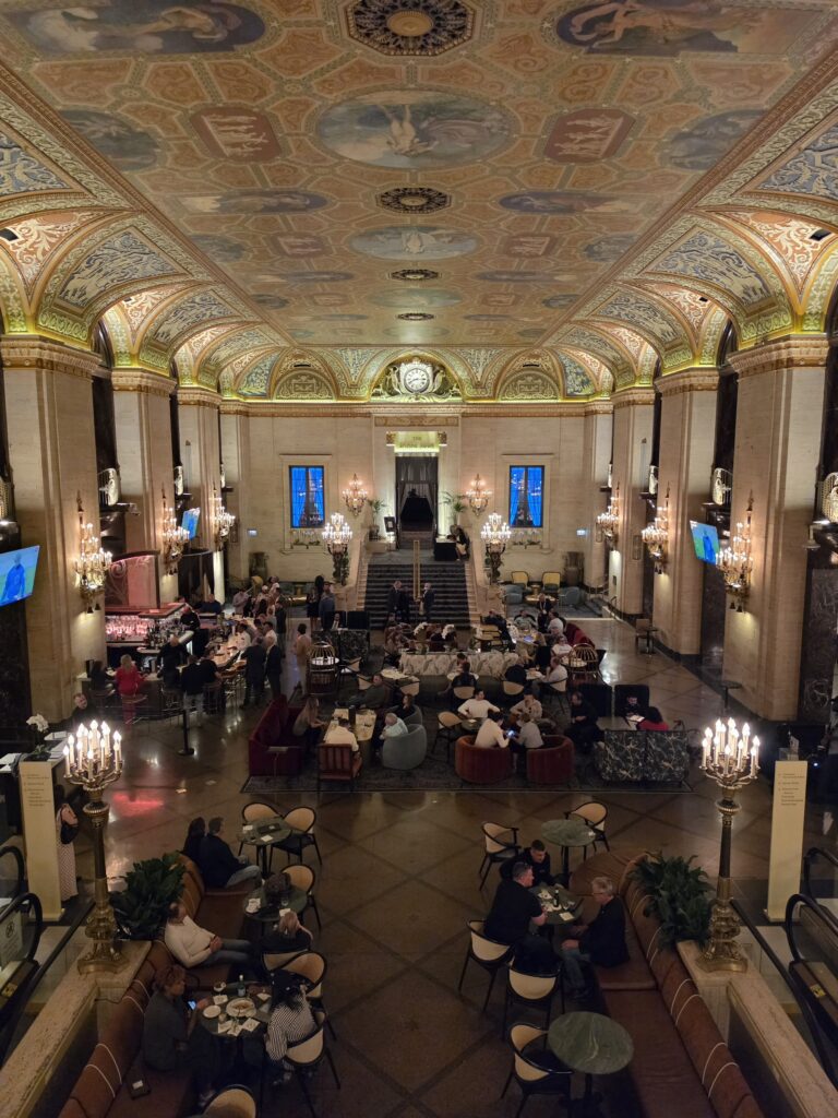
The Palmer House is never talked about as a place on Route 66. However, the parking garage is actually STEPS away from the starting point, the BEGIN sign, of Route 66 and the hotel itself is half a block in. The Palmer House’s history coincides with the history of Route 66. Although initially built in the 1800’s, it was destroyed in the Great Chicago Fire. It was then rebuilt and opened in 1925, and the plans for the start of Route 66 nearby was no accident.
The Palmer House is a luxurious hotel that is in contrast to the roadside motels, motor lodges, and motor courts that travelers would expect to see along the Historic Route 66. But, hey, it’s Chicago…the city…and it shows how diversified Route 66 really is.
The Palmer House is truly a first-class establishment with spacious rooms, and personalized service. It has a true old age feel…as you might feel like you have been transported into the 1940’s.
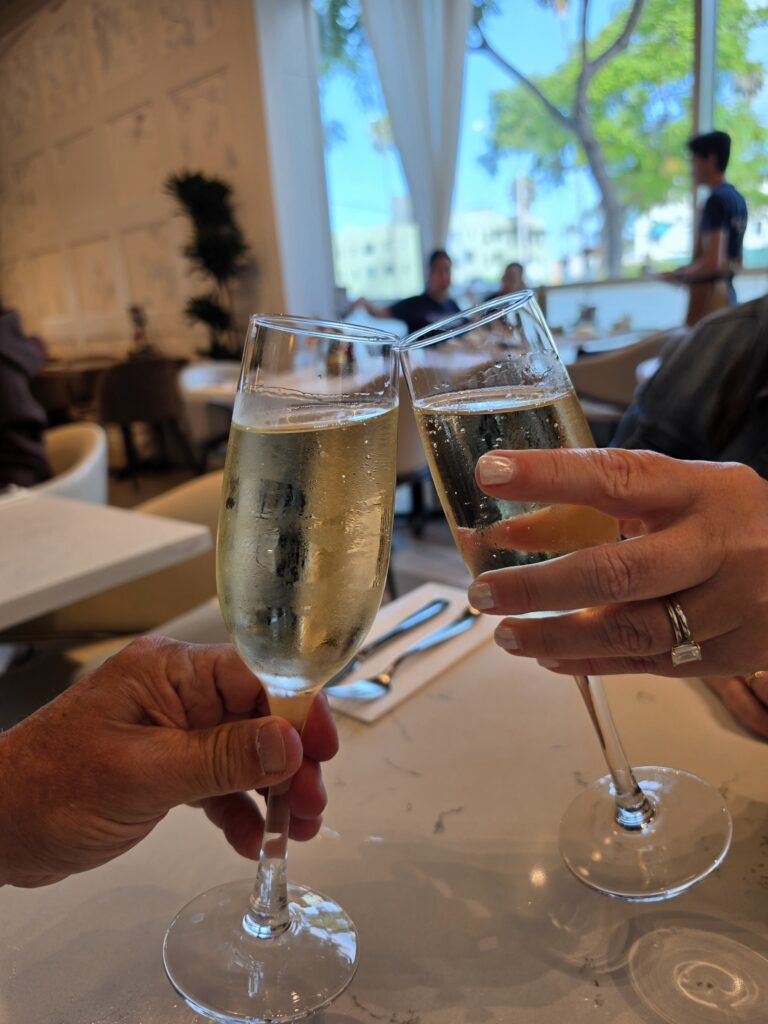
We were upgraded to a beautiful suite and provided with robes, slippers, and champagne…a perfect touch for the first night of our honeymoon, and a great start of a journey on Route 66.
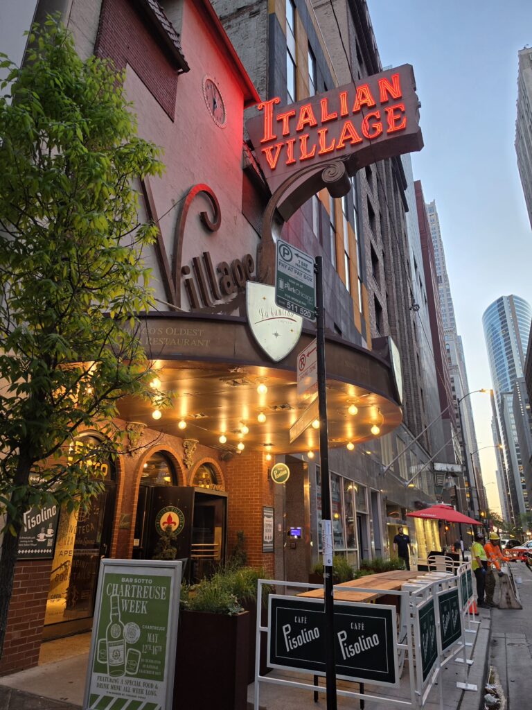
The Village is an old Italian restaurant that opened in 1927 and serves traditional Italian classics. The place is a really quaint and romantic place. The food was absolutely terrific, the service was first rate. While it is family-friendly, The Village is perfect for couples whether it is a special occasion or just a night out for a great meal.
The most efficient way to present our journey is to list the stops planned, basically our itinerary for the trip; talk about the places we ate; and discuss the accommodations for each night. Each day will also be linked to the Day’s photo diary posted during the trip.
Day 1 – Chicago to Litchfield – 245 miles
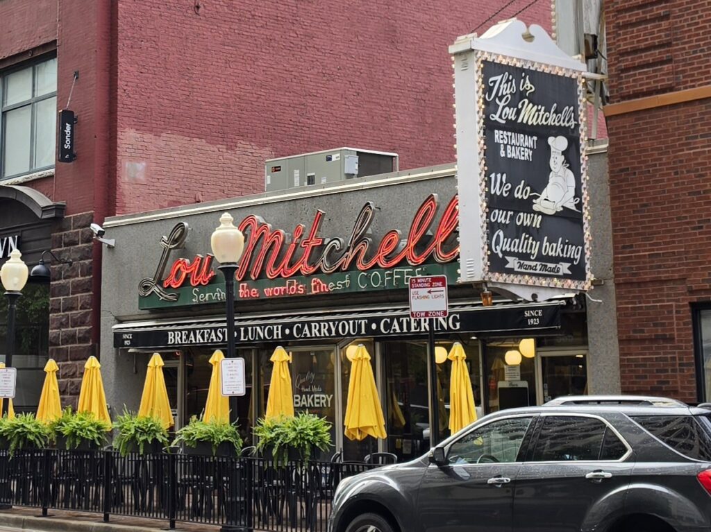
- Chicago, Illinois – Lou Mitchell’s, Start sign at East Adams Street/East Michigan Avenue
- Joliet, Illinois – Blues Brothers statue
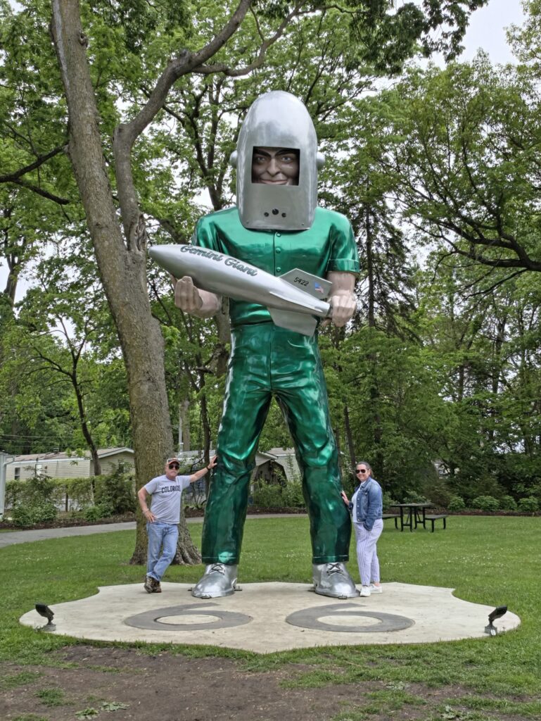
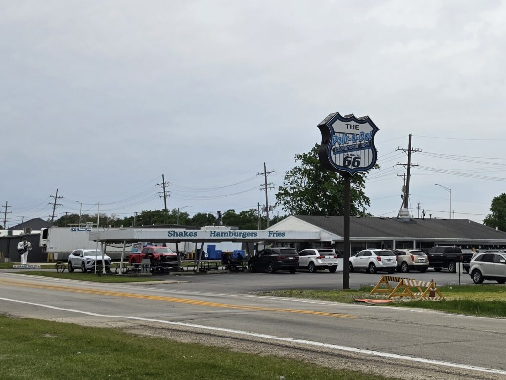
- Wilmington/Braidwood, Illinois – Gemini Giant, Polk-a-Dot Drive In
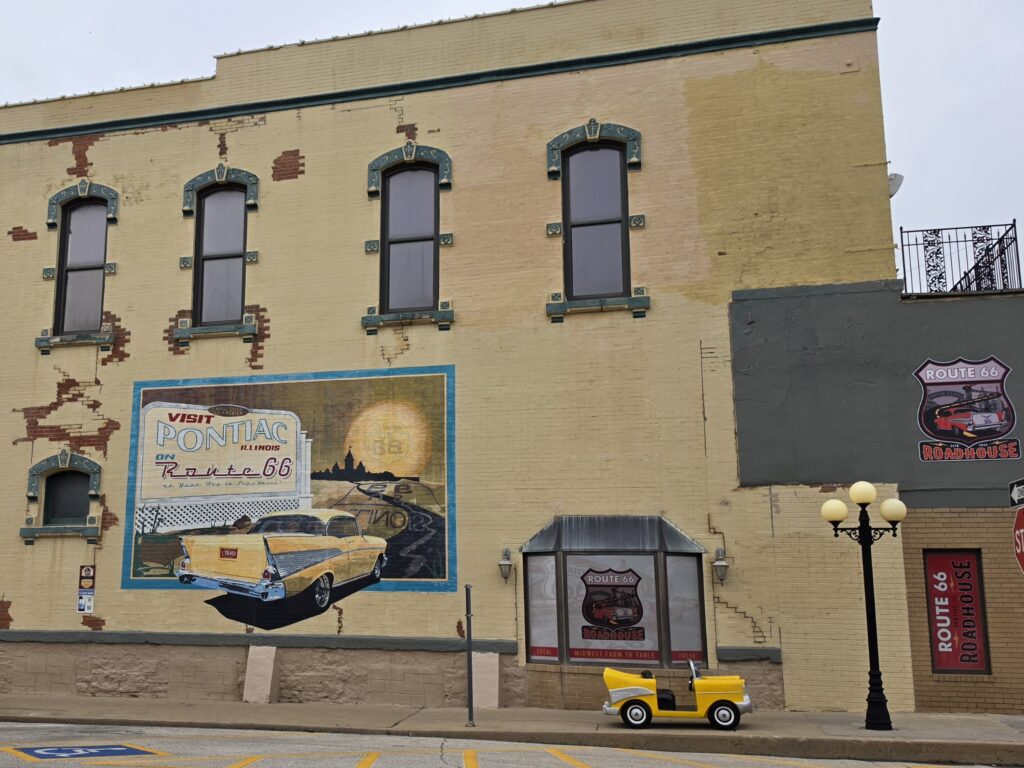
- Pontiac, Illinois – Murals
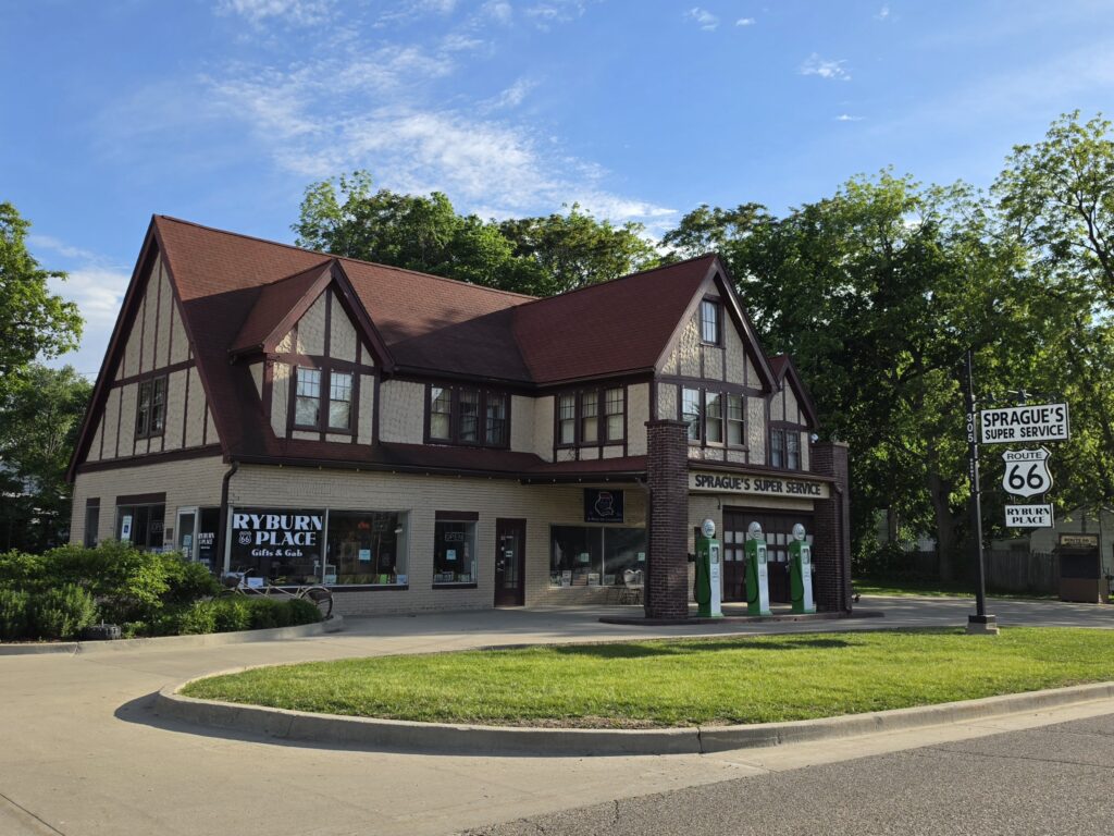
- Normal, Illinois – Sprague’s Super Service Station
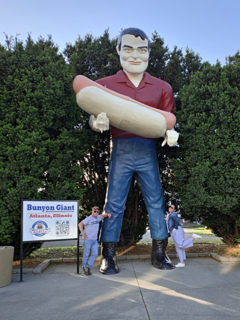
- Atlanta, Illinois – Giants
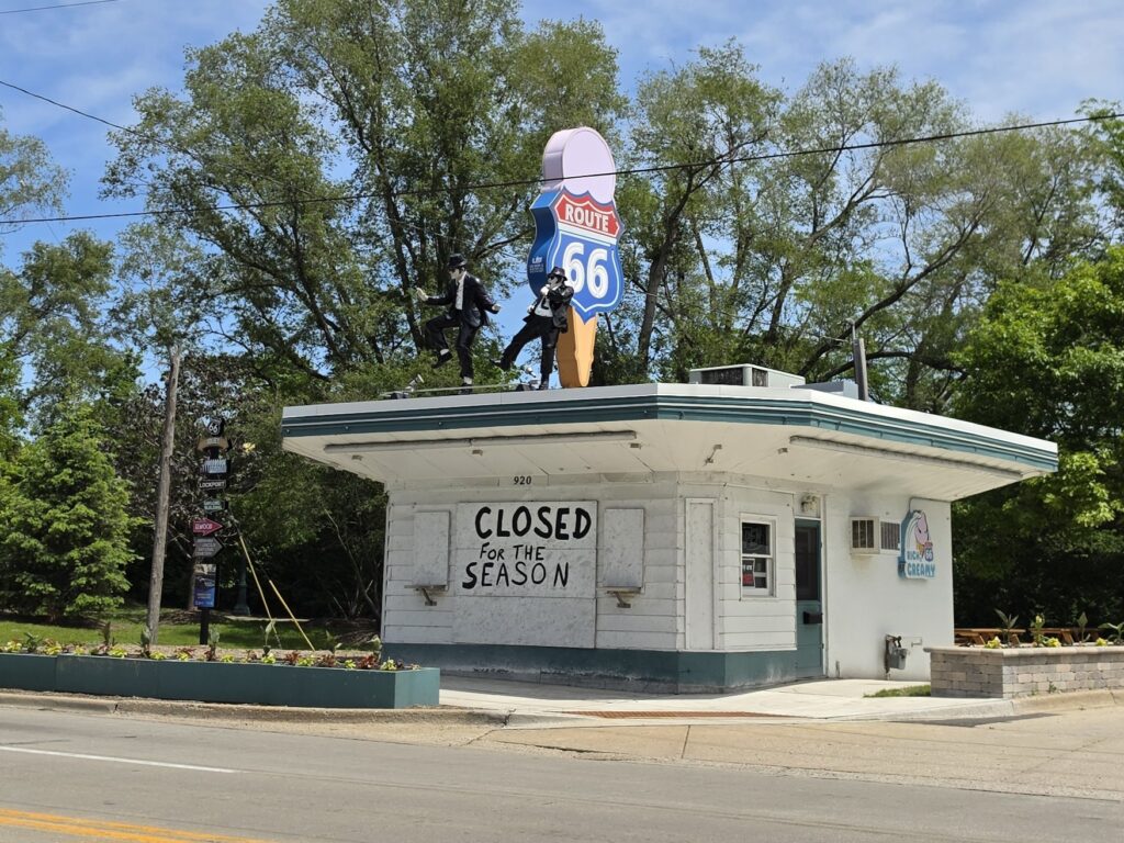
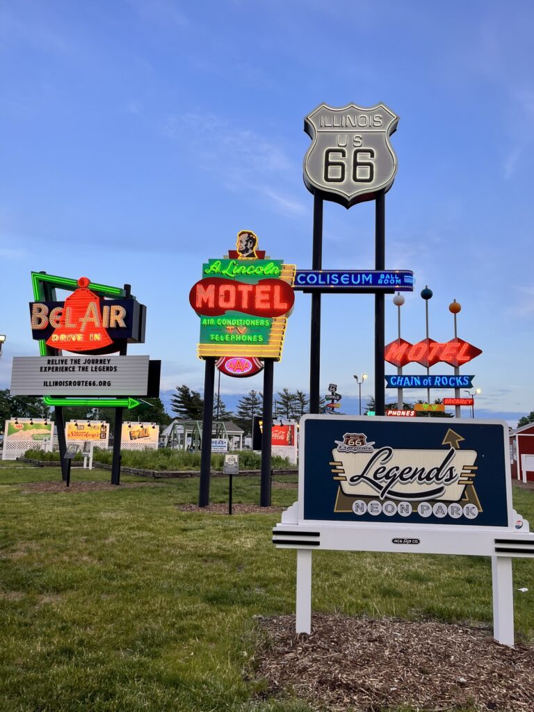
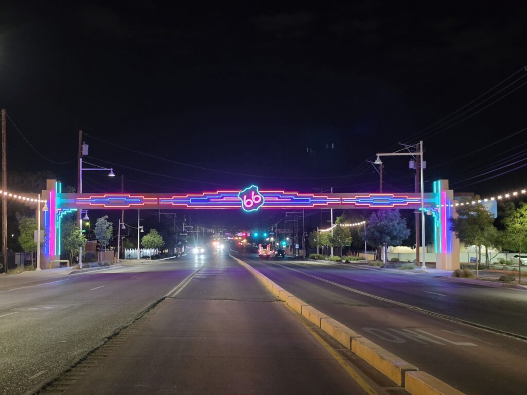
- Springfield, Illinois – Neon sign exhibit, drive-in theater
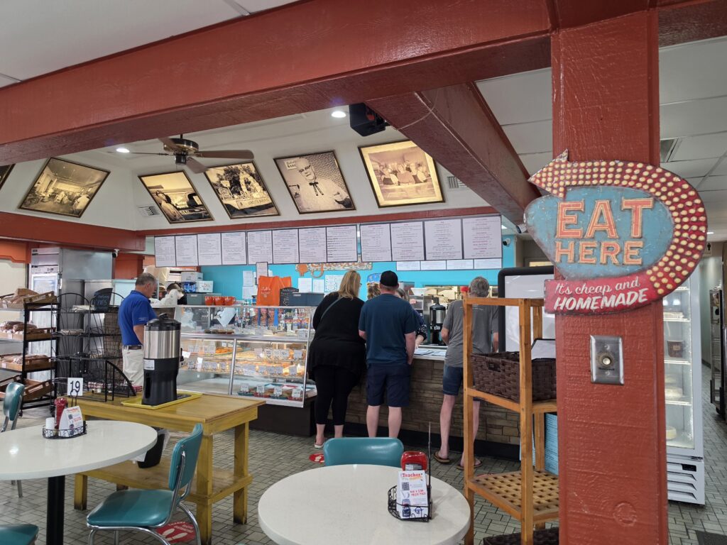
We started the day off by having breakfast at Lou Mitchell’s on Route 66 in Chicago. The place was PACKED and it was bustling with people. The food was really good and the portions were huge. And they move very quickly. Definitely a bit of a “tourist trap” but a good place to get breakfast as a part of Route 66 history.
We then backtracked and headed to the beginning of the eastern end of Route 66 across from the Chicago Institute of Art.
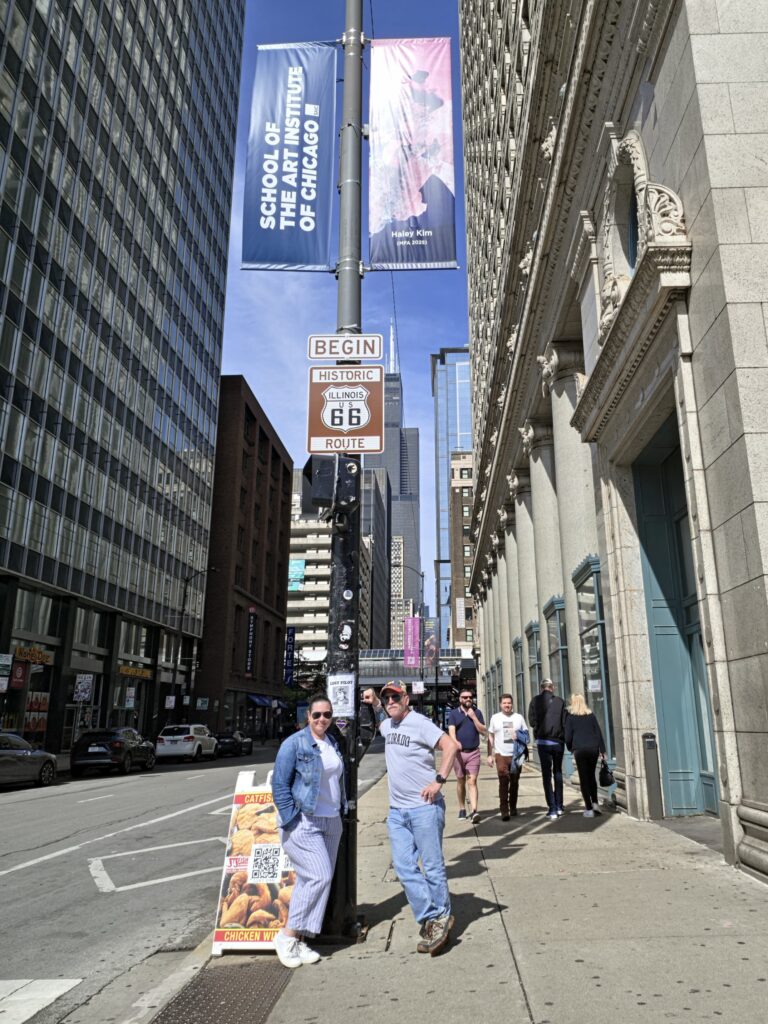
There is a newer “BEGIN ROUTE 66” sign that was placed on the Navy Pier, however, the official sign remains at the corner of East Adams Street and East Michigan Avenue, and that is where we began.
We stopped for a snack and much needed coffee at Ferrara Bakery & Café in Chicago, Illinois. I am unclear as to why nobody mentions this as a stop along Route 66. It’s been there since 1925 and the baked goods are really good.
We drove through some sketchy areas of Chicago, the first of which was Cicero where Al Capone was known to have held business in the area. It was soon after passing through that we quickly learned how easily we could get thrown off course as we encountered our first intersection where a sign had to have been missing. And so we went straight when we should have turned left.
The next stop on the list was Joliet, Illinois to see the Blues Brothers statue on top of an ice cream shop.
We stopped for lunch at Juliet’s Tavern in Joliet, Illinois. It’s a nice place with a diverse menu. It’s not a place that I would take the kids, but definitely a place that would make for a nice dinner spot.
Then it was on to take on the Gemini Giant in Wilmington, Illinois.
We just had to stop for ice cream at Polk-a-Dot Drive In in Braidwood, Illinois.
It is Day 1…and seven hours and three minutes into the trip…and after another frustrating situation with the navigation…
MELISSA: “I HATE THIS TRIP!”
We hit Pontiac, Illinois which is known for the many murals. Most of them telling a story about the town and its residents.
Normal, Illinois is the home of Sprague’s Super Service Station.
Atlanta, Illinois is like the Land of the Giants.
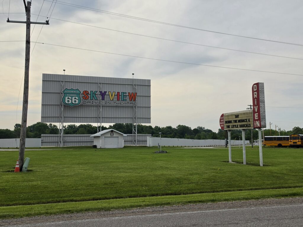
We finished the day off with a visit to the neon exhibit at the fairgrounds in Litchfield, Illinois.
We got in late to our motel and dinner ended up as Bobo’s Peanut Butter and Jelly for me and nothing for Melissa.
Litchfield Illinois – Carlin Villa
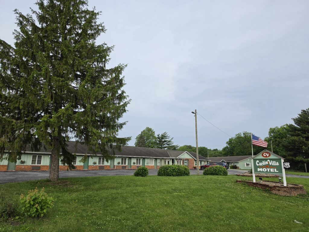
Truth be told…Carlin Villa in Carlinville, Illinois was not our first choice. But trying to stay at the specific places we were looking at on Route 66 proved fruitless. I found Carlin Villa on a lark and was able to book a room without a problem. When reaching out to express that we were on our honeymoon, and if they could do anything special, the owner said, “…we give one room, one bed.” I am not quite sure what she meant by that, but OK.
We arrived on the later side and after spending about 10 miles on a dark road, we discovered that Carlin Villa is, in fact, on Route 66. It just happens to be on one of the iterations that we were not previously aware of, but it made the second choice more palatable.
And the accommodations were better than expected. The room was exceptionally large, especially for a motor lodge and was one of the many rooms that had access from an interior hallway rather than an exterior entrance. There was a large gathering room at the end of the motel lobby with a fireplace and some sofas.
The rooms were a bit “dated” and appeared to need some attention in the bathroom. But it was definitely a place that was kept in that time capsule of the past and it was clean. Definitely a place to stay and definitely a place when a second choice turns out to be the best choice.
Day 2 – Litchfield, Illinois to Springfield, Missouri – 271 miles
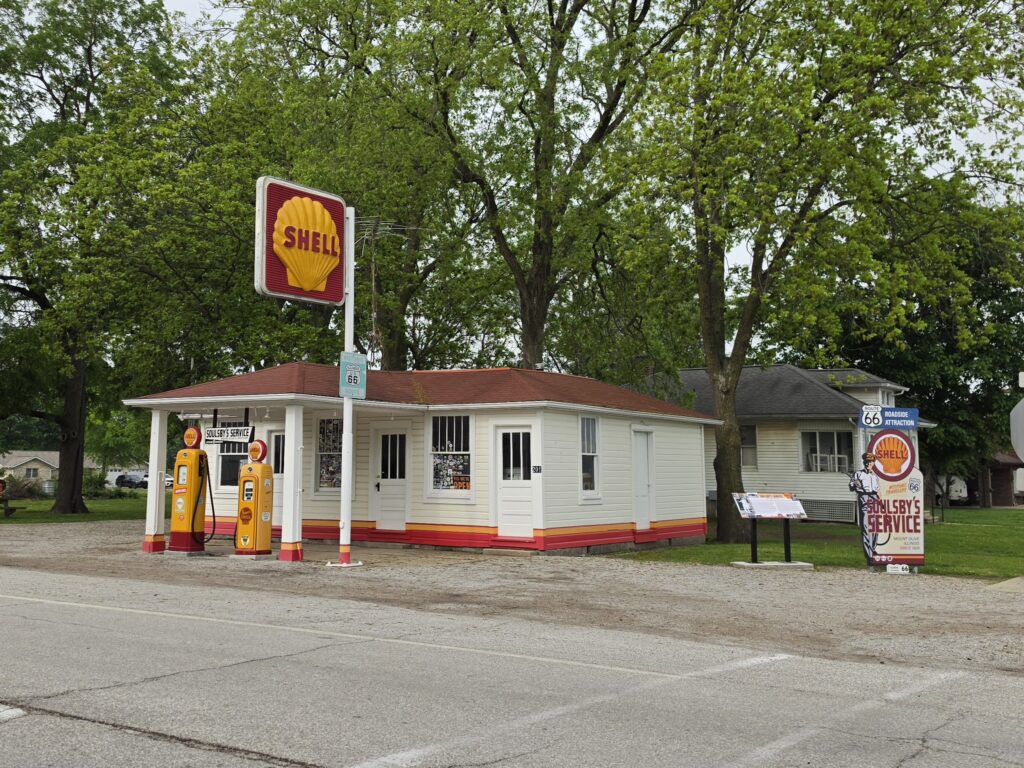
- Litchfield, Illinois – Soulsby Service Station, Skyview Drive-In
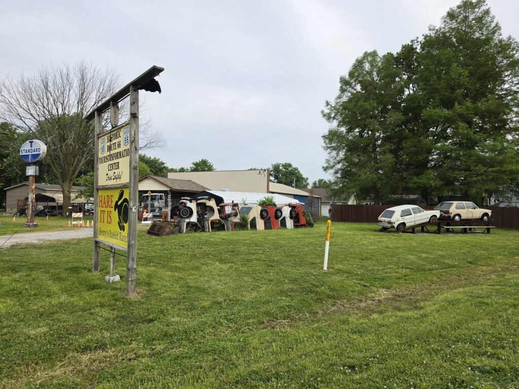
- Staunton, Illinois – Henry’s Rabbit Ranch
- Old Chain of Rocks Bridge
- St. Louis, Missouri – Gateway Arch National Park, Ted Drewes Frozen Custard
- Stanton, Missouri – Meramac Caverns
- Cuba, Missouri – Murals
- St. Robert, Missouri – Uranus Fudge Factory
- Springfield, Missouri – Route 66 Car Museum
Breakfast was at Jubelt’s Bakery & Restaurant in Litchfield because Aristan Café – the place everyone talks about – was closed; they have odd hours considering the place is considered an “icon” for travelers along Route 66. But how can you open late and close early if you are “catering” to travelers? Jubelt’s is right next to Aristan and if you are there, choose Jubelt’s. The food, service, and prices were great. And…they are OPEN!
We first stopped at the Skyview Drive-In Theater in Litchfield, and then made our way to Soulsby Service Station in nearby Mount Olive.
Henry’s Rabbit Ranch in Staunton, Illinois is a place everyone talks about. It’s off the path just a bit but worth the stop just for the pic. The property is actually closed to visitors because Henry recently passed away and his family is still debating what to do. But nobody will bother you if you are out of your vehicle to take a quick pic but don’t trespass.
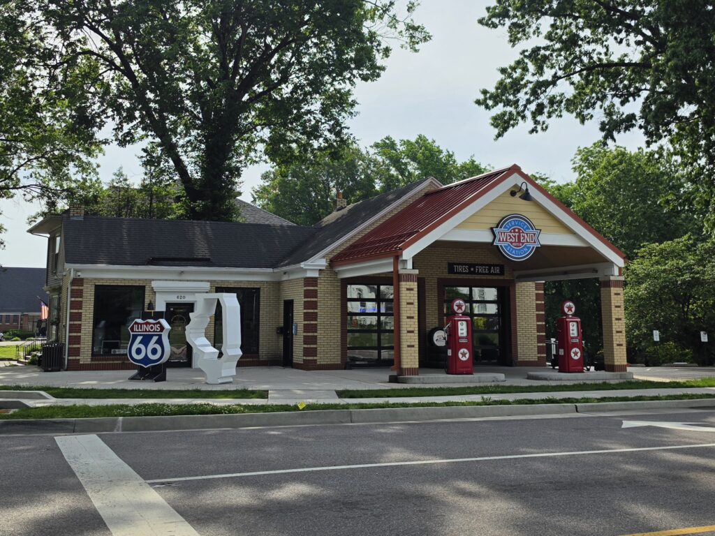
A great example of what is NOT listed by anyone is a refurbished Texaco gas station, West End Service Station in Edwardsville, Illinois. It’s being used as a visitor center but was closed when we stumbled upon it.
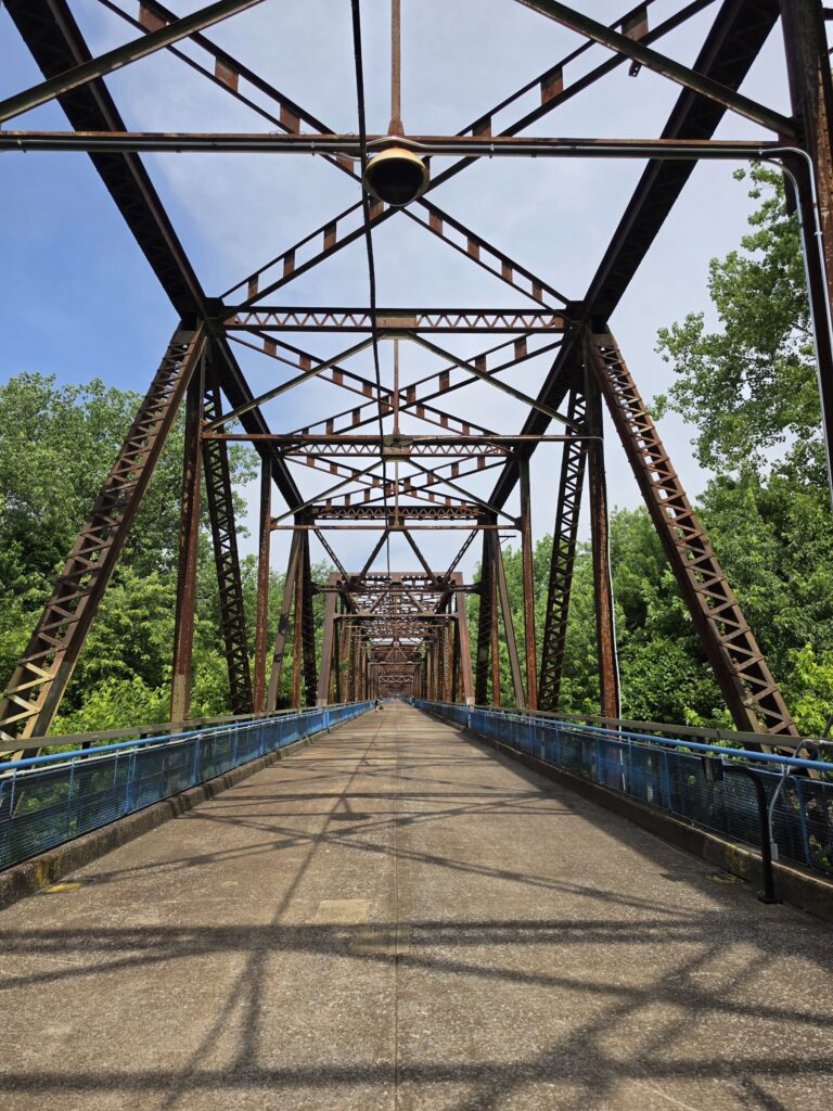
Another stop that is off the beaten path is the Old Chain of Rocks Bridge. It used to be used as a part of the original Route 66 but is strictly for pedestrians now to take a walk over the Mississippi River.
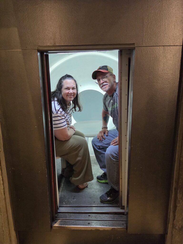
We had reservations for 11 a.m. go up to the top of the Arch at Gateway Arch National Park in St. Louis, Missouri. I am not a fan of heights and was leery about this, but I so badly wanted to do it and I promised Melissa.
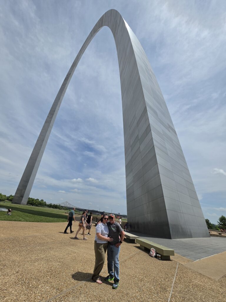
We took the tight ride up to the top, which took all of about 7 minutes, we were at the top for 10 minutes, and then back down.
Rather than making another long stop for lunch we decided to share a huge pretzel and get coffee at the café. The pretzel was ok, the coffee was awful – I threw mine out after two sips.
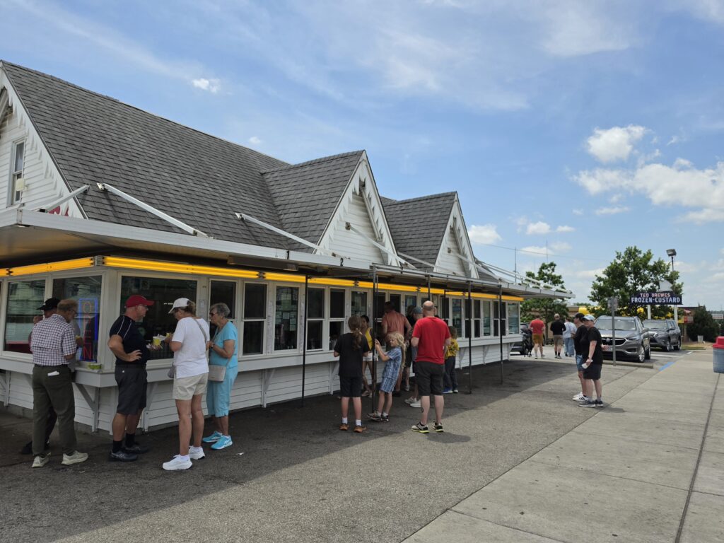
Next stop on the agenda was for ice cream at Ted Drewes Frozen Custard in St. Louis. There was a huge crowd and the lines were not too long. They only offer vanilla custard with any flavor you want blended in. It was good and definitely worth the stop for a treat.
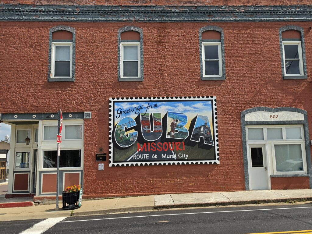
The next stop was Stanton for the Meramac Caverns but, in the spirit of time, we bypassed that. So we stopped in Cuba, Missouri and drove around looking at the many murals that led it to be labelled “Mural City.”
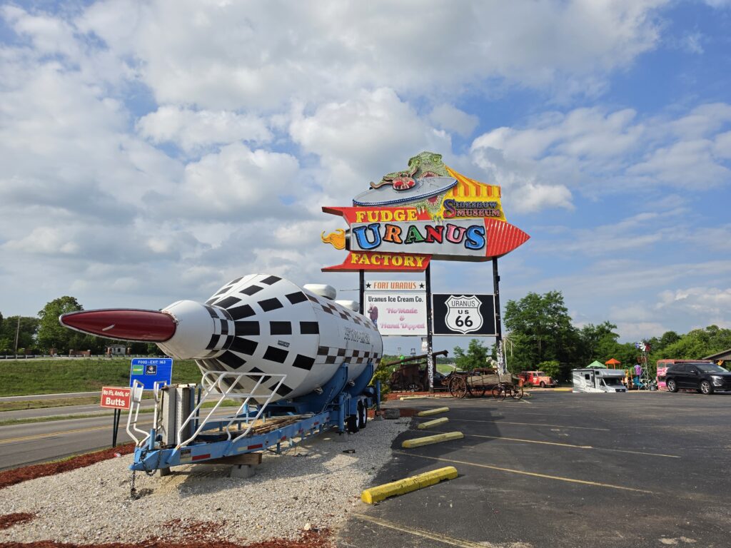
We were having trouble deciding where to stop for dinner and there were not a lot of options. So we decided, reluctantly decided, to stop at our old “go to” Cracker Barrel in St. Robert, Missouri…since we were there already seeing the Uranus Fudge Factory. BAD decision. They were out of food. Not everything…but MOST things. Melissa ordered meat loaf. MEAT LOAF! It’s a staple on their menu. They were out of it. They were out of the spiced apples that they always have. There was a large family at another table and four members of the family had to make second, or even third choices, because the place was out of their first choices. How does that happen at a place like Cracker Barrel that caters to travelers?
Springfield Missouri – Rockwood Motor Court
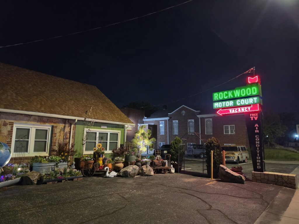
The Rockwood Motor Court is a completely refurbished and renovated motor court that presents the old-time charm of motor courts from the 50’s and 60’s. The place is creatively decorated – both interior and exterior – and has beautiful landscaping with multiple places to gather as a group or in solitude. The rooms are rather on the small side, and the bed is especially not made to accommodate larger people. We are on the smaller side and it was a tight fit for us. But that is what was customary in lodgings back in the day.
The place is especially fitting for a trip along Route 66 as it definitely captures the vibe and nostalgia from when travel by car was the norm.
Day 3 – Springfield, Missouri to Tulsa, Oklahoma – 181 miles
- Springfield, Missouri – Gary’s Gay Parita Sinclair
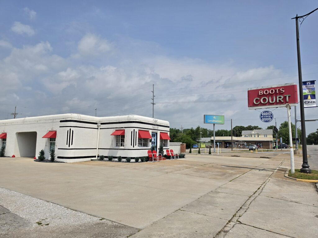
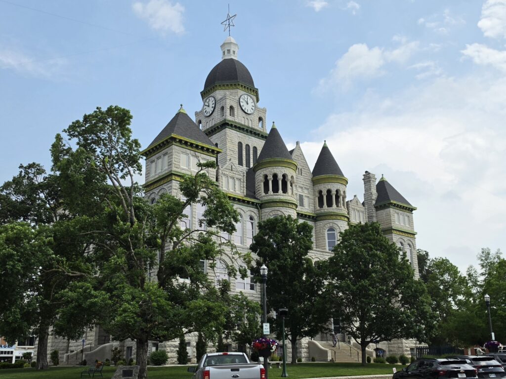
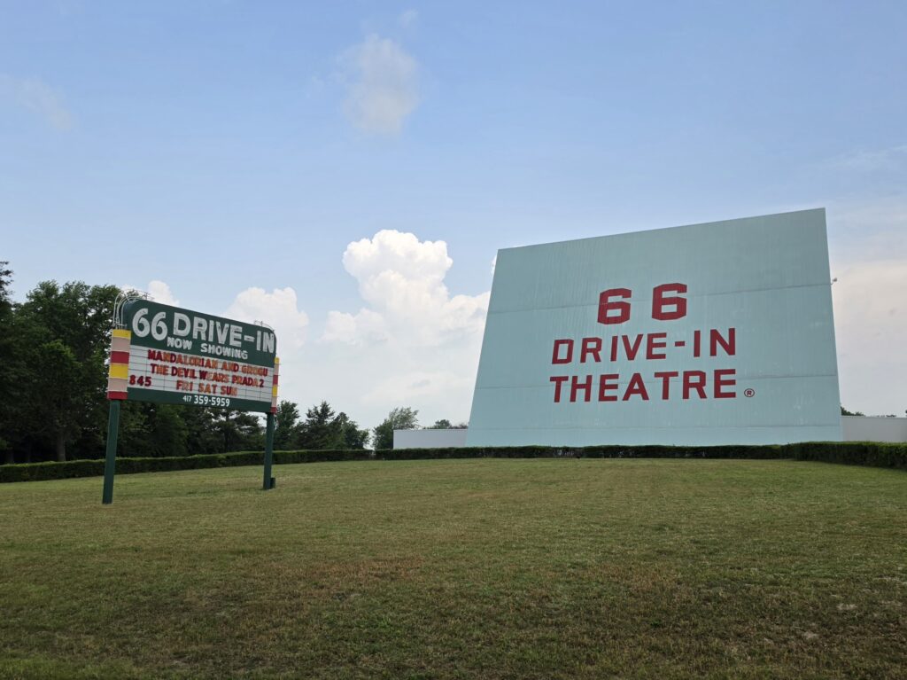
- Carthage, Missouri – Courthouse, 66 Drive-In Theatre, Boots Court Motel
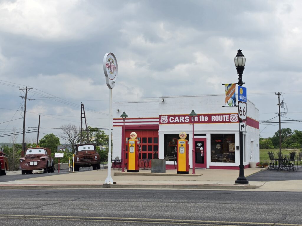
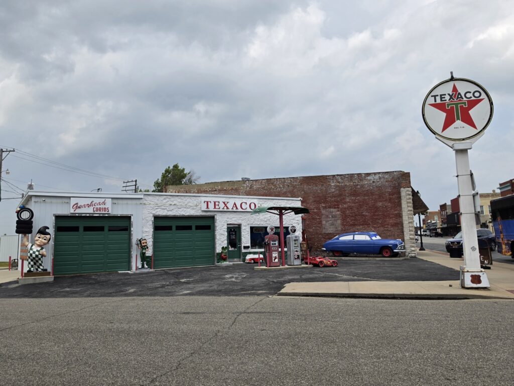
- Galena, Kansas – Cars on the Route, Gearhead Curios
- Riverton, Kansas – Nelson Old Riverton Store
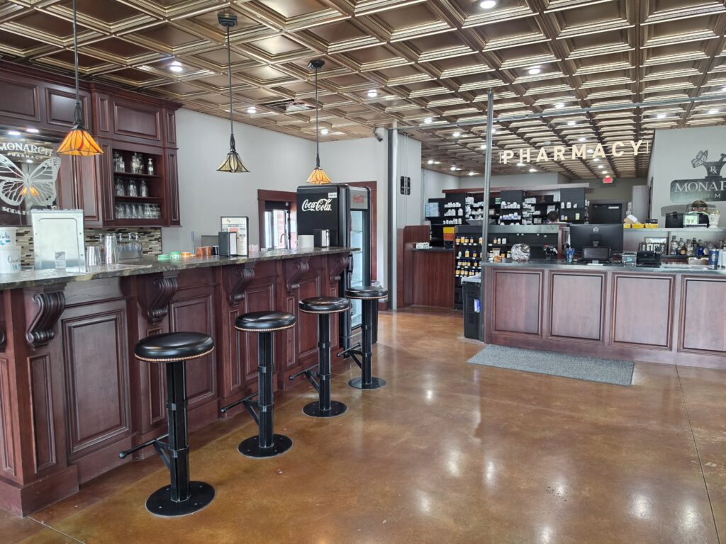
- Baxter Springs – Monarch Pharmacy and Soda Fountain, Rainbow Curve Bridge
- Catoosa, Oklahoma – Blue Whale
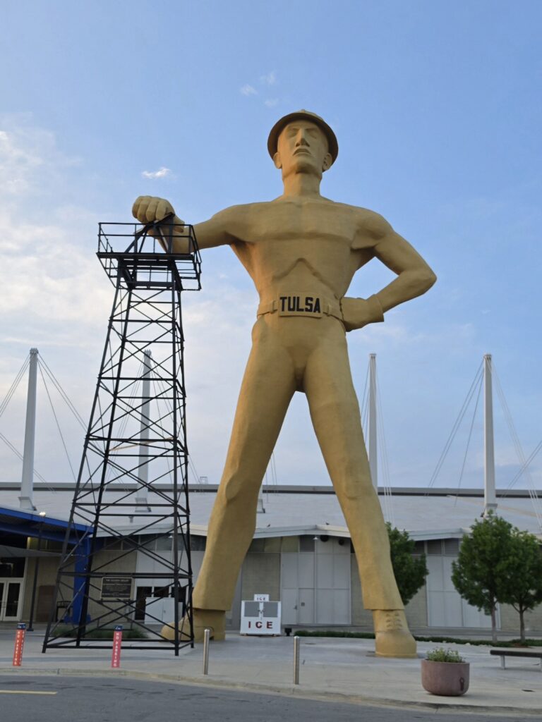
- Tulsa, Oklahoma – Golden Driller
College Street Café in Springfield, Missouri was walking distance from where we stayed. It is an old-fashioned diner and the locals are regulars. I ordered French toast and it was the first time I had had French toast that was not only dipped in egg, but dipped in malted pancake batter as well. It was great! Listening to the conversation was a nice touch to catch the vibe.

The first stop on this day was a place called Gary’s Gay Parita Sinclair. And it is truly off the beaten path in Paris Springs, MO, and you pass through a virtual ghost town of Halltown, and an actual ghost town of Plano on the way. The place is a nice collection of really old vehicles and other antiques from the early to mid 20th Century. There is also a small gift shop and the owner is there willing to talk to anyone and everyone and provide a real history lesson of the area.
Next up was Carthage, Missouri. We stopped to see the Boots Court Motel, the Carthage Courthouse, and the 66 Drive-In Theater.
Kansas would be a very short stint on Route 66 as it’s only 13 miles through a corner of the State. But obviously the town of Galena made a huge impact on the creators of Cars.
Both Cars on the Route and Gearhead Curios were inspirations for locations in the movie.
Nelson’s Old Riverton Market in Riverton, Kansas was on the itinerary as a stop for lunch. It was a total BUST. It is an old candy store type of place with a deli counter in the back. But unless you are a meat eater, there is NOTHING for you to eat. Melissa felt obligated to order something and got a half pint of potato salad. And she was force-feeding me potato salad as I was bitching and complaining. But I have to admit the potato salad was good because apparently they add mustard to the potato salad in these parts.

Well…ice cream again! Monarch Pharmacy and Fountain in Baxter Springs, Kansas was also on the itinerary and the ice cream was REALLY good. Probably the best we had on the trip. We also spent time talking to owner Kelly and step-daughter Jordan who were wonderful and provided some great insight into the people who have been passing through on a similar journey.
EVERYONE mentions the Blue Whale of Catoosa. Well…we saw it…but it was fenced in and there were two firetrucks there. I was aware that there was a renovation going on, however, the owner had messaged me on social media and said to stop by and speak with her. I had mentioned the dates of our trip, and never was it mentioned that the place would be closed. Apparently it has since been reopened, but we didn’t have the opportunity to experience it.
Tulsa…if you have seen any episodes of Tulsa King, then seeing the Golden Driller statue is awfully familiar.
SMOKE. Woodfire Grill in Tulsa, Oklahoma was the choice for dinner. Again, although there were some non-meat items on the menu, I had to ask how things were cooked because EVERYTHING was cooked in a meat-based oil. I don’t get that but they did accommodate me to cook my meal separately. The meal was fairly good and I would try it again, however, the entire ordeal of KNOWING that everything is prepared using some kind of meat product is too stressful.
Tulsa Oklahoma – The Campbell Hotel

The Campbell Hotel was previously known as the Casa Loma Hotel located in the Max Campbell Building at the end of the trolley line that ran from downtown to Delaware Avenue on 11th Street. It reopened in 2011 as a luxury hotel and event center with a very rustic western-themed décor. It has been beautifully restored and was a fun and exceptionally comfortable place to stay.
The area is not the absolute best, but what area is? Never felt unsafe and it truly felt like we had taken a step back in time. The place is on the National Register of Historic Places and should be experienced when staying in Tulsa Oklahoma.
Day 4 – Tulsa, Oklahoma to Shamrock, Texas – 273 miles
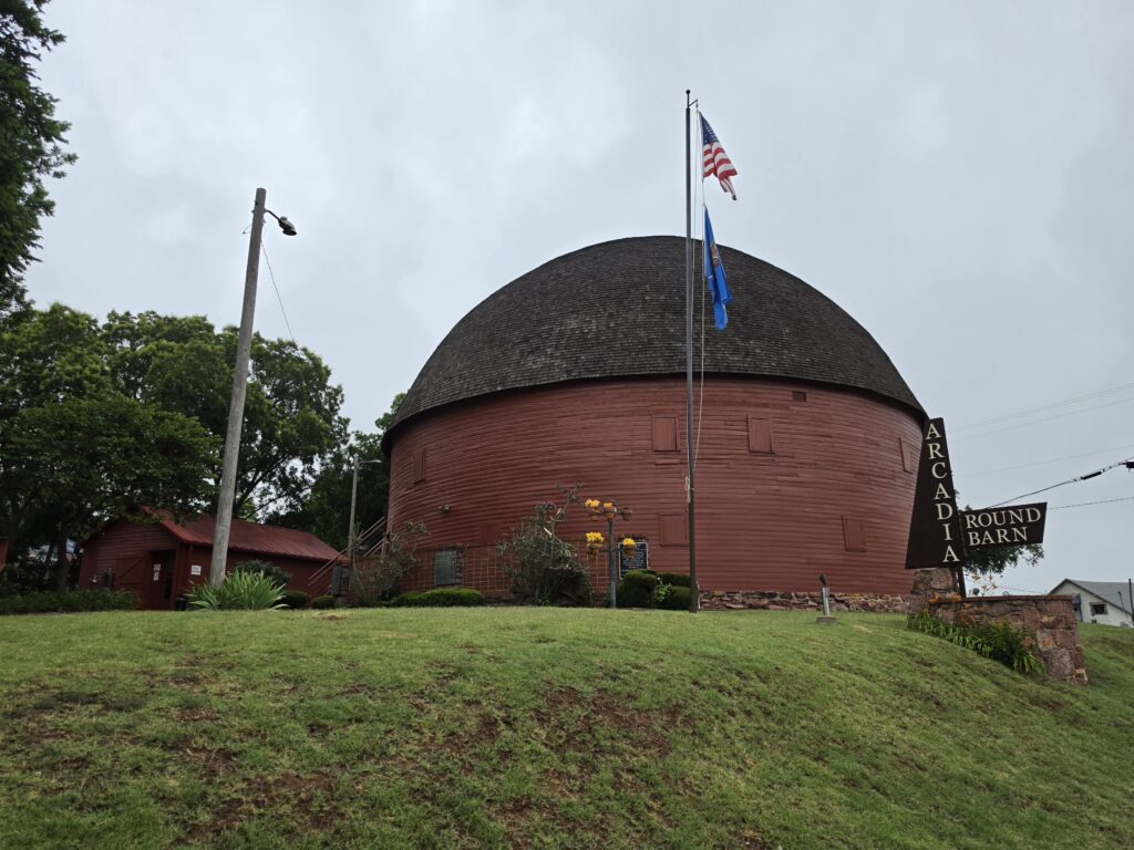
- Arcadia, Oklahoma – Round Barn, Pop’s Soda Ranch
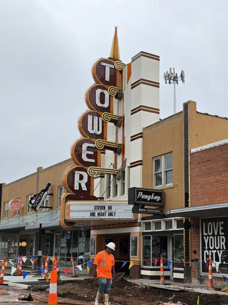
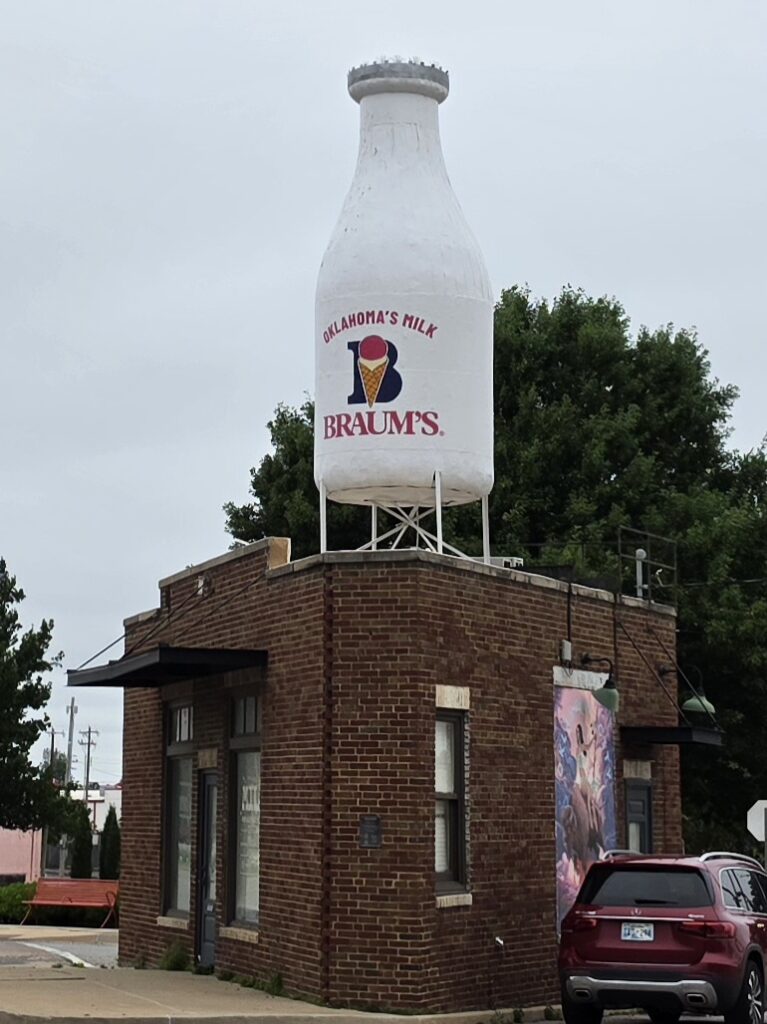
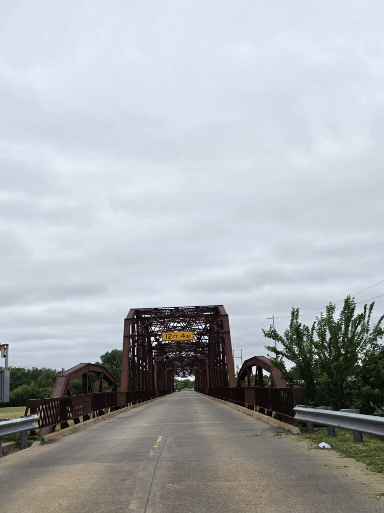
- Oklahoma City, Oklahoma – Giant Milk Bottle, Truss Bridge, Tower Theatre
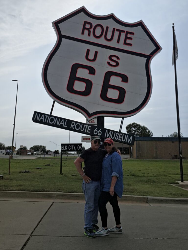
- Elk City, Oklahoma – Biggest Route 66 sign, National Route 66 Museum
- Shamrock, Texas – U Drop Inn, Conoco Tower station

Tally’s Café on Route 66 in Tulsa, Oklahoma is a diner that is a throwback to the 1950’s. It’s another typical “greasy spoon” that had us thinking that we should have purchased that cooler. They have a huge breakfast menu with many options and big portions. But it was still a very greasy breakfast.
The first scheduled stop on the itinerary was Arcadia, Oklahoma. But we first came upon another town – Sapulpa would be a huge surprise. It was not on our radar, certainly not on our itinerary. But it would be one of the nicest downtowns with some very nice historical landmarks, most of which were not mentioned by people on social media pages, that’s for sure. Sapulpa is a town that should have been placed above quite a few others in our opinion.
The Round Barn in Arcadia would be our next stop. It is here that we happened upon a vehicle belonging to a father and daughter, Joe and Sophia – from Colorado – who were traveling the same route as us. And we left them one of our ducks and we heard from them and have been sharing stories and pictures with them ever since. One of the nice connections we made traveling Route 66.
Lunch would be at one of the planned stops on Route 66 at Pop’s Soda Ranch in Arcadia, Oklahoma. It’s a great place if you like soda, of course.

And they have more than you have ever seen in your life. If you love soda, this place is for you. Melissa had a grilled hot dog that she said was great. For me…the food was blech…but the soda was worth it!
The rest of the day was spent driving to Oklahoma City where we sought out the Tower Theater, the giant Braum’s milk bottle, and the historic Rock Creek truss bridge just west of the Oklahoma City limits.
The 100-mile stretch of Route 66 from Tulsa to Oklahoma City is considered by some to be known for the old “Route 66 vibe.” To be honest, I drove that stretch…and I am still wondering what is meant by that. What particular “vibe” is it referring to? Because I don’t get it.
Somewhere between Yukon and before Weatherford, we drove through a town called Calumet, Oklahoma that is completely abandoned.


Elk City is the home of the largest Route 66 sign and the NATIONAL Route 66 Museum. We stopped at the sign but, again, we passed on the museum…because it was closed. 5:02 p.m. and they had already locked up. So that is what we also couldn’t quite understand. If this such a big deal…Route 66…the 100th Anniversary…why are so many businesses…so many museums…so many visitors centers…CLOSED?
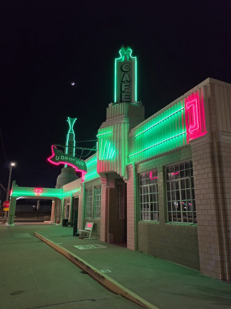
We finished up the day by arriving in Shamrock, Texas where we saw another landmark on our list and a huge inspiration for the movie Cars – U-Drop Inn and the Conoco Tower gas station.
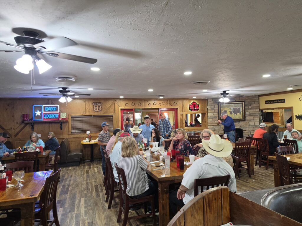
The Mesquite Canyon Steakhouse in Shamrock, Texas is a local favorite and for good reason. The food was GREAT. Melissa had a steak and she said it was by far her favorite meal of the trip. Well…you’re in Texas…beef SHOULD be great, right? But this place was special. Definitely family-friendly and very easy to see that it was frequented by the locals. A number of family-filled tables. The service was great and the desserts were a real treat. I would agree with Melissa that, overall, this was the best meal of our trip. And, unfortunately, it’s not on anyone’s list of suggested places. Don’t miss this one!
Shamrock Texas – Western Motel
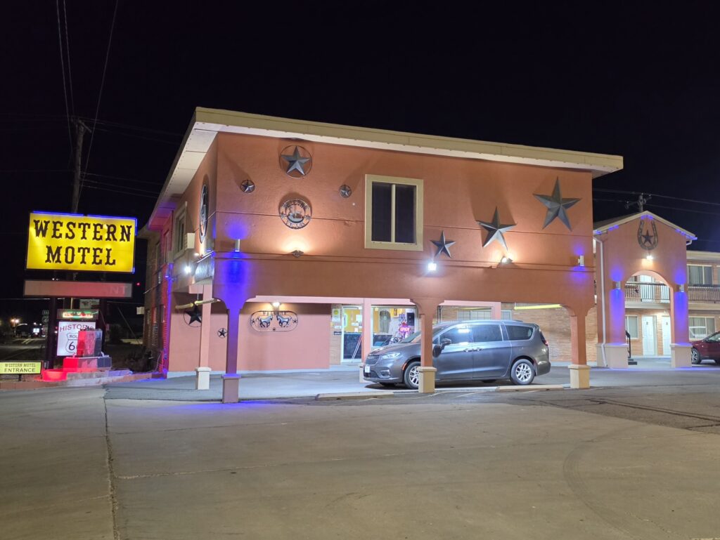
The Western Motel in Shamrock, Texas is long-established motor lodge that is in a great location directly across the street from the U Drop Inn café and Conoco Tower Station that were inspirations for the movie Cars.
The motel is a 1960’s style motor court and while somewhat dated, is clean and in the style of the decade of the 60’s.
The staff is extremely cordial and went way above and beyond to make our stay as a honeymooning couple very special.
We were given a room with a view that is worthy of a post card. Enough said.
Very clean and family friendly…a perfect stopover along Route 66.
Day 5 – Shamrock, Texas to Tucumcari, New Mexico – 204 miles
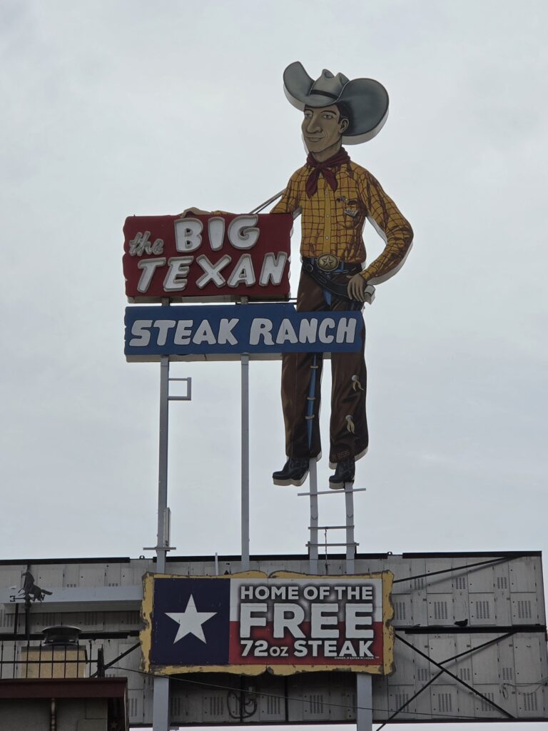
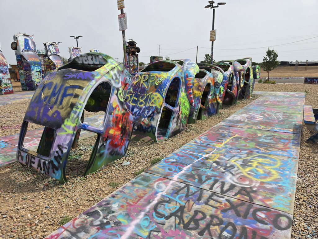
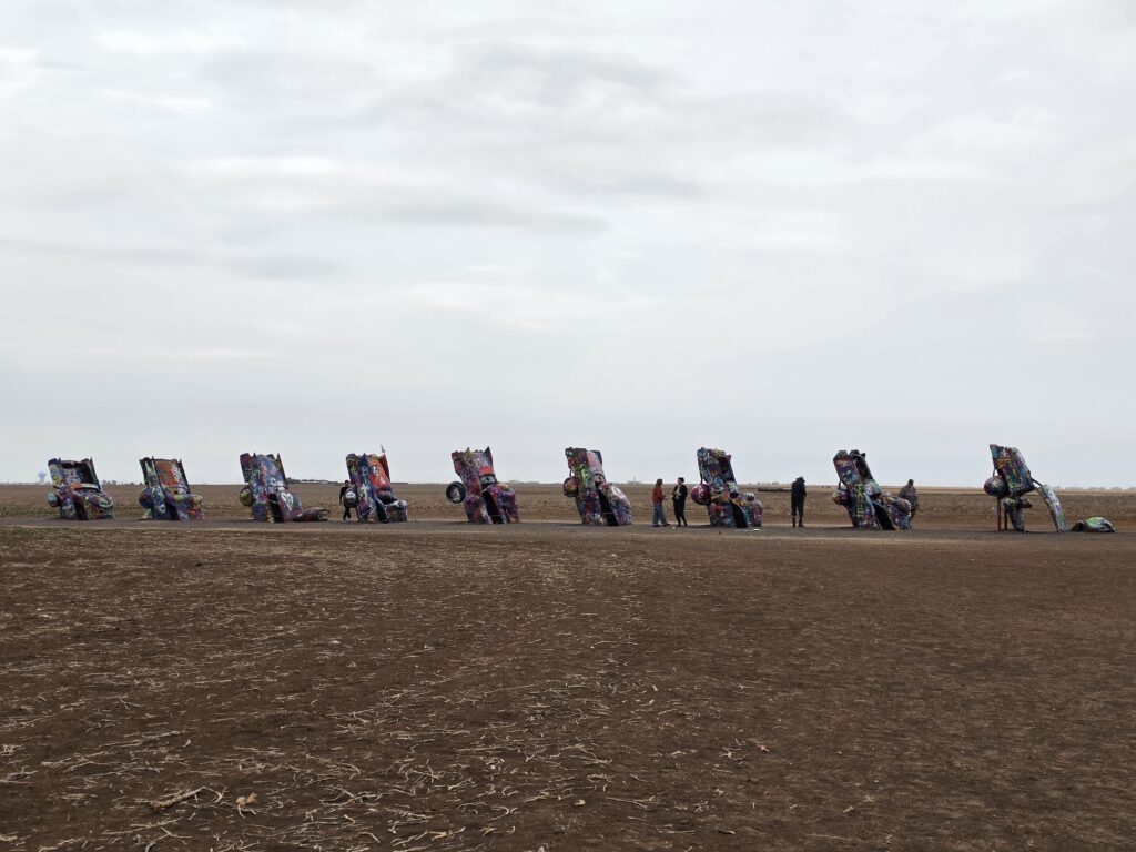
- Amarillo, Texas – Big Texan Steak Ranch, Slug Bug Ranch, Cadillac Ranch
- Adrian, Texas – Midpoint
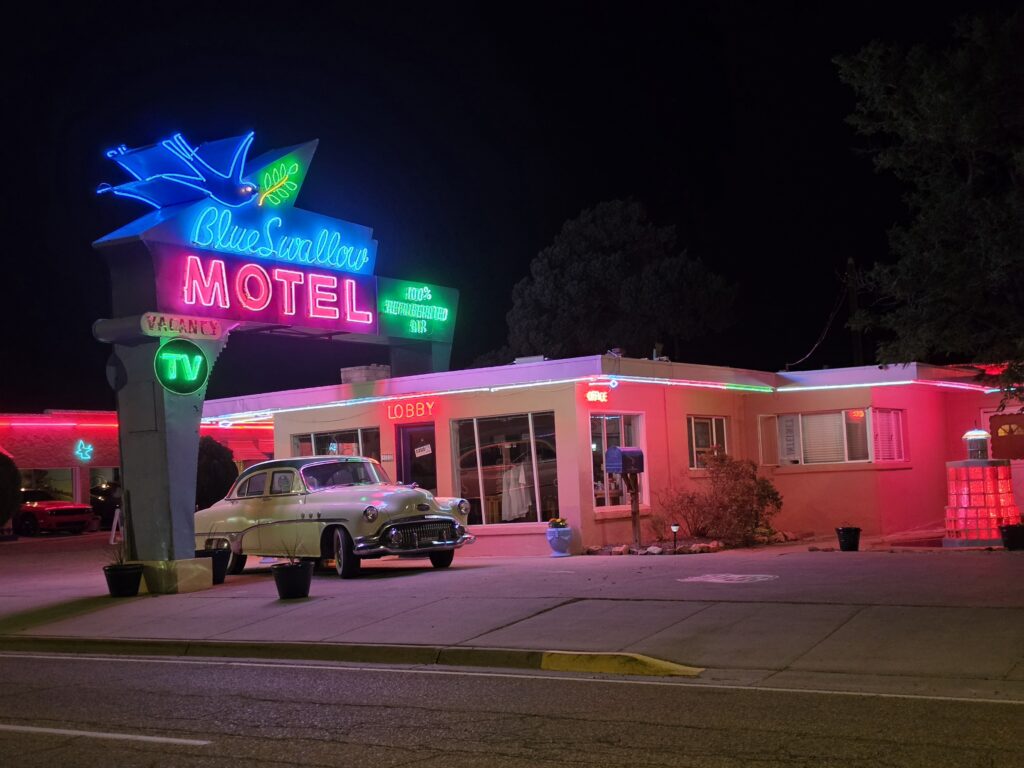
- Tucumcari, New Mexico – Route 66 Monument, Blue Swallow Motel, murals, NEON
Breakfast we had nothing. There was really no place available at an early hour to grab a bite or even coffee, except for a gas station. And we were not wanting gas station coffee or another greasy spoon.
We started off our day driving through McLean, Texas. A once thriving town is now eerily abandoned. There were a few cars driving through here and there, but it truly looked like the Armageddon had come and gone from the place.
Amarillo would be our first scheduled stop of the day. There would be The Big Texan Steak Ranch, Slug Bug Ranch, and the famous Cadillac Ranch.
We finally reached Midpoint Café in Adrian, Texas…the halfway point of the trip. As I said earlier, the sign says that it is a distance of 1,139 miles east to Chicago and 1,139 miles west to Los Angeles – a total of 2,278 miles. But, as explained earlier, that doesn’t take into account some of the added loops of the original Route 66 that add up to the 2,448 miles.
The food at the Midpoint Cafe was typical diner food but good. The service was GREAT. When I questioned if the veggie burgers were cooked on the same grill as the meat, the chef came out and made sure to let me know that she was going to cook MY burger separately and asked if I needed any other accommodations. And the she came out and checked on us to make sure everything was good. You don’t get that kind of service every day.
Tucumcari, New Mexico was probably the biggest disappointment for me. I planned the trip around being in Tucumcari at night, specifically to see all of the beautiful neon that is talked about. As a local said to me, “Everyone expects Tucumcari to look like the Las Vegas Strip at night. And, in it’s hey day, it did. If fact, there was more neon in Tucumcari than in Las Vegas. But that all changed when the Interstate came through and those businesses that lit the town up just couldn’t survive.”
There are some places in town still hanging on and running on reputation. But my expectations set me up for a big let down.
We had dinner at Dell’s in Tucumcari thanks to a recommendation from a local. And it was a bad experience. The food wasn’t great and the service was terrible. They handed us our check without even asking if we wanted dessert or coffee. A huge pass on this one.
Tucumcari New Mexico – Historic Route 66 Motel
There are other places in Tucumcari that seem to get mentioned a lot more, but the Historic Route 66 Motel is a really nice place and deserves to be ranked right up there with the others. The décor is definitely retro and fitting for the era.
We were given a nice surprise gift as a “honeymoon couple” when we got to our room.
The place doesn’t have the neon that the other area motels are known for, but it does have all of the other features that you want in a nostalgic setting.
The ONLY possible complaint we had was that there was no outlet available to charge any device. So while it might not have been needed back in the day, this is an example of why some people had suggested bringing an extension cord or power strip along on the trip.
The place is in a great location and the owner has a great flair for conversation and educated us on things about the history of Route 66 that are not common knowledge, but were quite accurate when I decided to go down the rabbit hole.
Day 6 – Tucumcari, New Mexico to Albuquerque, New Mexico – 176 Miles
- Albuquerque, New Mexico – Central Avenue, retro strip with neon signs
We fell upon Carlson’s Coffee House in Tucumcari, New Mexico and had a wonderful breakfast. It’s a cute coffee shop setting. And the coffee is free as long as you are sitting there and drinking it. Everything is freshly made by the owners. This place is not mentioned anywhere and damn well should be. The places that ARE talked about are not WORTH mentioning. And the sign is a bit misleading…you might think that it’s a tattoo place.
So it’s this part of the trip where you can either take the ORIGINAL Route 66 from 1926 which takes you up and through Santa Fe, or bypass it with the 1940 revision. The story we were told with the reason for this revision was that in the 1930’s, the motor vehicles making their way to Santa Fe couldn’t make it up and down the many steep hills along the way. Well, they could make it down, but had trouble making it UP. That’s because unless the vehicle had a FULL tank of gas, when the vehicle would be heading up a steep slope, the engine could not get any fuel, causing the vehicle to stall. Motorists would find themselves turning the vehicles around and driving them in reverse up the slopes, and then turn the vehicle back around when they got down the slopes. So rather than have an engineer quickly solve that problem in a motor vehicle, someone made the brilliant decision to say, “Hey, we don’t need to go to Santa Fe anyway.”

Lunch was at the Plaza Café in Santa Fe, New Mexico. It’s an old fountain/soda shop that has been updated and modernized with a pretty diverse menu. A lot of options and reasonable prices. And the location is right in the middle of the town square.

While in Santa Fe, I made the decision that, since we were in a big “city” that this would be an opportunity to find an Urgent Care facility as I had been having problems with my eye and it had been days already and was really becoming annoying. We found an urgent care a few blocks away from the center of town and, I have to say, was the absolute nicest facility I have seen. It was in a beautiful building and the staff were extremely nice, knowing that I was just passing through. The doctor wrote a prescription, had it sent over to the nearby Walgreens and we were on our way.
But not so fast, the Walgreens pharmacy was on a lunch break so we had to wait about 20 minutes until they were back. Then once they opened up, the person behind the counter told me that they hadn’t received anything for me. However, I had the paperwork with the time that the RX was sent over electronically. So I asked if they could call the facility and they refused, saying they don’t do that. They said it could take 30 minutes to an hour for the RX to go through the system. I called the facility and they said they would call the pharmacy, which they did. But the pharmacy would only take the RX electronically. After 45 minutes, I asked the person at the counter again about the RX. They told me that it could be about 3 hours for me to get the prescription filled.
Uh…no. I called the facility again and they said they would send the RX electronically to a CVS at my next destination. When we arrived in Albuquerque, it was waiting for us. There always seems to be an issue with Walgreens – whether it be in New Jersey, Colorado, or New Mexico.
We got a dinner recommendation for the Sawmill Market, a huge food court, in Albuquerque, New Mexico. MANY options. We each tried one of the options. Neither was good. Honestly, I can’t believe that a local would recommend a “food court” over a local well-known restaurant.
After dinner we waited until it got dark and drove up and down Central Avenue to see the neon. There were a lot of nice neon signs lit, but there were also a lot that were dark. Again, it begs the question…”Why have a neon sign if it is not going to be lit up at night?”
Albuquerque New Mexico – Monterey Motel

The Monterey Motel in Albuquerque has a beautiful neon sign that, when lit up, harkens back to the old days of travel on Route 66. And although the exterior gives the appearance of that era, when we opened the door, we were surprised to see that the inside is a completely remodeled and updated modern “hotel” room with all of the modern amenities.
We were also surprised with a special honeymoon gift from the staff that included red rose petals on the floor for a very romantic touch.
The motel is situated only a few blocks from the historic Old Town Plaza.
There is a beautiful pool that is open into the night hours and shines alternating colors throughout the night. Although the lobby doubles as a bar, the grounds are definitely “family friendly” and a great place to stay in Albuquerque.
Day 7 – Albuquerque, New Mexico to Holbrook, Arizona – 230 miles
- Grants – Drive thru sign, sandstone cliffs
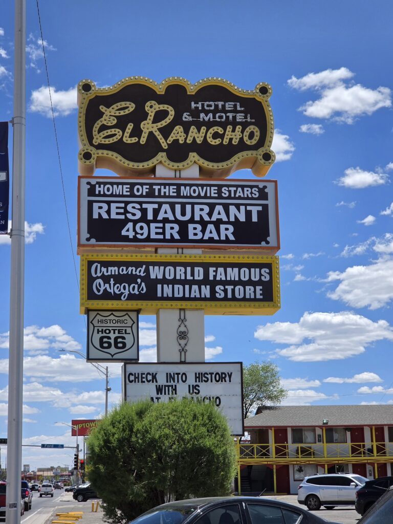
- Gallup – El Rancho Motel, mural
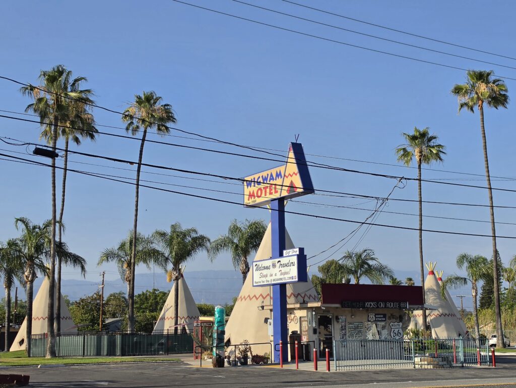
- Holbrook, Arizona – Wigwam Motel, Petrified Forest National Park
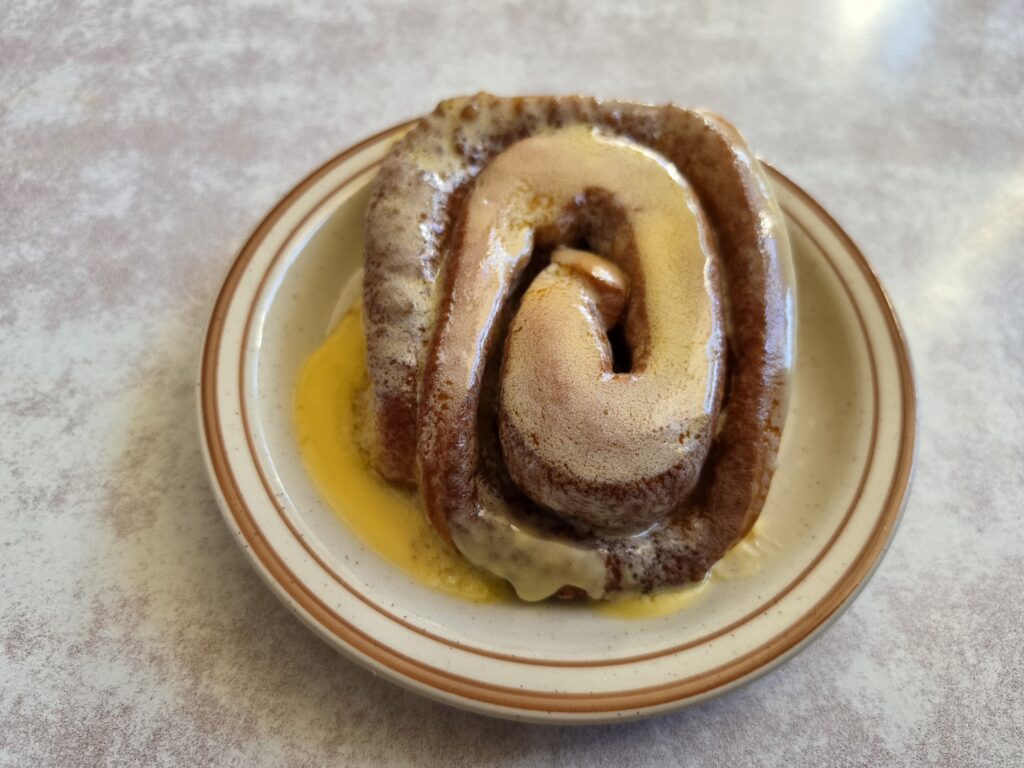
We researched and found the Frontier Restaurant in Albuquerque, New Mexico for breakfast, right across the street from the University of New Mexico. The place is HUGE and has a huge menu of Mexican favorites. They are known for their also huge cinnamon roll…which was not that great…just loaded with butter. I thought cinnamon rolls had icing…who dumps butter on a cinnamon roll. Apparently they haven’t heard of the ongoing cholesterol problem at this place.
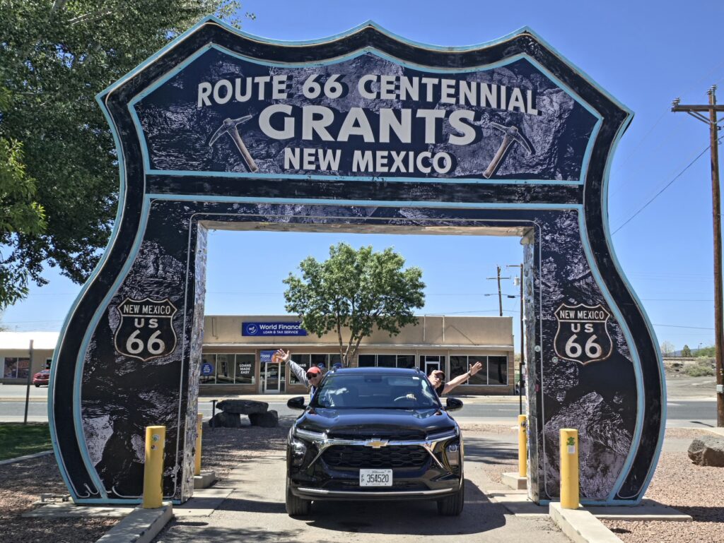
The first stop was Grants, New Mexico. The big thing on everyone else’s list was to drive through the Grants Route 66 sign. Then people had listed “sandstone cliffs.” We seemed to have missed that. But we did see a lot of abandoned motels and old decayed neon signage.
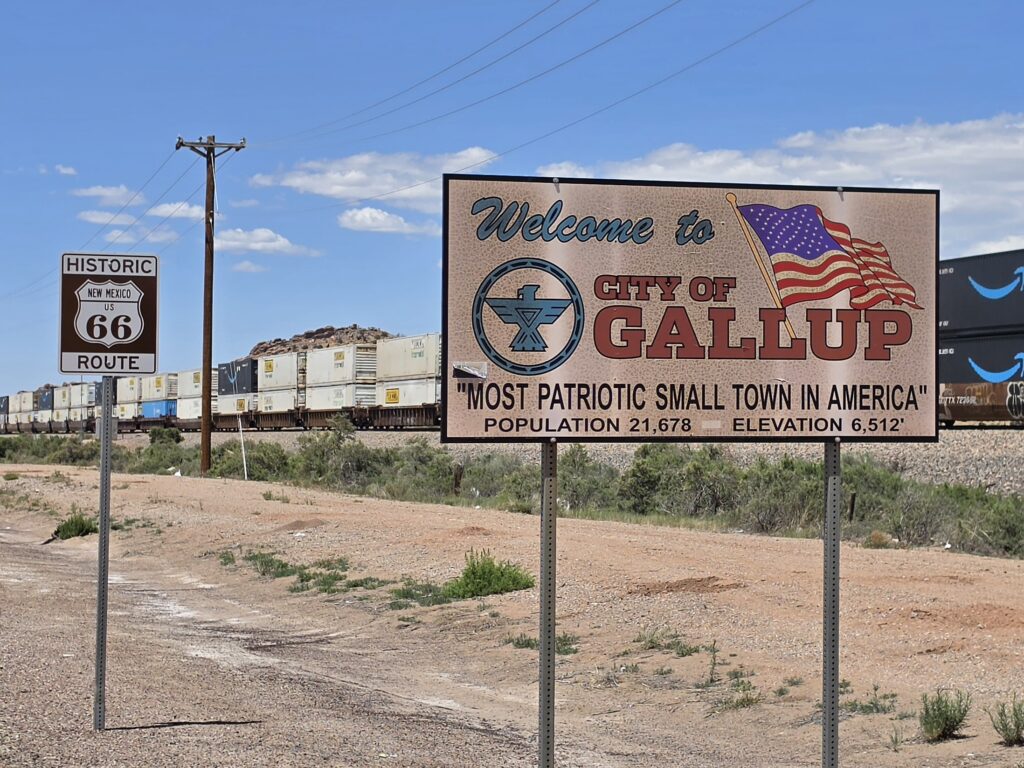
Gallup, New Mexico seemed like it was a lot like Grants, only was a bit more up to date.
Sick of diner-type food, we found Angela’s Café which is actually located in the Visitor’s Center in Gallup, New Mexico. A nice variety of sandwiches and salads that was a very nice change from the choices we had been presented most of the trip so far.
We arrived in Holbrook, Arizona before 3 p.m. and the accommodations at Brad’s Desert Inn were not ready. So we took the opportunity to do laundry. An hour and a half later and the room still wasn’t ready. Apparently, we were there on the day of high school graduation and the entire town seemed to be closed. It was like in My Cousin Vinny when the whole store “got the flu.” So we had to wait until someone was able to get the room ready.
It was extremely hot and we were driving around just trying to see some of the sights around town – including the Wigwam Motel – and stay out of the heat.

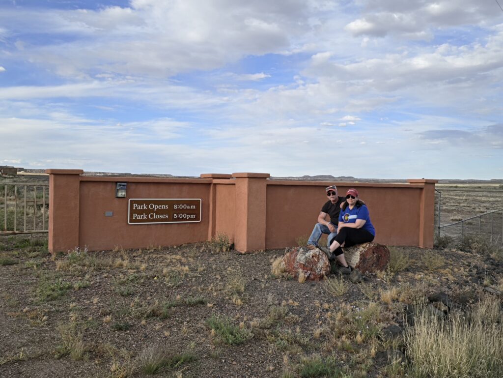
The goal for the day was to see Petrified Forest National Park at the END of the day to avoid the scorching hot temperatures and be able to experience the Park when it is much cooler. So after doing laundry, driving around, we finally got into our room around 4:30 p.m. We got settled in and got changed into our hiking boots, and made the 19 miles drive to the Park.
When we arrived at the entrance at about 5:30 p.m., there was an electronic gate that was closed. Perplexed, we sat and looked at each other and it was difficult to get any information because we didn’t have a cell signal and there was nobody to talk to. We did see two vehicles leaving the Park, the gate opened to allow them to exit.
Apparently, the Petrified Forest National Park closes because of the theft of the petrified wood. So to curb the theft, they curb the hours people are permitted to enter the Park. Now the wood is really kind of cool, but neither of us can understand why in the world anyone would want this wood. Of course it just isn’t right to take anything from a National Park, that is so wrong. But what are you doing with this stuff?
After arriving doing laundry and an “access denied” at the Petrified Forest National Park, dinner choices were not abundant. We ended up going to a Safeway nearby where Melissa got cheese and almonds and I had a banana.
Holbrook Arizona – Brad’s Desert Inn
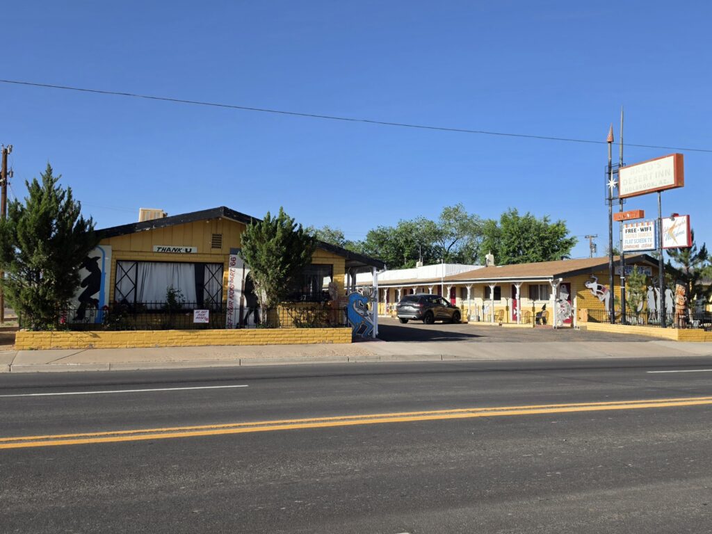
The exterior and rooms are VERY cutely done with a nice western theme. The rooms were clean and well-maintained and we were provided with a very comfortable king size bed.
It is clear that the grounds were recently refurbished. The floors in the room were uneven and covered with a linoleum so you can feel the unevenness in the floors when you walk. The parking lot is a bit of a mess as the pavement is chewed up. Signs are posted CLEARLY stating that it is a one-way path and there is diagonal parking and it CLEARLY states “NO backing in” for specific safety reasons as the manager emphasized. But just as she was reinforcing what the signs clearly said, some woman decided to turn around and back in to a space, and then immediately pull out of the parking lot in the wrong direction.
One thing that was not mentioned, is that there is a freight train that runs directly past the motel every 20-30 minutes – ALL DAY and ALL NIGHT. So if you are not used to the sound of VERY LOUD TRAIN WHISTLE (Think My Cousin Vinny), then you are in for a rough night.
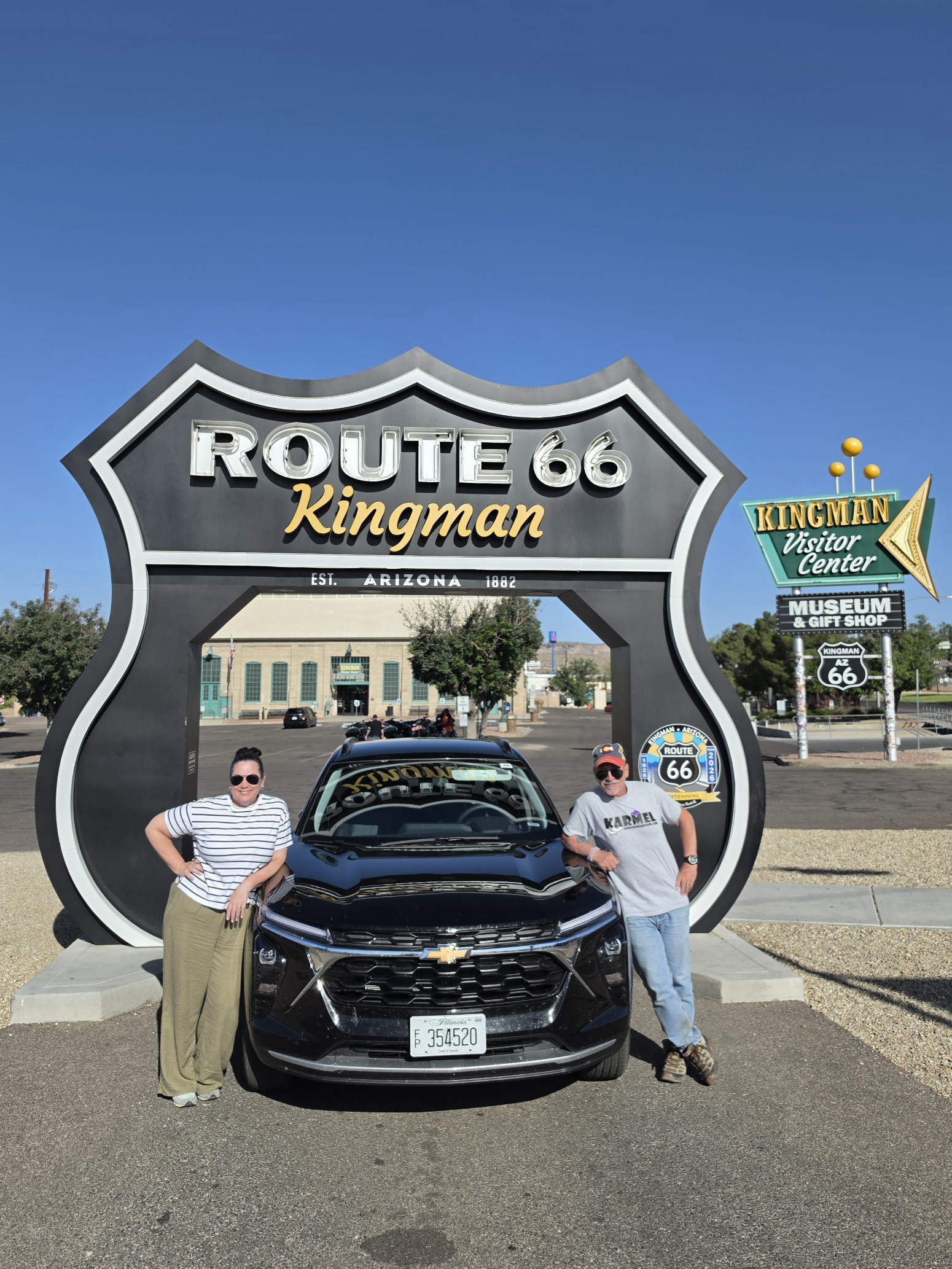
Day 8 – Holbrook, Arizona to Kingman, Arizona – 237 miles
- Joseph City, Arizona – Jack Rabbit trading post
- Winslow, Arizona – Corner
- Williams, Arizona – Grand Canyon Railroad, neon, diners
- Seligman, Arizona – (known as the birthplace of the Route 66 revival) Delgadillo’s Snow Cap Drive-In, vintage signs, old diners
- Peach Springs, Arizona – (Inspiration for the name Radiator Springs) Grand Canyon Caverns
- Hackberry, Arizona – Hackberry General Store
- Kingman, Arizona – Mr. D’z Route 66 Diner, Arizona Route 66 Museum, Drive-thru sign
Breakfast? We had no breakfast because there was no place to eat so we SCROUNGED the insulated bag for snacks and some yogurt that Melissa had bought as Safeway the night before.
We made the drive back to Petrified Forest National Park which really threw off our day because it was 30 minutes there, and 30 minutes back, so that is an hour of driving that was really allocated to the day before. And doesn’t include the time spent IN the Park. And as early as we were starting, it was already getting hot in the desert sun.
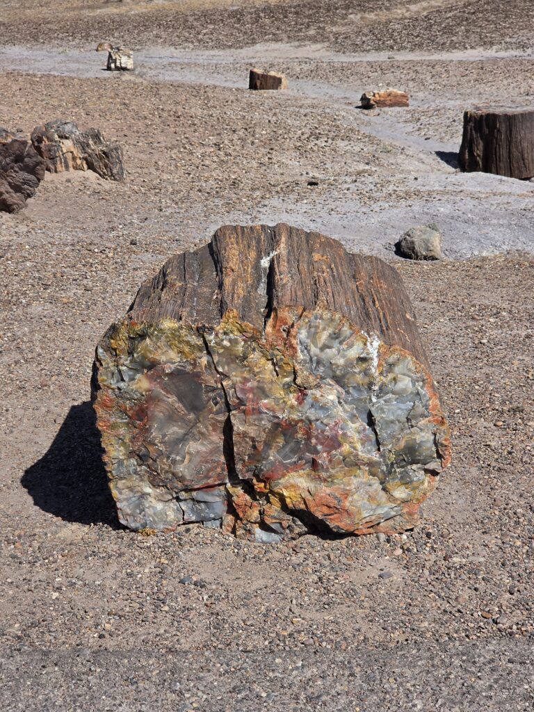
We spent about an hour walking the trail near the Visitors Center and then drove about 7 miles down the road to see some of the sights. It was wood. A lot of it. Whether it was the frustration of the night before getting to the Park and it being closed, the heat, or knowing that we were already behind schedule, we both decided we had enough. The important thing was, it was another National Park checked off the list.
We had a number of stops on the list and we were already talking about what to eat. And it would go on ALL DAY. Because when we would look, there was nothing to eat other than junk. There were a couple of stops where I had listed specific places to eat. So we just thought we would figure it out as we got to the towns.
First stop was the Jack Rabbit Trading Post in Joseph City, Arizona. The big thing is the sign with the rabbit on it…which we also saw at Henry’s Rabbit Ranch in Staunton. So why is THIS one so much more worthy of a picture spot?
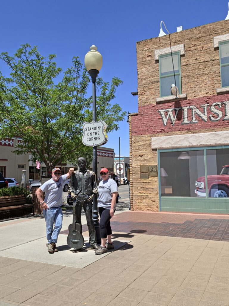
Winslow, Arizona…everyone HAS to stand on that corner. The town created an entire park around that site. The area was really bustling with people, all clamoring to take a picture. The rest of the town seemed very quiet and quite sparse…it was just that one corner that seemed to be active.
Williams, Arizona is known as the Gateway to the Grand Canyon. It features that Grand Canyon Railroad which takes riders into the Grand Canyon and back. I expected to see some kind of formal train depot. But we didn’t see one. We drove around and we ended up on the main drag which was swarming with people. There were a lot of shops and plenty of kitchy signage. Yes, there was some neon, but most of on the newer end.
The one thing that still exists is the Grand Canyon Hotel which is the oldest hotel still operating in Arizona.

Still couldn’t find a place that was appealing to eat. Moving right along…
Seligman, Arizona is said to be the birthplace of the Route 66 revival. I am not sure of who made the assessment, but it was a bit of a disappointment. First, it is so obvious that the entire town is trying to play off the movie Cars. It’s understandable because some of the inspiration FOR the movie came from a visit to Seligman. But if you are going to imply that the cars on your property are the characters from Cars…at least put SOME effort into making them look SOMEWHAT LIKE the characters. Come on…throwing a sunshield onto your dashboard with eyes isn’t going to cut it.
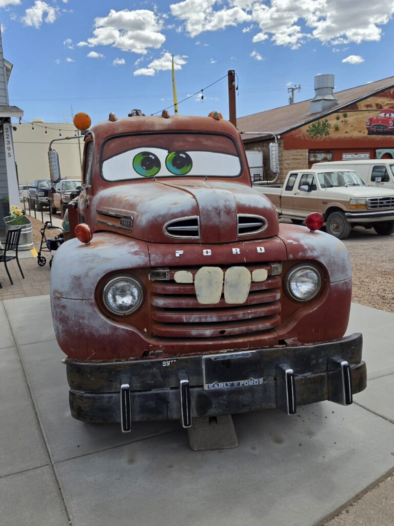
And the throngs of people swarming to get pictures of these feeble attempts on display, you would have thought they were seeing the actual stars walking the red carpet and they are just trying to snap a quick photo. It reminded me of the “street performers” who dress up like characters on the streets of NYC in costumes that look so damn fake, but the tourists clamor for it anyway.
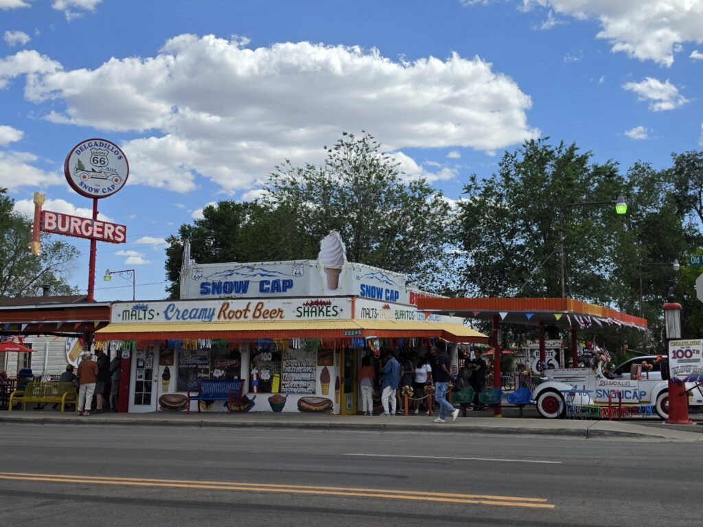
So the talk was about eating again. And on the list was Delgadillo’s Snow Cap Drive-In. The place was packed, the line was around the building. And when looking at the menu…greasy crap…again. What makes this stuff so appealing to people? I took some pictures and we decided to move on. There was nothing much to see that we hadn’t seen already.
Peach Springs was on the list and for good reason. This town was supposedly the inspiration for naming the town of Radiator Springs in Cars. But we decided to bypass because the two places to eat – both of which were on the list – The Caverns Grotto and Crystal Restaurant, were both not appealing and a not easy to get seated. So the odds were it would be a huge waste of time. And we weren’t going to explore the Grand Canyon Caverns simply because we had gotten the late start and wouldn’t have enough time.
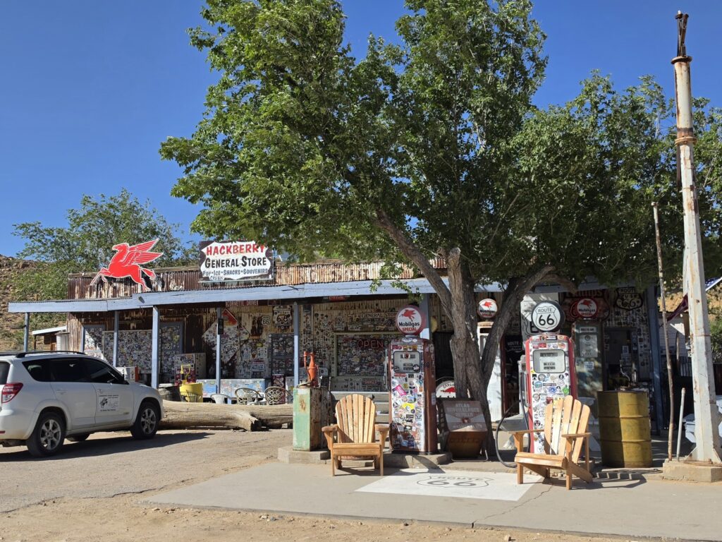
Before getting to Kingman, our next overnight stay, there was a long stretch of Arizona desert and in the middle of a lot of nothing was Hackberry General Store in Hackberry, Arizona. It was an old gas station, like so many other places, that had some old cars (of course) and a gift shop, and some snacks. It made for a nice stop because we each got a nice cold soda.
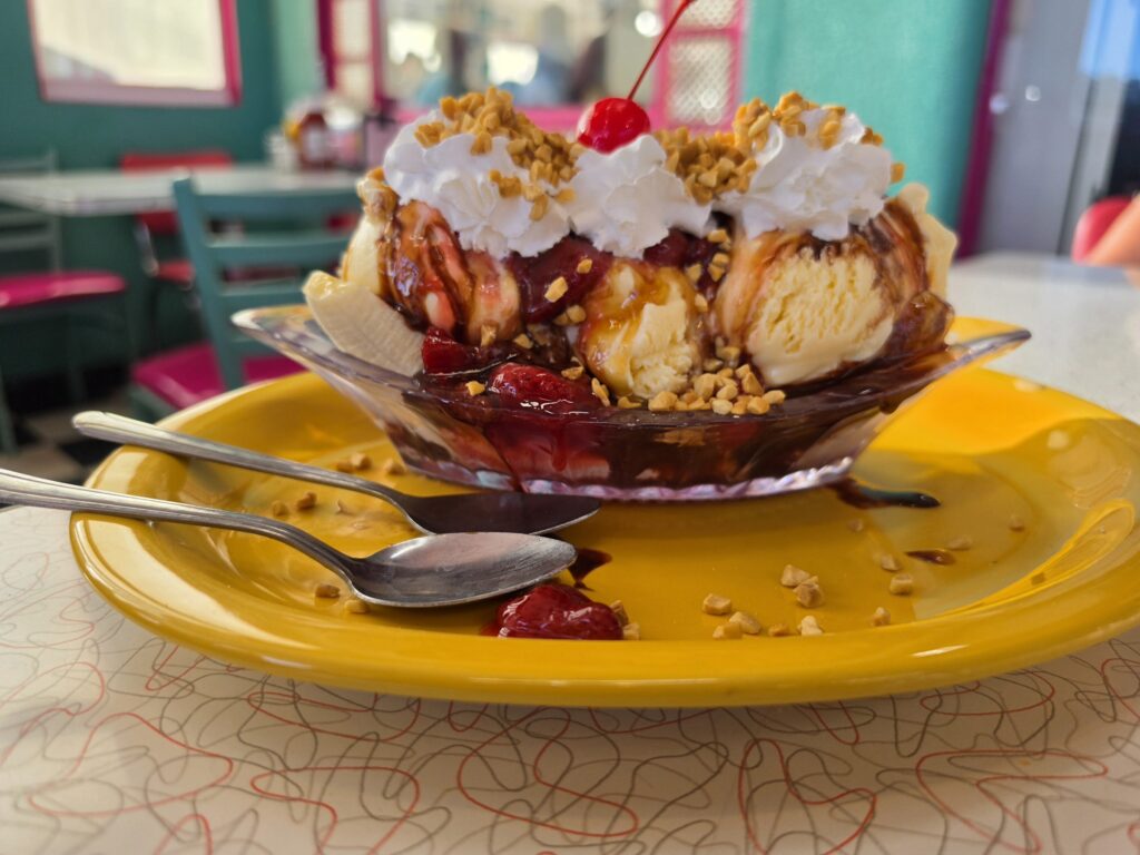
Mr. D’z Route 66 Diner in Kingman, Arizona was on the itinerary so we scored dinner – greasy burgers (mine was veggie), French fries and onion rings. The onion rings were SO greasy that when Melissa bit into it, the oil was just dripping out of it. The real treat, literally, was the Sissy banana split we shared. How many times did ice cream become our meal?
We again ditched one of the places on the list – the Arizona Route 66 Museum – simply because of timing. A lot of the museum stops take a lot of time and that’s all well and good, but is it worth it especially if you are committed to specific time frame, and one which is on the shorter end?
Kingman Arizona – El Trovatore Motel

The El Trovatore is an exceptionally well-kept and creatively designed motel. The exterior is well-animated (literally) with characters and images that are well-recognized. The interior is clean and nicely decorated with some interesting touches (like old suitcases for nightstands) and the bathroom had a lot of original features, lending to a very nostalgic feel. It is conveniently located to the areas of interest in town.
On the downside… The room had no available outlet to charge any device. The bathroom fixture could not be turned on or off without using a chair, so if you are under 5 foot 7, it’s a challenge. The office is not occupied most of the time and an emergency number is posted to reach someone. However, when calling the emergency number, there was only an answering machine. And I didn’t receive a call back until three days later. So how is that an “emergency” number?
The place is great and highly recommend staying at the El Trovatore when in Kingman Arizona.
Day 9 – Kingman, Arizona to Santa Monica, California – 335 miles
- Oatman, Arizona – burros, wooden boardwalks, old mining town
- Amboy, California – Roy’s Café and Motel, Crater
- Oro Grande, California – Elmer’s Bottle Tree Ranch
- San Bernardino, California – Wigwam Motel
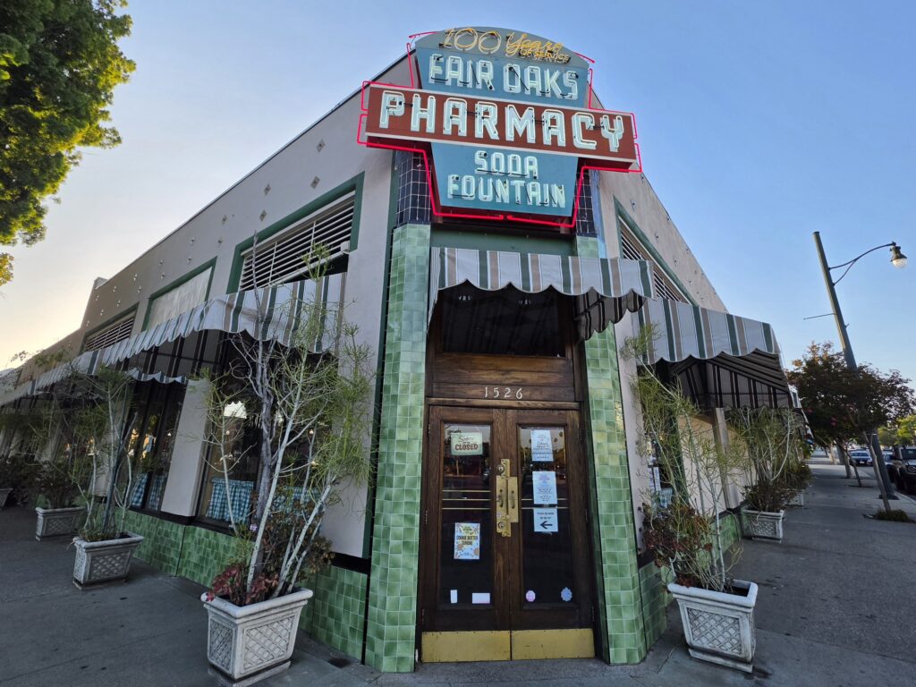
- South Pasadena, California – Fair Oaks Pharmacy
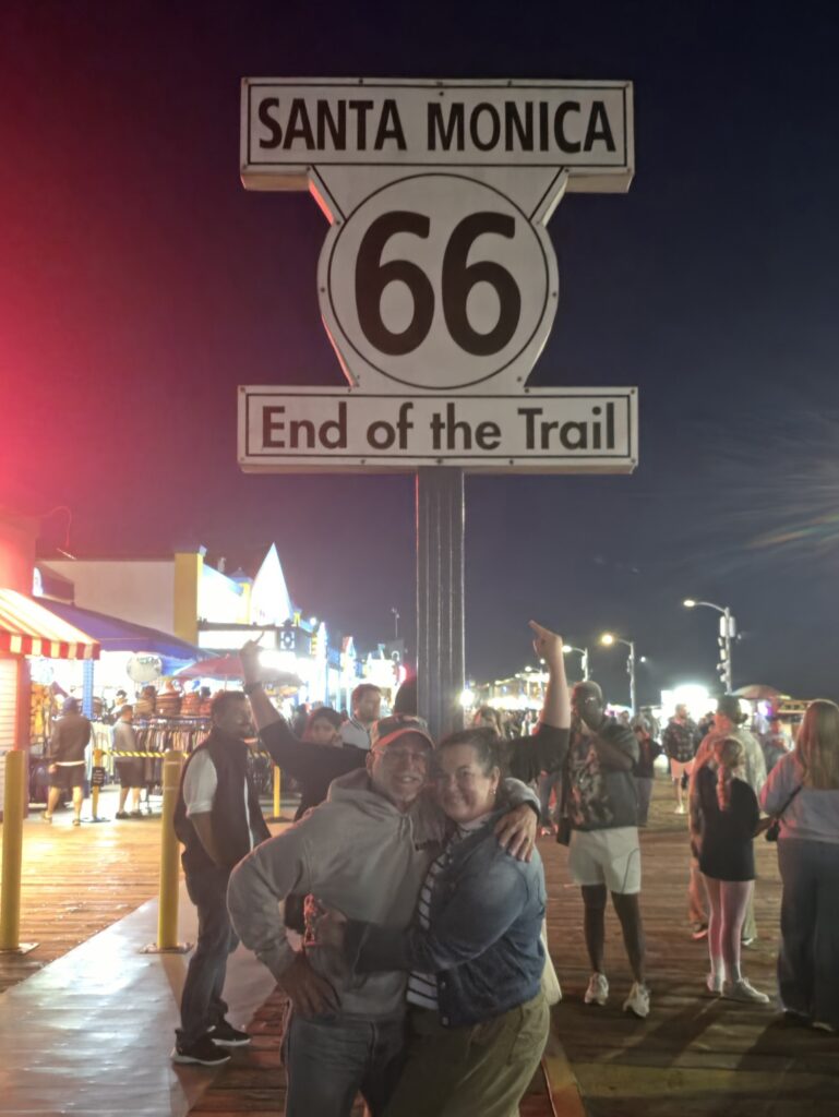
- Santa Monica, California – Santa Monica Pier, End of the Trail sign, Mel’s Diner
We had the longest one-day drive of the trip ahead of us, over 300 miles. Melissa was excited about the burros in Oatman, Arizona, that was the one part of the trip she was truly looking forward to. So knowing that we were going to be spending some time there, we got an early start.
We finally had a great breakfast at yet another place never mentioned. Calico’s in Kingman, Arizona has a great breakfast buffet at a great price. It truly was the best breakfast and best bargain of the trip.
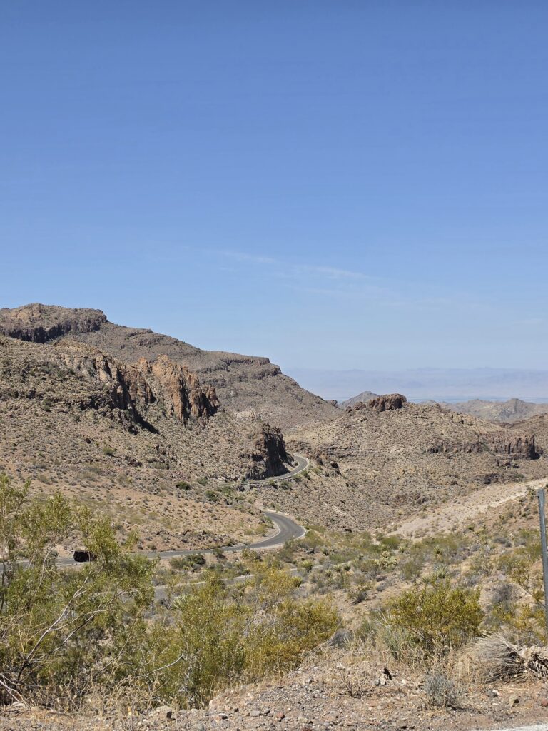
In doing my research, I had become aware of a stretch of road known as the “Arizona Sidewinder.” I am not great with heights, and I am absolutely frenetic when it comes to driving on the edge of mountain with huge…HUGE dropoffs…and no guardrails. So when I read about the Arizona Sidewinder, I was going to do what I could to avoid. I had read that there was some kind of bypass. But that would not be quite accurate. You CAN go passed the area and double back, apparently, but that would have been such a waste of time. But to be honest, I wasn’t quite paying attention to where we were at…and there were no signs saying “You are now ON the Arizona Sidewinder” and suddenly….there we were.
It was 8 miles, 191 curves, a number of them hairpin turns, on a narrow road on the edge of a mountain. I was sweating profusely. But I am proud to say…I did it.
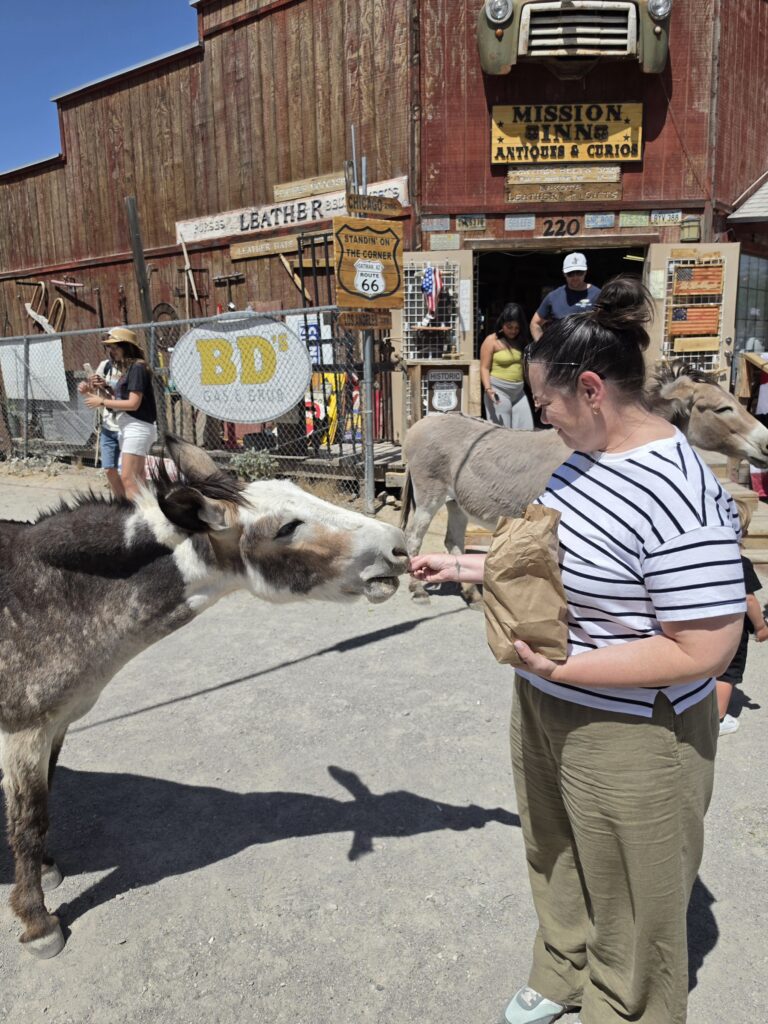
Immediately upon entering the town, you can feel like you stepped back in time to the 1800’s. The building facades of the old town with the wooded boardwalks up and down the street. It was like being on a movie set only this was real. And, of course, the burros were roaming freely and Melissa was happy. Definitely her favorite part of the trip.
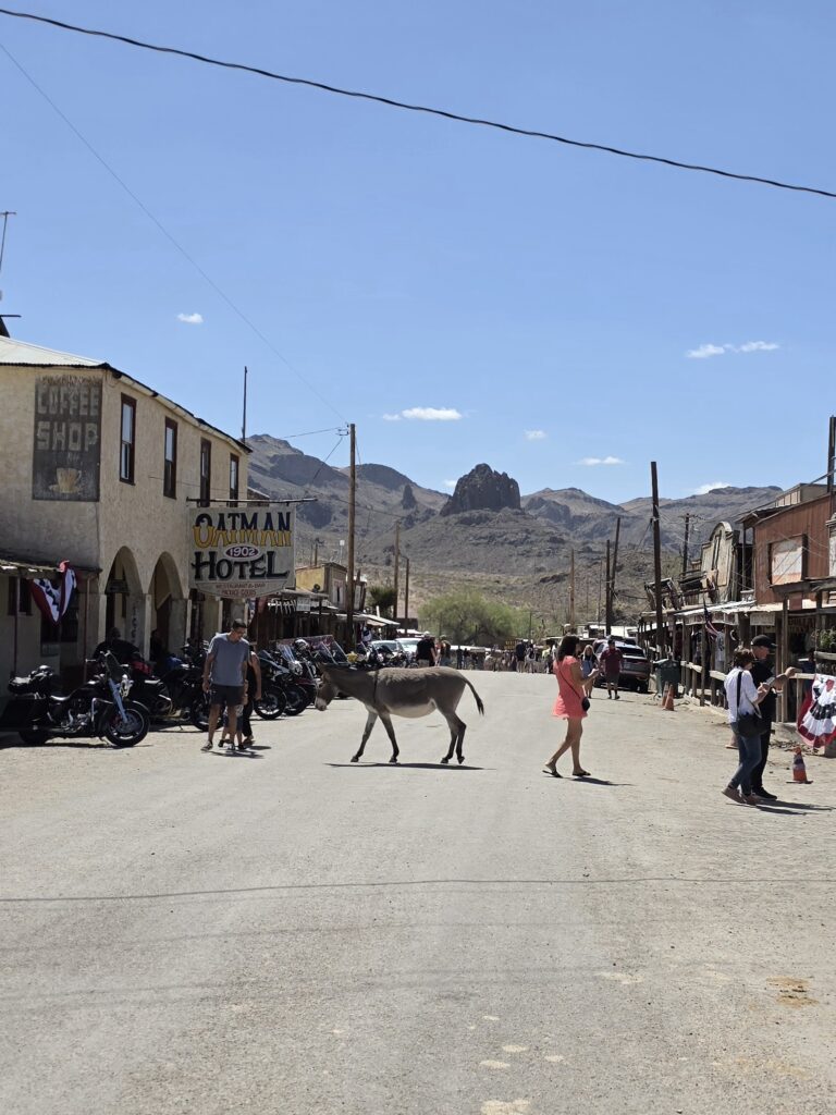
It was blistering hot in Oatman, Arizona – it got up to 98 degrees – and I got a root beer float while Melissa had a scoop of ice cream.
Our next stop was Amboy, California. This too is where the directions became confusing. Because we crossed the border over a bridge from Arizona into California, we were lost. We saw a sign for Route 66 on the pavement, but it led to a dead end. So we backtracked and took the Interstate until we could reconnect with Route 66 just before Amboy.

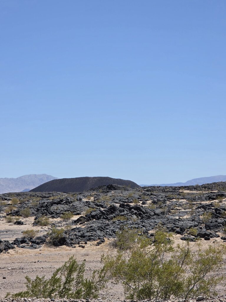
The big attractions in Amboy were Roy’s Cafe and Motel and the meteor crater. There was a lot of construction on Route 66 and it was a rough ride. We got to Roy’s Cafe thinking it might be a place to eat, however, it turns out it was just a tourist stop with a gift shop and some drinks and snacks to purchase out of the case.
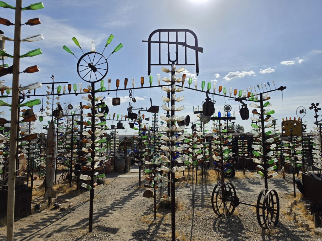
Elmer’s Bottle Tree Ranch was the next stop in Oro Grande, California. A really large display of bottles, of course, and other antique pieces.
Although we stopped at Roy’s Café in Amboy and were disappointed, we had found another Roy’s Café in Barstow, California, owned by the same people. Again we were disappointed as the food was AWFUL. I ordered the salmon dinner with a side of mashed potatoes. The plate is brought to me and I asked what was on the potatoes. She told me it was “sausage gravy.” I told her that I was a non-meat eater, a vegetarian (most people don’t understand pescatarian) and that I could not have the sausage gravy. Two minutes later she returned with the same plate and said, “He scraped most of it off of the potatoes, it will take about 40 minutes for him to make new potatoes.” Uh…no. the sausage was still there. You made a mistake. NOWHERE did it say that the potatoes has sausage gravy…or ANY gravy…so why should I take it. So she apologized and offered me salad instead. So what does she do? She scrapes some of the potatoes off the plate and puts lettuce on top of the potatoes and sausage gravy. The place sucked. That’s it in a nutshell.
The final leg of the final leg of the journey was underway as we were entering the Los Angeles vicinity and that meant traffic was about to get bad, even though it wasn’t a work day. Why? Because it’s Los Angeles.
We pulled over to take a picture of another Wigwam Motel in San Bernardino. We had booked reservations at this one two years ago but upon checking in, we immediately checked out after seeing that the owner had an aluminum back against the wall behind him for protection. That’s how bad the area is. Which is shame because we stayed at the one in Kentucky and it was GREAT.
There was a place I found that was really old in South Pasadena, Fair Oaks Pharmacy. We stopped and, of course, that was closed. But the neon sign still looked good.
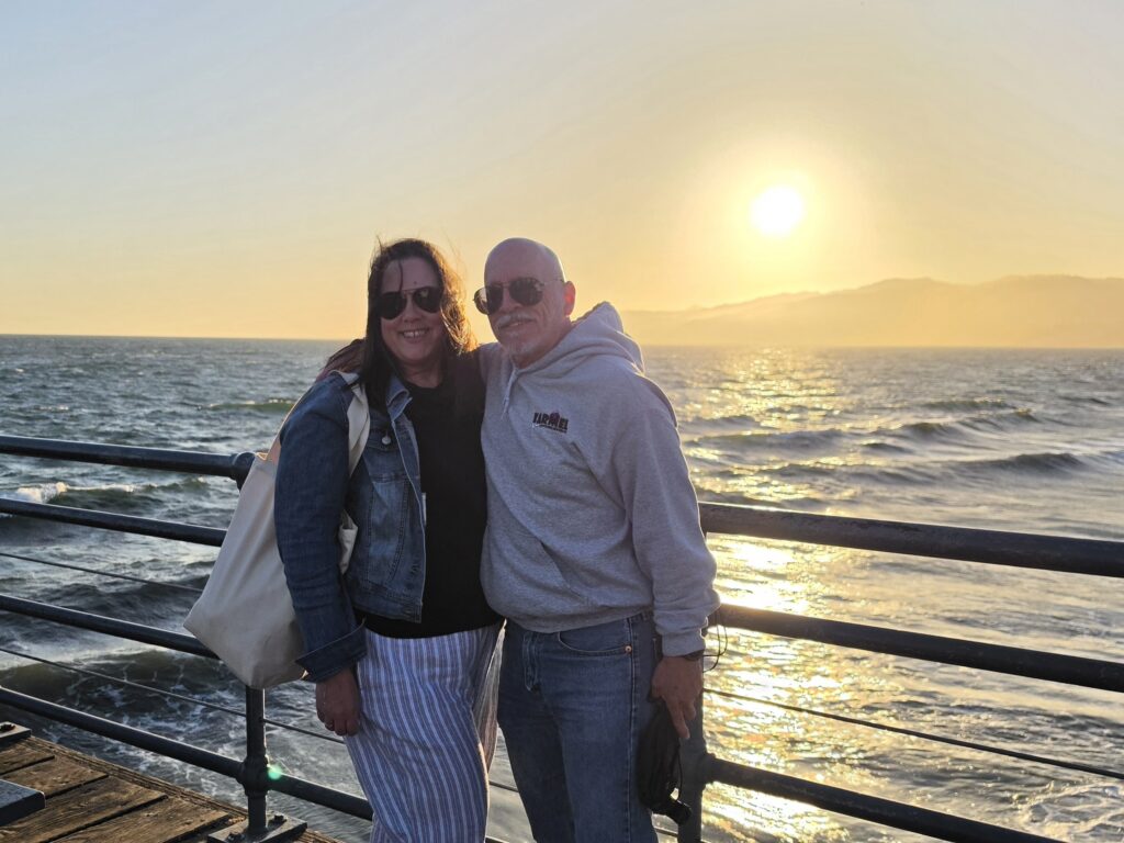
The last 20 miles took 2 hours. By the time we got to the END sign on the Santa Monica Pier it was 9 p.m. It was also a balmy 58 degrees, a 40-degree drop from the 98 we had experienced earlier in the day.
The Pier was sheer chaos. The picture we took was a disappointment. I took it as a selfie which uses a different lens and because of the lighting and so much movement, the resolution of the picture sucked. It was so exciting to finish the trip, just like when the two of us finished running our marathons, but I was disappointed that I didn’t capture the moment the way I wanted.
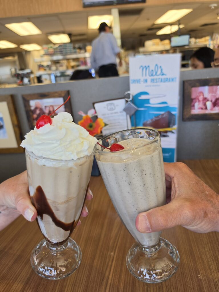
We were so exhausted and getting in so late, there was no dinner, no Mel’s Diner as planned to celebrate. The celebratory milk shakes from Mel’s would have to wait until the next day.
Santa Monica California – Hilton Santa Monica
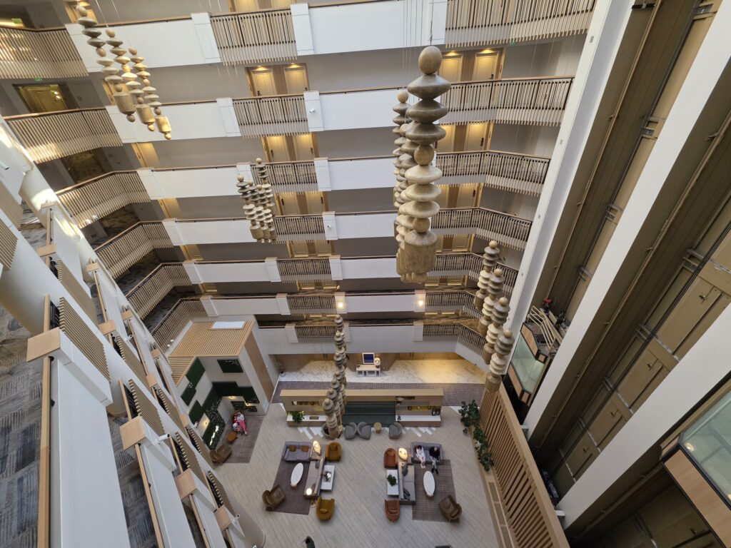
The Hilton Santa Monica is a luxurious hotel in the heart of Santa Monica. It is the essence of a first-class hotel and it is three blocks from the Santa Monica Pier and the western end of Route 66. The staff upgraded us to a junior suite for our two-night stay. This would, in fact, be the only place we stayed more than a single night.
Day 10 – Santa Monica, California
We planned to spend a full day just exploring the area and enjoying the sites.
Melissa arranged for a nice honeymoon breakfast at Sweet Maple. The meal was EXCELLENT as I had a Dungeness crab benedict and they treated us to champagne.
We bopped around and saw the Beverly Hills sign, Rodeo Drive, the Hollywood sign, Grauman’s Chinese Theater, and The Brady Bunch House. We also took the time to see the three houses Larry David lived in on Curb Your Enthusiasm, as well as Jeff and Susie’s house. And the office for the show Selling Sunset. Ya know…the tourist thing.
We finally got our celebratory milk shakes at the classic Mel’s Diner near the end of Route 66 in Santa Monica. The shakes were good but the service was terrible.
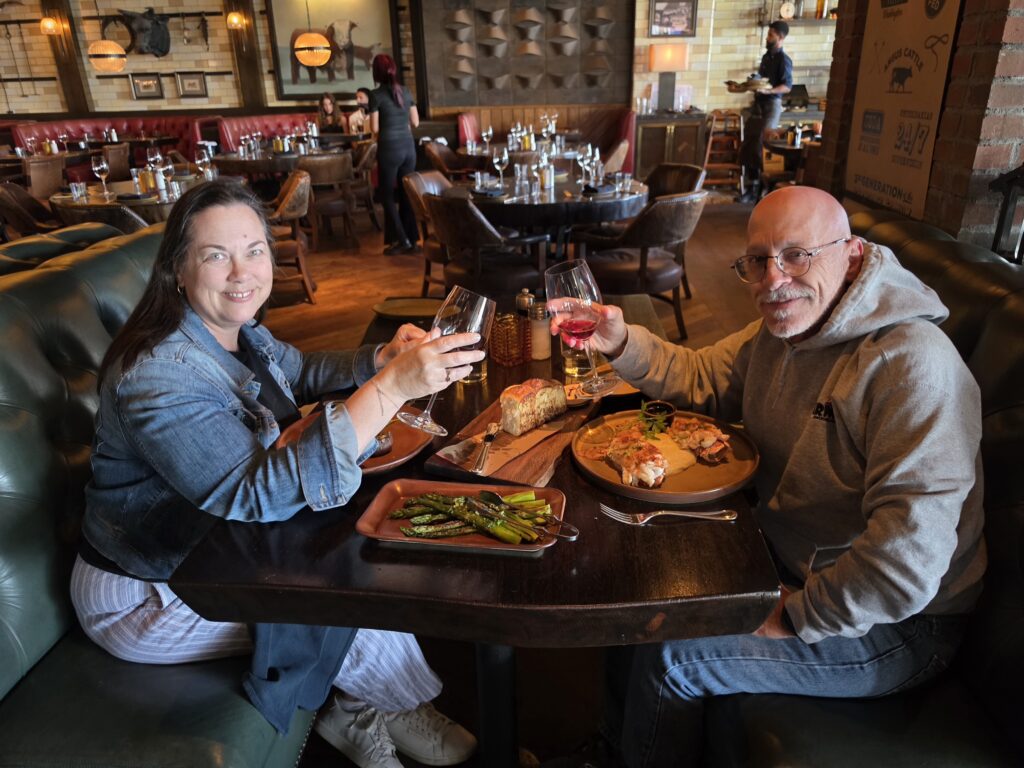
We concluded our honeymoon with a great meal at Meat on Ocean right on Route 66 directly across from the Santa Monica Pier. Melissa had a great steak, and I had twin lobster tails. The best of both worlds!
We went back to the Santa Monica Pier for one last look, for Melissa to put her feet in the Pacific Ocean, and to watch a beautiful sunset, and beautiful end to a long journey and memorable honeymoon.
Favorite part of the trip?
Melissa will tell you that her favorite part of the trip was our stop in Oatman, Arizona. The burros meander freely and she was excited about that as soon as we had learned about it. So the excitement built as the day approached, and as she said to me, “It didn’t disappoint.” Experiencing the old town and walking amongst the burros and feeding them was a very nice experience.
For me, the best part of the trip was the thrill of the quest…looking for landmarks and finding them, but also finding those that have not been mentioned by others. Seeing the old and abandoned decaying structures and thinking about the stories behind those structures and the peopled that had owned them.
The least favorite part of the trip?
Melissa will say that her least favorite part of the trip was me getting out of the car to take pictures of all of those abandoned gas stations.
My least favorite part was Melissa making faces and comments when I did get out of the car to take pictures of all of those abandoned gas stations after Day 2.
Would we do it again? Yes, we have both said that we WOULD do it again. But we would definitely allow for more time, explore more of the museums and other sites we didn’t get to fully observe. And perhaps, PERHAPS, do it in the opposite direction. That is a thought. But it will all come down to whether or not I agree to not get out of the car to take pictures of all of those abandoned gas stations.
Subscribe
We’d love to have you along for the ride! Subscribe to our newsletter to get a little piece of our latest adventures delivered straight to your inbox.
Thanks for your version of Route 66!
I’ve travelled from Tulsa to California and I agreed with numerous remarks you made about places on the route.
It’s quite an experience, the road out West!!
May you have many great, safe travels
Thank you so very much!!!
LOVED, LOVED, LOVED your account of the navigation!! That was SO US😂🤪. I don’t know how many times I told my husband, “tomorrow I’m driving and YOU CAN DO THIS JOB”😂. I told him I needed 8 hands and arms so I could read the app, AAA map, EZ GUIDE, travel book, watch for signs, murals, attractions and take pictures 😂🥳😂. We are in our 70’s and so plan to do the trip again next year♥️. True 66ers
It truly was an adventure…it wasn’t too long before the books were thrown in the back seat! LOL
Absolutely loved and enjoyed your commentary of your travels on Route 66! My cousin and I, both in our 70’s, are driving Route 66 with side trips to National Parks beginning September 6 and ending October 16. We laughed so hard while reading your post as it sounded so much like us!!! It will be the trip of a lifetime and we can’t wait for our adventure!!
So glad to hear that. Please keep us posted on how it goes. I’m sure it will be a lot of fun. And if you need any input, just reach out.
What an amazing experience and so much fun for everyone to see and enjoy your amazing information. What a wonderful way to enjoy life and our country.
Thank you! And thank you for all of your input!