Melissa’s rules are lost on the trail in Shenandoah National Park

People ask us all the time how we do things. You know what? Sometimes we just go. No real plan. We just go. We looked at the list of National Parks and checked into the ones that were within driving distance so that we could do it over the weekend without interrupting work and family obligations. And a short distance away, we decided upon Shenandoah National Park in Virginia.
It is a four-plus hour drive for us and we were hoping to get an early start. I set up a work station in the car so Melissa can do her work, without missing a beat. Unless, or until, we get into a bad cell signal area, and then she might get knocked off line, but, for the most part, we’re all good. She works and I try not to talk and distract her with nonsense.
Normally we disagree with the idea of going to Cracker Barrel. But we ended up getting a later start than we had hoped, and with hunger setting in, and the weather looking like it was about to get bad, we agreed to make the stop once we got into Virginia.
I kinda like Cracker Barrel…Melissa is not really into it. The “down home” appeal of it gets you right to the heart. Okay, that is a bunch of crap. I get a kick out of all of the antique items displayed from the ceilings and on the walls. Melissa thinks it’s “stuff” that just leads to clutter. We both like the old candies and sodas that you can purchase. The rocking chairs out front are always an enticement, and I get a kick out of seeing people playing the overly large checkers game out there. But why do people plop their diaper-wearing kid to sit on the one inside and play with the checkers, when other people are going to think to touch it afterwards? No consideration for other people. People. We love people. LOL
Why does it seem like we tend to hit bad weather? After our fine dining experience at Cracker Barrel, we jumped back on to I-81 and drove right into a torrential downpour. The interstate was bad as it was difficult to see, at best, and with the tractor trailers passing us at seemingly blinding speeds, we were getting the sprays from the wheels on to the windshield. So my co-pilot suggested we get off the highway and take some better lit local roads. Because, you know, local roads have street lights.

Nahhhhh…they don’t. Not in the foothills of Virginia. Well, it was another wild ride on the winding roads, up and down the hills of…I don’t where we were. I KNOW we ended up on some mountain because we were going way UP…and then we were going way DOWN…in the dark…in the pouring rain…and the dense fog.

We had found that Elkton was the town right at the southwestern gate, the Swift Gap entrance, of the Park. And since we were looking to do some of the trails closest to that gate, we figured we would stay overnight in that vicinity.
We really like to get a true feel for the area and look for accommodations that are a bit nostalgic, privately owned, a mom and pop roadside establishment. We researched and found the Country View Inn where we could get a “cabin.” However, because of our late start getting on the road, and the torrential rain we drove through, we didn’t exactly “find” our lodging, as we drove into the night on some twisty-turny roads only to discover the place…closed. After all, it is WAS after 10 p.m. and it WAS NOT a, say, Hampton Inn. The office door WAS open, they are very trusting in these parts, but the sign said, “Back at 4.” Not sure if that meant “a.m.” or “p.m.” But now we were exhausted and searching feverishly for another place to crash, but, alas, no cell signal. And even if we had those great old AAA Tour Books, we couldn’t even call a place, or get a GPS signal to have directions. Ugh.
It’s great having no cell signal so the kids can’t reach us, but late at night, in the pitch black darkness, on winding, hilly roads, damn I love that cell phone.
Eventually we drove and re-entered the atmosphere, I mean, civilization, I mean, we finally got a cell signal. And we were able to find, thankfully, our usual “go to” and old reliable Hampton Inn in Harrisonburg, about 17 miles back in the other direction. James Madison University – JMU – country.
So, when all else fails…find a Hampton Inn. But we didn’t want the wet eggs in the morning. And we were hell bent on the local experience. So first thing in the morning we went back to Elkton for breakfast with the locals.
And we couldn’t get any more local than breakfast at C & S Diner. And they let you know that it is “Down Home Cooking at its best! It says so right on their menu. They also make it very clear that they are “…not a fast food restaurant. Food is fresh and prepared when ordered. Nothing is pre-fried.”

The menu had some interesting offerings. While Melissa settled on the French toast, I jumped on the salmon cakes, with eggs and potatoes. The woman serving us was very cordial and accommodating, made us feel right at home, even though it was obvious to everyone that we were the strangers from another universe in the room…whether it be the sweatshirts we were wearing, or OUR accents, we definitely stuck out like two sore thumbs.
When I tasted the coffee, and then the water, that were given to us, I immediately noticed how good both tasted. I am always complaining about how the water smells and tastes like chemicals back home, and the water in this place reminded me of fresh spring water I used to drink when I would go camping with my dad as a kid. And I assumed that the great tasting water had to make the coffee taste so good as well. So, I mentioned it to Melissa, and she agreed that the taste was different and really good. And, I cautiously indicated to Melissa that I was going to ask where the water came from because I was curious. Melissa’s “we’re not here to make friends” more often than not trumps my need to “satisfy my curiosity” but I received a pass on this one. So I asked our server, “Where do you get the water from?” She looked at me kind of funny like I was complaining…so I added…”because it’s really good.”
“It comes from the town of Elkton…oh wait….no…I’m sorry…it comes from the Coke machine.” Hmmmm…wait…isn’t the Coke machine hooked up to CO2 tanks – carbonators – that work in conjunction with the syrup dispensers, and the water line hooked up to your tap water line? I mean, my grandparents owned a candy store/luncheonette and used to have their soda dispenser in their apartment for years after. So is the water they are serving provided in a never ending supply of water containers provided by Coke? Or Pepsi? Or is it perhaps Poland Spring or Dasani? Where is that hose attached to?
Of course, it was bothering me, but so was watching the couple canoodling at the table behind Melissa. Melissa detests when a couple sits on the same side of the table. I don’t get bothered by that…it’s cute and kinda romantic. (Melissa inserts finger in mouth in gagging gesture…) But come on. You’re eating. WE’RE eating. They are literally pushed up against each other, rubbing each other’s leg with one hand and feeding each other with the other hand. And, no, they were not of the younger age group. They APPEARED to be a tad older than us. Very entertaining. As was the conversation of the people around us. It was clear that they all knew each other. And for anyone familiar with the Andy Griffith Show (Melissa is not…grrrrrrr) you could very easily hear similar conversation visiting Floyd the barber, or Thelma Lou at the coffee shop.
The food was really good, the service was great, the coffee was one of the best cups of coffee I have ever had. Definitely a place to experience in the area. But I am going to find out about that water, damn it!
Now it was time to head to Shenandoah National Park but, first, we wanted to try again to have at least one night at the Country View Inn. It was on our way to the Park entrance anyway so we decided to stop in.
This time the office was open and there was a person there who welcomed us. I mentioned that we had been there the night before and that we would like to stay the night, and that we would come back later to get the room. Much to our surprise, she offered to give us the room immediately, saying that she had just cleaned it so it was ready. The room…was one of their cabins. Now…in my brain…a cabin is made of logs, or at least some kind of natural wood. This small structure was cabin in size, but not cabin in look? It was clean, it was quaint, it was…it was. We put our things in our small structure (I just couldn’t bring myself to refer to it as a “cabin”) and headed out the couple of miles down the road to the Park entrance.

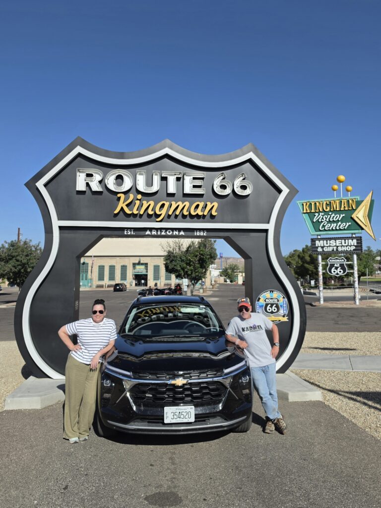
One of the common things that you see people doing as soon as you get to the entrance of a National Park, part of the experience, is the obligatory picture in front of the sign. Cars are usually lined up, most of the time there is a parking area so that you CAN get that picture. And there is usually a line of people so that you don’t have to worry about how you are going to get that picture of the two of you because there is always someone there. “Can you take a pic for us? And then we can take one of you?”
Not at Shenandoah National Park. Not even a shoulder to pull over. We decided to forego the picture moment, at that moment, because we felt that we needed to get started since we were hoping to get in at least two hikes, possibly three.
We had driven in the inclement weather the night before, and it was kinda dreary out this morning. When we got to the Park entrance and drove up to the gate, there was a sign that immediately warned us of a “dense fog alert.” Shenandoah Park comprises a number of mountains with many, many trails, including the famous Appalachian Trail. But it can be traveled the entire length of 105 miles by Skyline Drive. It is the only public road running through the Park and it takes about three hours to travel the entire length if you attempt it on a clear day. There are many sections that give you great views if you are in the passenger seat, you had better not look if you are in the driver’s seat because it is very twisty-turny. And if you are nervous being close to the edge of a mountainous road, bring the Xanax with you.
While Skyline Drive is generally open 24/7, it WILL be closed due to inclement weather, which tells you that it CAN be perilous in some parts. And we began our journey to the first trailhead in…DENSE FOG!
Our first trek was to find waterfalls…we love waterfalls. So we ventured to the South River Falls Trail. While the fog was dense, the crowd was sparse. Parking was easy at the trailhead. It was a bit chilly when we got out of the car and we decided to don the cold weather gear, Melissa put on her winter coat.
We made our way onto the trail and noticed that the wood footings that are sometimes placed on the trail are heading downward. So we don’t have to ascend to high altitude. But, wait, I think we DROVE up to a high altitude, so that means we are going to go down, to come back up? One thing we tend to forget is not only checking the distance on the trails but also checking the altitudes. Because, for the most part, it’s not the distances that get you, it’s the altitudes, and the sharpness of those climbs. Oh, and also, the degrees of difficulty, the terrains of the trails. Yeah, that would be good to have somewhat of an idea of what you are about to get yourself into. And….BE PREPARED! But I will get back to that later.
According to the NPS site, and information guide, the South River Falls Trail is a 3.3 miles circuit, with a 910 feet elevation, and is considered “moderate” on their hiking scale.
Melissa, as she always does, warned me about our goals and objectives. We’re not there to make friends. Head down, no eye contact, don’t pet any dogs. It’s like a pre-game speech by Knute Rockne. I got it!

So we began our descent and trekked along a twisting and winding dirt path, interrupted by a couple of what are described as “bridges” over water. In reality, they are flat and jagged stones set across moving water that you have to carefully climb over. Along the way you are following a stream that has water that is moving downhill and over some small rock formations creating many mini waterfalls. The views, the sounds, the smells…are all well worth the trek down. I wanted to stop and take pictures at each and every one of the little alcoves where you could venture in and get up close. I could also see us sitting having a lunch at any of these spots if the weather was a bit nicer. It was so peaceful and serene.
The main attraction on the trail is, what else? South River Falls. So onward and upward! Or downward. Whatever.
Some of the terrain was a little bit slippery, muddy, and made footing difficult. Thankfully, we both had our Merrill hiking boots. Wait! Commercial time! We are both experienced marathon runners and we both understand how important footwear is. And we are both very conscious about how something feels, whether it’s a piece of clothing or shoes. Functionality and comfort are very important. The Merrill hiking boots are not only great for footing on a rough path, they are also super comfortable. In fact, they are so comfortable, that I have, at times, worn my waterproof Moab 3 shoes as everyday footwear. OK, back to our regularly scheduled programming.
So Melissa and I “climbed” down the fog covered path and got to the lookout to see…NOTHING! Oh, we HEARD the waterfalls, we just couldn’t SEE the waterfalls. It was like the Grand Canyon all over again. You get all the way there and nuttin’! So we DID take a picture and turned back.

It was time to head in the other direction which means…we have to climb back up…ugh. The steep incline was tough, admittedly, we struggled. It was a great workout, though. By the time we got halfway back, we were without a layer or two of clothing, we were sweating.
Even though we didn’t get to see the wonder of the South River Falls, the trail was well worth it. The many different water sites along the way were enchanting enough. I am sure that when the greenery is in full bloom, it would be even more appealing.
The workout we had getting back up to the trailhead made us really hungry. We drove further north on Skyline Drive to the Byrd Visitor Center which is at mile marker 51, just about the half-way point of the Park, to have lunch at Big Meadows which houses a gift shop and restaurant. But, alas, the restaurant was closed. But they DO have what is basically a general store which has a lot of great supplies for the camping community. And, of course, when you are hungry, you should never go to the grocery store, right? And we ended up buying a TAD more than we really needed…we didn’t need those Moon Pies…but they were so good going down!

We wanted to spend some time on the Appalachian Trail and many of the trails either follow along, or intersect, the AT. So for our second hike of the day we decided to do the Milam Gap Trail.
The NPS site describes it as a 4 miles round trip, an elevation of 870 feet, and moderate in difficulty. Given that it was getting later, and we were exhausted from the first hike, we decided to do an out and back, get to the Appalachian Trail, and come back.
Again, we found the parking lot and it was fairly empty, with a few young guys playing baseball, believe it or not, in the parking lot. It was a bit warmer, and much clearer, by the time we started at the trailhead as compared to earlier in the day. And this trail was a bit different than the trail earlier in the day as well.
It was a slight descent on to a dirt path and it was very noticeable that the trees were not only bare, but so many were broken and downed. It almost looked like the aftermath of something destructive. We had noticed it somewhat on the earlier hike, but with the dense fog and trying to concentrate on the flowing water, we weren’t really focused on it.
For the second time that day, I got my toe caught on a jagged rock and fell, for the second time banging my right knee and I would end up with a pretty nice black and blue mark. It would have been helpful to have the hiking poles at some points, but, alas, Melissa doesn’t like to use them and makes fun of me when I use them…”God bless us…everyone!” I don’t want to listen to THAT over and over again.
We made it to the section of the trail that merged onto the Appalachian Trail and was marked “AT” on a concrete post. We wanted to take a picture next to the post. And although this is an instance where it’s OK to speak to other people, there was not a person around. We had to figure out a way to position the camera, on the ground, and wrestle with the grass that was in the way of the lens. It was at that moment that we regretted leaving the tripod back in Wyoming in Grand Teton National Park.

We got our picture and hoofed it back to the trailhead. And once in the car, we wanted to make sure we got that other picture back in front of the entrance sign. Again, there was no place to pull over, no place to park, so we had to pull onto the grass and, again, fiddle with the phone to get the grass out of the way of the lens. Considering that every place else it is the thing to do, where is everyone?

It was time for dinner and hoping again for some local fare, and in the mood for burgers (veggie for me) and beer. We ended up at 33 Beer and Burgers in Elkton. I will make this quick. The burgers were ugh, the beer was bleh, and everything was fried and greasy. Oh, wait, Melissa liked hers…she said the onion rings were “kick ass.”

We were definitely not satisfied. So now we were looking for dessert. We had passed an ice cream place the night before, with a crowd standing, waiting even in the pouring rain. So we headed back there to Kline’s, the McGhaheysville location on Spotswood Trail. There was again a fairly large crowd waiting on line. We got on line and looked to see the flavors. The sign said “chocolate, vanilla, and salted caramel crunch, the special flavor of the day.”
Melissa looked at me and asked, “What is this…breakfast, lunch, and dinner? Where are the other flavors?” I thought perhaps there was more and sought out another sign with a list of flavors. But there was none on the side of the building. No other sign on the other side of the window on the inside. I suggested Melissa go to the window and watch, as I saw the workers scooping soft serve from a container, rather than getting it from a soft serve machine.

She said, “I’m not pressing my face against the glass when those kids are working!”
I said, “I didn’t ask you to press your face against the glass…I just suggested you look to see what they are doing. It’s different.”
She said, “I’m NOT doing that.”
Well…OK…she’s not doing that…and we are not getting ice cream. Not standing on line for THIS! Where are Reyna and Ramon at this point? They could have provided a bit of insight on THIS one!
Now what? Back to the small structure to try to get some rest and much-needed sleep. Didn’t get ice cream and didn’t get much sleep either. The place was cute…really…it was. But it was the absolute worst mattress I have ever slept (or not slept) on. And the noises! I am used to traffic from being on a main road. That wasn’t it. The heating unit made noise. The mini fridge in the room made noise. The bed, every time one of us moved in the slightest way…noise. And…then…COCK A DOODLE DOO!!! Of course, at the crack of dawn…the roosters across the way began a concert. It was like damn carnival!
We were planning to enter the Park at one of the other gates – this time the Thornton Gap entrance, not far from Luray. So we decided we’ll get breakfast, and visit the famous Luray Caverns on our way to Thornton Gap.
Looking for another local joint, we found a Broad Porch Coffee shop on Main Street in downtown Luray. It’s clear because of the Caverns, the town has become, for the most part, more commercialized than some of it’s neighboring counterparts, just comparing it to even Elkton. As opposed to C & S Diner the day before, Broad Porch Coffee was, for the most part, a replica of Starbucks, only with some more items on the menu.
The menu items looked like they would be appealing, they were more than just your run of the mill breakfast items, in a feeble attempt to be a gourmet eatery. It would have been more appetizing to have a simple local diner breakfast than the nova salmon and some kind of cream something that was smeared on the bread. It wasn’t what I expected, and not what I hoped for. Feh! Melissa disagrees with me…she liked it. Me…obviously…not so much.
We had been to other caverns, mostly in Pennsylvania, many of which I had visited as a child with my parents. And, naivete aside, I always thought these places were nothing more than tourist traps. Yes, they were nice to look at, but after a few minutes, they would mostly look just like some of the fake background and structures you would see carefully constructed at, say, Disneyworld.
We arrived to Luray Caverns and it was so much more than just the caverns. It looked like the entrance to a theme park. The parking lot was huge, there were multiple buildings housing a gift shop, an eatery, a toy exhibit, a car exhibit, and you could see a cue that was long and winding that could probably have a couple thousand people standing and waiting on line to enter the actual cavern.
When I saw that it was $32 a ticket to “explore” Luray Caverns, I truly thought “Here we go!” But, much to our surprise, Luray Caverns is more than just a tourist trap. It really is a remarkable place to experience. It is a long and winding walk through an amazing array of impressive stalactites, stalagmites, and dazzling mirror pools. You often feel like you are somewhere lost in a sci-fi movie or on some other lost world.

It is self-guided, although there were a number of employees stationed throughout who were very gracious with offering information and answering questions. There were not a lot of people making their way through while we were there, so we quite often had the sanctuary of being alone and hearing the isolated dripping of water somewhere around us.

The stop is well worth it. We also, for the price of the admission, got to walk through the Car & Carriage Caravan Museum. It had an amazing collection of VERY old vehicles set up in chronological order by the date of their respective production. There was also an old toy exhibit, but, uh, eh…we had enough.
On to the National Park for our second day of hiking. But, wait, there’s more! As we were driving we passed, on the opposite side of the road, one of the Dukes of Hazzard museums. I made a quick u-turn but it was closed. I wasn’t a fan of Dukes of Hazzard but Melissa and her brother Peter were. So we jumped out and she had me take a picture of her with her face on the body of Daisy Duke.
We made our way to the Thornton Gap entrance of the Park only to find out that it was closed due to a car fire at the gate. So now we had to execute an alternate plan…and make our way up to the Front Royal entrance, the northernmost gate of the Park.
We got there and, lo and behold, there was a slight pull off area for vehicles to park. And, lucky for us, we ran into two people who we had passed on one of the trails the day before. So we were, this time, able to do the exchange of picture taking in front of the Park sign without having to finagle the damn phone in the grass.
We had planned to do two or, hopefully, three short hikes before heading home but we needed fuel…we needed food. Front Royal is a bit more “bustling” than some of the other small towns surrounding the Park. They even have their own visitors center, not associated with the National Park Service.
Directly across from that visitor center, and sharing a parking lot, is the Main Street Mill. It had a bit of an unusual menu which led me to get a bowl of pasta for lunch. So I could get carbed up (the upside) but not exactly what I would like to have for a meal – I would have preferred some sort of protein (insert a Melissa eye roll) – at that point (the downside). But they did have some local beer and they offered flights. So…voila! Something to look forward to. We got four different brews, all recommended by the server. Uh…nah. Let’s go back to the water back at C & S Diner from the Coke (or Pepsi) machine.
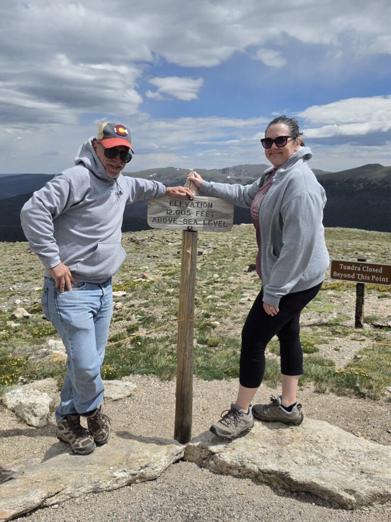
Back into the Park we went and Melissa wanted to stop at the visitor and Ranger station to get some insight into the nearby trails. There was a tree stump near the station and I got Melissa to get up there and take her usual “arms wide” picture with a view of the Blue Ridge Mountains in the background.
Melissa spoke to a ranger and told her that we wanted to have three “easy” hikes, each with hopefully something special, or unusual, or out of the ordinary…something memorable. And she gave us three places, all within approximately five miles from where we were. So we decided to go to the furthest one, Compton Gap, and work our way back.
We got back in my Jeep and I started driving the five miles. I didn’t make it five miles. I didn’t make it ONE mile. We were at one of the sections of Skyline Drive that goes twisty-turny, winding around, close to the edge and…NAH…I DON’T THINK SO. There was a lookout that had a small area to pull over…and so I did. Melissa gleefully took over…not because she got to drive the car…because she HATES driving my car…but gleefully because she just gets some perverse pleasure seeing me squirm. I ADMIT…SHE is the daredevil…I can be…sometimes…when it comes to heights…the wimp. Yes…it’s true…and I own it. SHE will hang off the edge of a rock formation just to take a picture as I am SCREAMING at her to get back away from the edge…all the while holding on to a mere twig for dear life. So she had to drive while yelling at me, “JUST CLOSE YOUR EYES GOD DAMN IT!”
I HATE Skyline Drive!
We SAFELY got to Compton Gap parking lot, and for the first time, the lot was full. After squeezing on to the side of the road, we saw a couple walking off the trail and I quickly, yes me, ran back to the car and moved it into one of the spaces. Then we encountered a woman, with a minivan loaded with kids, arguing with us that she wanted the space. Melissa so loves confrontation so she put her head down while I informed the woman that we were there first but that I would gladly give her the spot if she wanted it. In the meantime, three other spots opened up. But Melissa wanted no part of it so she urged me to hurry. And we did. On to the wrong trail heading in the opposite direction. After ½ mile in, we discovered our miscue, and now we had to turn back and get to the other side of the road and the correct trailhead. But now Melissa is hemming and hawing about running into the woman and the small entourage of rug rats. Head down, no eye contact, no talking.

With our heads down, we made it back to the lot and then across the street and headed to the proper destination. The Compton Gap trail would take us along the AT for a good portion, and then there would be a split – one side would take us to the Compton Pass Peak, and the other to some unusual and unique geological discovery.
According to the NPS site, this trail would be 2.4 miles in and out, an elevation of 855 feet, with a moderate degree of difficulty. Uh…wait…what happened to “easy?” Good luck.
Right off the bat we realized this wasn’t going to be “easy.” Perhaps the ranger thought it was easy. Okay, well, here we go. At least this one is up first, and then down. Get the hard part out of the way. After not seeing those falls on Day 1, this better be worth it.
The trail is pretty much carved out, as most are that are so commonly traveled. And, of course, there is the occasional jagged rocks scattered about. But this trail is, at times, at a very steep angle, with very narrow footing, and some very tight turns.
Oh…one of the things that drives Melissa crazy is when someone insists on engaging with me because I am quite often wearing a University of Miami sweatshirt. Inevitably, I will get a “Go CANES!” or “It’s all about the U!” and get the two-handed “U” formation. That usually draws a shake of the head or a “Why?” from Melissa. And…EVERY SO OFTEN…and it’s NOT often…someone will acknowledge her when she is sporting her Marist sweatshirt or hat.
Anyway, I mention this because, and we all know the rules by now, about halfway up the trail, there is a huge rock formation and an “older” couple is sitting upon the side of it resting. And, of course, they begin to engage. And because we were passing, and it was a tight squeeze, it was unavoidable. This time, it was Melissa wearing a Grand Canyon sweatshirt that caught their eyes.
Hard as she could, she couldn’t NOT say anything. So, she said, “Yes, we were recently at the Grand Canyon…have a nice day.” And then, softly, she said, “Alan…walk damn it!”
And we went on and continued our climb up and around, and up again. We came to the spot where we could go left to the geological spectacular…or right to the peak and lookout. Melissa and I just looked at each other. There was a family with kids…and they were heading…uh…left. Melissa said, “We’ll go right.” And so we did.
Heading to the peak led us to a rocky area that meant climbing and finding spots to place your feet so that you can pull yourself up. Once you got yourself up there, then it was pretty much a jagged rocky path to the overlook.
We made it to the overlook and while I was, again, holding on for dear life, Melissa was standing there, hands on hips saying, “This is it? This is what I climbed all this way for? I think I have become a National Park snob.”

“Um…Melissa…can we just take the damn picture and get down? Please”
Luckily there was a young man there with his dog out on the ledge of the lookout. He asked if I would take his picture with the dog and he would, in turn, take our picture. I managed to take a pretty good pic of them, especially given I was doing it one-handed holding on to some vine growing in the rock. He took a good picture of us too, all while I am saying, “Take it already…please.”
Usually Melissa loves to hang out and torture me. This time…not so much. She wanted to head back in the other direction, take a look at this super natural geological thingy, and get down and make our way to the other trails.
On the way back toward that rocky area, who do we run into? But the couple from earlier. And again, HE says, “Oh…the Grand Canyon!” And she says, “We JUST HAD that conversation with them.” He said, “We did…oh yeah.” And Melissa, again, in Melissa D’Angelo Avoidance Mode, is making her way in the other direction. But she turned back to say something and she said, “Alan…she fell!”
I turned and immediately ran back, Melissa right behind me. The woman was down, her head was bleeding, and in those mere seconds, she had already established a lump on her forehead the size of a billiard ball!
Obviously we had no ice, and other than wipes, we didn’t have any supplies. I quickly got a flat, cold rock, and gave it to the husband to place on the lump to try to hold the swelling down. But, now, how to get help. There ain’t no cell service!
So back out to the lookout knowing that there is open space and dial 9-1-1. Fortunately, there was JUST ENOUGH of a signal to get through to a dispatcher who put me through to the Park Rangers. But, my signal was bad and the call kept dropping. I gave them the location of where I believed we were according to the trail map and they asked me not to move from the spot. I was close enough to where Melissa was with the couple to yell back and forth. But, where am I? Back out at the overlook close to the ledge.
The young man and his dog were out there, I told him what happened, and I asked him if HE had a cell signal. He said he didn’t, but he did have some medical supplies. So he went back to where Melissa was already tending to the woman. He took out some gauze and went to hand it to the husband. The woman said, “I don’t want HIM doing it, he’s already got tremors.” So the young man is holding the gauze and staring at Melissa. Melissa has CPR training, and she decided “FINE!” and took the gauze and wrapped the woman’s head.
But the fear is that it is a head injury and what happens if there is a brain bleed or if she loses consciousness. This is a pretty remote area. You hear about these incidents, you read about them, you see them on TV, in movies…but how often do you ever become a part of an actual search and rescue operation?
It seemed like an eternity for help to finally arrive. In that span of time, you start to get acquainted with people because you are forced into a situation, and emergent dynamic. It turns out this older couple was a bit older than we initially thought. (I am leaving out their names to protect their privacy…but I will call him “E” and her “M”). Believe it or not, M is 80 years old and E was celebrating his 81st birthday that day, by going for a hike on a trail that they had accomplished dozens of times before. They may have slowed down a bit, but they were moving themselves quite well over some very steep and uneasy terrain. M actually fell because, like me the day before, she had gotten her toe caught on the jagged end of a large rock and fell forward hitting her head on another rock.
Melissa spent the time kibitzing with them, ensuring that M was alert, and making jokes. She made M feel safe and comfortable while waiting for aid to arrive. M’s biggest fear was that her children would find out that this happened and they would attempt to stop her from such activities that she has enjoyed so much.
All the while, the young man, Chris, and his puppy Pico, stayed and assisted to keep M and E safe and feeling that they were not alone on the trail. Oh…and Melissa pet the dog too!!!
And that is something to think about. What if? What if nobody was around? It was already getting later in the day…what happened if nobody came upon M and E? What if we weren’t there? They are 80+ years old…that’s so impressive that they are still doing these kinds of activities. But…well…what if…?
And since they were so accustomed to the hiking, so accustomed to THIS particular trail, they had nothing. I’m ALWAYS carrying a backpack or, at minimum, a sling bag, just in case. They had nothing. No water. No food. No anything. Although they WERE wearing Merrill hiking shoes so they WERE in appropriate footwear. But it made me think how you just never know. As a Scout, I was taught, as cliché as it is, “Always be prepared.” And when something like this happens, and you actually witness it, you’re involved in it, it hits you.
I guess that is what prompted Melissa to say, “Okay, we’re taking the poles from now on. I will say it (the Tiny Tim bit)…but we should take them.”

After about 55 minutes, a park ranger finally made it to the location, carrying a back pack with medical supplies that looked like it had to have been at least 40 or 50 pounds. He assessed the situation and, after checking in by radio with the medical team, asked if she was okay to attempt to stand. There were two other rangers on the way up the side of the mountain, and she INSISTED that she wanted to try to walk down on her own. So the decision was made to let her start down and see what happened, while we followed for possible further assistance.
Halfway down we were met by the two other rangers who brought hiking poles. Ahhhhh…the hiking poles. And after they were all secure, we went ahead and waited for them all down in the parking lot where there were other park rangers, medics, and an ambulance waiting.


M came over and thanked us again, gave Melissa a big hug, and then we went our separate ways. Wishing our friend a full and safe recovery, and many more years of adventures.
Happy Trails…to you…until we meet again…
Subscribe
We’d love to have you along for the ride! Subscribe to our newsletter to get a little piece of our latest adventures delivered straight to your inbox.